We do extensive research prior to investigating a subject in order that we may be as productive as possible in discovering valid and useful information. Research of a subject more often than not requires extensive travel throughout the state so we map subject localities as one of the first steps.
Ghost towns in Alabama are a popular subject for more reasons than you may think. For instance, it is often required that we survey an abandoned property or ghost town in order to recreate a past event in order to help determine if the event could have actually occured as described in old newspaper articles or testimony of witnesses.
As stated elsewhere, we are not “ghost hunters” or any other type of “fill-in-the-blank hunters” with the exception of “truth.” Our small team consists entirely of trained and experienced professional investigators and investigative journalists searching for the real story – the truth. We are extremely fortunate to be able to call on former colleagues and a multitude of local experts across the great state of Alabama.
All of us here at Digital Alabama have what we consider the best jobs in the world. We are paid to travel the state and try to solve not only current mysteries but some of the oldest recorded or rumored incidents in our state’s history.
In summary let me say that you are the beneficiary of thousands of dollars worth of our time. We never publish results of our investigations without permission of our clients but we do fill these pages with incidentals of our investigations that make for some very interesting reading. We would love to work on your case. We would also greatly appreciate any information you may be able to share that would help us with our endeavors. We offer “Total Threat Solutions™” using the world-standard investigative process.
If you have investigation needs, questions or helpful information, please contact the editor via email: staff at digitalalabama dot com and please leave your comments below.
For additional articles, visit the table of contents page: Alabama Ghosts
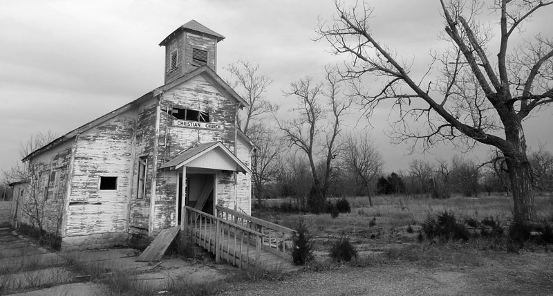
Map of Ghost Towns in Alabama:
loading map - please wait...
Aigleville, literally translated as Eagle Town, was a town on the Black Warrior River in Marengo County, Alabama. The settlement was established in late 1818 by former French Bonapartists and refugees from Saint-Domingue, as a part of their Vine and Olive Colony. Each settler at Aigleville owned three separate land lots. These included the town lot, a garden lot (called a small allotment), and a farm (called a large allotment). With the failure of the colony at large, Aigleville was a largely abandoned by the late 1830s. Despite this, General Lefèbvre-Desnoëttes' house was noted as still standing during a governmental resurvey of the area in 1842. The site was heavily forested by the early 20th century. This gave way to open land with industrial usage during the later half of the 20th and into the 21st century, under its ownership by a local cement plant. Wikipedia contributors, "Aigleville (Alabama)," Wikipedia, The Free Encyclopedia, http://en.wikipedia.org/w/index.php?title=Aigleville_(Alabama)&oldid=636968409 (accessed January 16, 2015). | |
Arcola is a ghost town on the Black Warrior River in what is now Hale County, formerly Marengo County, Alabama. Established in the early 1820s by former French Bonapartists as part of their Vine and Olive Colony, after they were forced to abandon their first town at Demopolis and many found Aigleville unsuitable. Although never more than a village, Arcola became the largest settlement in the colony. Beginning in the 1830s American settlers moved into the area and purchased most of the former French land grants, primarily using Arcola as a river landing. By the 1850s the French settlement had disappeared, replaced by a community of adjoining plantations. Wikipedia contributors, "Arcola, Alabama," Wikipedia, The Free Encyclopedia, http://en.wikipedia.org/w/index.php?title=Arcola,_Alabama&oldid=597771249 (accessed January 16, 2015). | |
Barnesville is a ghost town in Marion County, Alabama an State Highway 19. Two churches still remain in Barnsville. Scattered populace still occupy Barnsville. | |
Battelle is a ghost town in DeKalb County, Alabama, United States. Battelle was once a thriving mining community which was spread in a north – south line along the foot of Lookout Mountain five miles north of Valley Head, Alabama. At the beginning of the 20th Century, Battelle included hundreds of houses, a school, a commissary, a hotel and post office, in addition to the furnace and coke ovens. Battelle had a water system with water from a spring that was pumped into a large wooden tank and then piped into the surrounding homes. After the mining company ceased operations at Battelle and the better homes were sold and moved, there was never much activity in the community. The Belcher Lumber Company of Centerville operated there for a few years in the 1940s. Wikipedia contributors, "Battelle, Alabama," Wikipedia, The Free Encyclopedia, http://en.wikipedia.org/w/index.php?title=Battelle,_Alabama&oldid=624613754 (accessed January 16, 2015). | |
Beaver Mills, also known as Beaver Meadow, is a ghost town in Mobile County, Alabama, United States, near U.S. Route 45, south of Citronelle. It was the site of a paper mill that was also used as a uniform depot during the American Civil War. After the Civil War ended, the old uniforms were then converted into the making of bonded paper. The mill still stands today. There are tall stone walls in the area, and buttons from uniforms can be found in the town. The woods have taken over most of the area, and no buildings remain (other than the mill). Beaver Mills is on private property, and requires permission to enter. The bridges have since been removed to prevent anyone from intruding. | |
Bellefonte is a ghost town in Jackson County, Alabama near the site of the Bellefonte Nuclear Generating Station. It is located roughly two miles southeast of Hollywood, Alabama. Bellefonte was settled in the early 19th century and incorporated on December 15, 1821, when it had nearly 200 residents. Its name was a subjective description consisting of the French words "belle", meaning "beautiful," and "fonte", meaning "fount." It was the Jackson County seat from 1821 to 1859. During the following decade, a post office, courthouse, and church were constructed. A post office was established in 1830. By 1844, the population had grown to 400. The town suffered severe damage during the Civil War. The post office was closed in 1859, and the entire town was abandoned by the 1920s. All that remains of Bellefonte today are the cemetery, the chimney of the local inn, and piles of scattered bricks. Wikipedia contributors, "Bellefonte, Alabama," Wikipedia, The Free Encyclopedia, http://en.wikipedia.org/w/index.php?title=Bellefonte,_Alabama&oldid=619606510 (accessed December 25, 2014). | |
Blakeley is a ghost town in Baldwin County, Alabama, United States. During the height of its existence, Blakeley was a thriving town which flourished as a competitor to its western neighbor, Mobile. It was the location of a major fort during the Civil War. One of the last battles of the civil war was fought here as Union soldiers overran Confederates. The town is now in an Alabama historic state park known as Historic Blakeley State Park near Spanish Fort. In 1813, Blakeley was founded by Josiah Blakeley, "an entrepreneur and adventurer from Connecticut who moved to Mobile in 1806. He purchased 7,000 acres of land in the northeastern portion of Mobile Bay. In 1813 he hired a surveyor to lay out the town of Blakeley and sold the first 10 lots. On January 6, 1814, the Mississippi Territorial Legislature authorized Josiah Blakeley to lay out a town to be known as Blakeley. It received official incorporation from the State of Alabama in 1820. Wikipedia contributors, "Blakeley, Alabama," Wikipedia, The Free Encyclopedia, http://en.wikipedia.org/w/index.php?title=Blakeley,_Alabama&oldid=640995668 (accessed January 29, 2015). | |
First capital of Alabama located off of Alabama Highway 22, west of Alabama River in Dallas County. Also spelled Cahawba, the capital existed from 1820 to 1825. The Alabama Historical Commission maintains Cahaba as a state historic site and as an important archaeological site. Now a park, abandoned streets, cemeteries, and ruins remain. 9518 Cahaba Road Orrville, AL 36767 Phone/Fax 334-872-8058 Visitor Center: Open 12pm – 5pm daily Grounds: Open 9am – 5pm daily www.cahawba.com Alabama Historical Commission | |
 | Cedric, Alabama was a small community in northeastern Chambers County, Alabama. Today it is entirely in private ownership. It is located 3–4 miles to the southeast of present day Roanoke, and about 1 mile southwest of Bacon Level Church. |
Situated near the Federal Road, Claiborne began during the Mississippi Territory period with a ferry over the river. During the Creek War a large stockade fort, named Fort Claiborne, was established at the site by General Ferdinand L. Claiborne. He used the fort as a base for the invasion of the Creek nation with the Regular Army of the United States, the Lower Tombigbee Militia, and friendly Choctaw. The community of Claiborne began in 1816, on the former fort site. Following the war Claiborne became one of the largest and fastest growing communities in what would become Alabama. Claiborne remained an important shipping port and trading center throughout the 1840s and 1850s. The coming of the American Civil War saw the construction of batteries along the lower Alabama River and at Claiborne. The town was heavily looted at the end of the war. Following the war, the town quickly lost importance in the new economy. By 1872 the population had dwindled to approximately 350 people. When the new railroad through Monroe County bypassed Claiborne in the early 20th century, the fate of the settlement was sealed. By 2008 the site contained only the James Dellet House and three 19th century cemeteries. Wikipedia contributors, "Claiborne, Alabama," Wikipedia, The Free Encyclopedia, http://en.wikipedia.org/w/index.php?title=Claiborne,_Alabama&oldid=610967062 (accessed January 30, 2015). | |
Situated near the Federal Road, Claiborne began during the Mississippi Territory period with a ferry over the river. During the Creek War a large stockade fort, named Fort Claiborne, was established at the site by General Ferdinand L. Claiborne. He used the fort as a base for the invasion of the Creek nation with the Regular Army of the United States, the Lower Tombigbee Militia, and friendly Choctaw. The community of Claiborne began in 1816, on the former fort site. Following the war Claiborne became one of the largest and fastest growing communities in what would become Alabama. Claiborne remained an important shipping port and trading center throughout the 1840s and 1850s. The coming of the American Civil War saw the construction of batteries along the lower Alabama River and at Claiborne. The town was heavily looted at the end of the war. Following the war, the town quickly lost importance in the new economy. By 1872 the population had dwindled to approximately 350 people. When the new railroad through Monroe County bypassed Claiborne in the early 20th century, the fate of the settlement was sealed. By 2008 the site contained only the James Dellet House and three 19th century cemeteries. Wikipedia contributors, "Claiborne, Alabama," Wikipedia, The Free Encyclopedia, http://en.wikipedia.org/w/index.php?title=Claiborne,_Alabama&oldid=610967062 (accessed January 30, 2015). | |
Minden is a ghost town in Calhoun County, Alabama, United States. It possessed a post office from 1878 to 1879. | |
Tooktocaugee was an unincorporated community in Calhoun County, Alabama, United States. | |
Turkey Town is a ghost town in Cherokee County, in the U.S. state of Alabama. The community grew up around the Cherokee town Turkeytown. A post office called Turkey Town was established in 1828, and remained in operation until it was discontinued in 1861. The community was named after the village, which was named in honor of the Cherokee chief Little Turkey. | |
Vienna is an unincorporated community in Pickens County, Alabama. Vienna was a prosperous river port from the 1830s until the American Civil War, situated along the eastern shore of the Tombigbee River on the southwestern border of the county. It declined rapidly in importance with the building of a railroad through Pickens County following the war. In 1917 the post office closed and this marked the end of Vienna's official status as a town. An important ferry crossing for north-south travel from Pickens County to Sumter County. Ferry was still in use in 1920. The area of Vienna is in private ownership. Stone monument at site of town and an unnamed cemetery. | |
| Washington is a ghost town located in Autauga County, Alabama on the north bank of the Alabama River, just west of the mouth of Autauga Creek. Washington was founded in 1817 on the site of the former Autauga Indian town of Atagi and named in honor of George Washington. On November 22, 1819, the Alabama territorial legislature chose Washington as the county seat of Autauga County, which it remained until 1830. A courthouse, hotel, jail, post office and pillory were constructed to meet the needs of the county government. The county seat was moved to Kingston in 1830 in order to be closer to the geographic center of the county. Soon after, many citizens began to leave, and Washington was deserted by 1879. The post office in Washington was operated from 1824 to 1854. |