Ashland Alabama

Ashland Alabama

Ashland Alabama

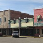
Ashland,  Alabama is the county seat of Clay County and is known as the   City of Friends. Ashland is proud of its small town atmosphere and offers many features found in much larger areas. Incorporated in 1871, the City of Ashland is located in east central Alabama just minutes from the recreation areas of Mt. Cheaha, Lake Harris and the Talladega National forest.  
Ashland Alabama Contact Information:
83183 Hwy. 9
Ashland, AL 36251
Phone: 256-354-2121
 

Ashland Alabama ​City Clerk Administrator:
Chelsey Wynn

Ashland Alabama Municipal Court Clerk:
Robin Catrett
Phone: 256-354-2112

Clay County Alabama

Clay County Alabama Map

Clay County Alabama

Clay County population is 13,932. Its county seat is Ashland, Alabama. Its name is in honor of Henry Clay, famous American statesman, member of the United States Senate from Kentucky and United States Secretary of State in the 19th century. Clay County was formed for geographic reasons. The citizens of the area had a difficult time reaching the county seat of Wedowee in Randolph County because of the Tallapoosa River to the east.

Moonshiners and Deputies Have Gunfight

Moonshiners and Deputies Have Gunfight
 

LINEVILLE ALABAMA SCENE OF FIERCE BATTLE

What is said to be one of the most exciting gun battles between officers and
outlaws took place on the streets of Lineville Alabama on Wednesday, October 17th, 1928, when officers of Cleburne County Sheriff’s Office and officers from Clay County Sheriff’s Office apprehended Sebe and Joe Echols of Cleburne when they were discoverd in Lineville and attempted to arrest them. It seems that Sebe was apprehended by the officers and after being placed
under arrest, made a dash for liberty, whereupon the officers gave chase,
firing twice but not hitting the fleeing man. Joe Echols, a brother, some
distance away, fired four or five shots at the officers as they persued Sebe
then made a get away but was later located at the home of Howell Turner, some five miles east of Lineville. Sebe was recaptured in the home of Dr. J.S. Ray by John W. Kilgore, a Cleburne County officer, where he happened to run while trying to make his escape. Sheriff Allen and Deputies Cook and George Thrower of Cleburne and Pope of
Talladega, were at the scene of the home where Joe was shot and captured following a pistol battle lasting several minutes.

Lineville Alabama

Lineville AL
Clay County Alabama
The geographical area containing today’s town of Lineville was inhabited by Native Americans as far back as at least 11,000 years ago. Up until the late 1500s, the local Indians were primarily from the Coushatta (Coosa), Alibamo (Alabama), Uchi, Tallassee, Arbeka, Choctaw, Cherokee, and Natchez tribes. White man probably made first contact with these local tribes during Hernando DeSoto’s expedition in 1540. Some historians believe that a few of DeSoto’s scouts came up Talladega Creek into what is now Clay County.

Cheaha State Park

Cheaha State Park
Clay County Alabama
Cleburne County Alabama

Cheaha State Park is a 2,799-acre state park in Alabama, located in northern Clay and southwestern Cleburne counties. The park, which is Alabama’s oldest continuously operating state park, encompasses Cheaha Mountain, the highest point in the state. Park facilities include a lodge, restaurant, general store, campsites, hiking trails, and other amenities. Day-use: The park has day-use areas for picnicking, swimming, and fishing. Scenic overlooks: Cheaha Mountain is topped with Bunker Tower, a stone building with an observation deck on top. Near the peak, Bald Rock has a wheelchair-accessible wooden walkway that provides an overlook of the surrounding region.

Cheaha Mountain | Clay County Alabama

Cheaha Mountain

Cheaha Mountain
Clay County Alabama
Cheaha Mountain, often called Mount Cheaha, is the highest natural point in the U.S. state of Alabama. It is located a few miles northwest of the town of Delta in scenic Talladega State Park, which offers a lodge, a restaurant, and other amenities. The highest point is marked with a USGS benchmark in front of Bunker Tower, a stone Civilian Conservation Corps building with an observation deck on top. The CCC also constructed a road to Cheaha, but the road has been closed for years. The old road is known as CC Road and contains interesting ruins.