AUTAUGA COUNTY ALABAMA

Autauga County Alabama
The word “Autauga” comes from the Indian village Atagi, located on the Alabama River at the mouth of Autauga Creek.
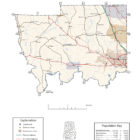
Autauga County Alabama Location
Autauga County is located in central Alabama. Its county seat is Prattville. The county was named after the Tawasee Indian town of Atagi, whose location is its southeastern corner. Autauga County is part of the Montgomery, Alabama Metropolitan Statistical Area. The county was created in 1818 from lands forcibly ceded by the Creek Confederacy in 1814 at the Treaty of Fort Jackson.
Autauga County Alabama History
As established, Autauga County included present-day Autauga County, as well as Elmore County and Chilton County. At the time, Autauga (aka, Tawasa) Indians lived here, primarily in a village named Atagi (meaning “pure water”) situated on the banks of a creek by the same name (called “Pearl Water Creek” by settlers). Autauga County was part of the territory ceded by the Creeks in the Treaty of Fort Jackson in 1814. The first county seat was at Jackson’s Mill, but the court only met there long enough to select a permanent seat at Washington, built on the former site of Atagi in the southeast corner of the county. In 1830 the county seat was moved to a more central location at Kingston. The town of Washington was completely deserted by the late 1830s.
See a bit more early pioneer information at Orangeburgh Migrations – Alabama
Source: Alabama As It Is by Benjamin Franklin Riley, D. D., 1887
Autauga county was created in 1818, and named from the Indian word autaugi, signifying a dumpling, meaning plenty. This is quite as suggestive to-day as it was when the Indian rudely cultivated his patches about his wigwam, realizing plenty from the generous soil in which this region abounds. From the first settlement of the county, in the earliest days of the present century, to this time, many of the best soils of Autauga have been subjected to the most exhaustive means of cultivation, and yet they seem as fruitful today as at any time in the past. Not only has Autauga held her place amid the most progressive agricultural counties, but it was one of the pioneer counties of the State in the manufactures.
The county has an area of 660 square miles.
Population in 1870, 11,623; population in 1880, 13,108. White, 4,397; colored, 8,711.
Tilled Land: 81,388 acres.—Area planted in cotton, 30,474 acres; in corn, 20,417 acres; in oats, 2,153 acres; in wheat, 700 acres; in rye, 63 acres; in rice, 43 acres; in sugar-cane, 22 acres; in sweet potatoes, 540 acres.
Cotton Production: 7,944 bales.
The surface of Autauga is undulating. In the northern portion there is a pine district, which is broken into hills and valleys. The forests are thronged almost altogether by the towering yellow pine, in the midst of which is slightly interspersed a stunted growth of black-jack oaks. The commercial value of this yellow pine is enormous, and will, one day, be a source of great revenue to the county. The lands of this region are thickly overspread with luxuriant herbage, embracing various wild grasses, clovers, and other plants, which afford superior pasturage. The deep subsoil of clay makes this a region favorable to the growth of fruits. The lands which skirt the streams in this portion of Autauga are good farming lands. Further down in the county the lands increase in their fertility, and one finds the farms multiplying the further south he goes. Sandy surface soil is still a predominating feature, but many of the lands lie well and are favorable to cultivation, both because they are level and because they are easily tilled. In this portion are found hummock lands, which lie along the streams. The table-lands are valuable for fanning because of their deep clay foundation. In the Southern portion of Autauga the lands grow more prolific, and in some places exceedingly fertile. Here are found what are called second-bottom or river-hummock lands. Here again is found a district of that fertile land which follows the deep rolling Alabama in its windings to the sea. That famons river forms the southern boundary of the county, and its rich alluvial bottoms yield splendid harvests. The lime lands in the southwestern part of the county are superior for the production of cotton. Thus it will be seen that the soils of Autauga range from the richest alluvial to those found upon the surface of the pine hills, including the red or brown loam table-lands of the county. The soils favor a diversified field industry, and. perhaps, no county furnishes a more thrifty and contented population than does Autauga. They produce for commerce and home consumption cotton, corn, oats, wheat, rye, rice, potatoes, sorghum, and sugar-cane. Many of these were at first planted only cautiously and as experiments, but they are productive and contribute so much to the happiness and welfare of the people that they are rapidly becoming staples. All the garden and orchard products that flourish in southern soil are easily produced in this county. Peaches, apples, plums, pears, grapes, figs, and pomegranates are ordinary luxuries. Principal among its timbers are white and chestnut oak, shell-bark hickory, ash, poplar, sweet gum, beech, maple, cedar, cypress, and vast districts of pine.
The water supply of the county is abundant, there being many streams, springs, and wells in every part of its territory. The main streams are the Alabama river, Big and Little Mulberry, Swift, Beaver, Nolan’s, Whitewater, Bear, and Autauga creeks. Flowing through such lands as have been described above, these streams enhance their value for the production of stock. This industry is assuming greater prominence every year. Wool-growing is fast resolving itself into one of the industries of the county. These swift and deep streams are favorable also to the manufactures. For many miles along Autauga creek there are the most favorable locations for manufactories. This is true of other streams in the county. Appreciating this fact, Daniel Pratt, one of the pioneer manufacturers of the South, built a cotton mill upon one of the streams of the county as early as 1846. This has been followed by others, and to-day there are the following manufacturing interests in different parts of Autauga: Prattville Mills, Autaugaville Factory, Planters’ Factory, and Lehman Mills. The Alabama river flows along its southern border, the East Tennessee, Virginia, and Georgia railroad also penetrates it in the west, and the Louisville and Nashville railroad cuts across the northeastern portion of the county; and these furnish the means of transportation. With an increase of such facilities, the county is in position to take a long stride forward. Principal among the thrifty little towns that dot the county over may be mentioned Prattville, the county-seat, with a population of 1,400, Autaugaville, Kingston, and Mulberry. These are thrifty centers and have good educational and church advantages. Common schools are sustained throughout the county.
Lands may be purchased at as low figures as $1-50 per acre; or, in highly-favored localities, it will cost from $S to $15 per acre. Since the recent discovery of marl deposits, the lands are more highly prized. These marls have not as yet been developed, but should they prove of no commercial value, they will be of great practical advantage in the enrichment of the surface soils. Immigrants would meet every encouragement in seeking homes in Autauga county.
There are 13,040 acres of government land to be had in the county.
Source: Northern Alabama – Historical and Biographical by Smith & De Land, Birmingham, Ala 1888
Population: White 4,760; colored 8,105. Area 660 square miles. Woodland 660 square miles. Gravelly hills 560 square miles. Calcareous lands, 100 square miles.
Acres – In cotton 30,120; in corn 20,750; in oats 2,910; in wheat 940; in rye 110; in rice 37; in sugar-cane 62; in sweet potatoes 500. Approximate number of bales of cotton, 7,700.
County Seat – Prattville: population, 1,625; located fifteen miles northwest of Montgomery.
Newspapers published at County Seat – Progress and Southern Signal (both Democratic).
Post offices in the County – Autaugaville, Billingsley, Bozeman, Independence, Jones Switch, Kingston, Milton, Mulberry, Prattville, Statesville, Vine Hill, Wadsworth.
Prior to 1818 this was a part of the territory of the county of Montgomery. In the fall of that year the Legislature at St. Stephens, assembled, by statutory enactment, created the new county of Autauga. It was named for Autauga Creek, a stream rising among the northern hills of the county, and meandering in a southerly direction, empties into the Alabama river.
The exact significance of the word “Autauga” is not now known. By some it is claimed to have meant “dumpling,” an article of food, indicating a land of plenty. By others it is thought to mean “Clear Water. ” The latter is probably more nearly correct.
The county is bounded on the east, west and north by Elmore, Dallas and Chilton Counties, respectively, and on the south by the Alabama River. Skirting the entire southern line of the county, the Alabama River affords ample transportation for its products to Montgomery, Selma and Mobile. The Louisville & Nashville Railroad crosses the northeast corner of the county, and the East Tennessee, Virginia & Georgia traverses nearly the whole of its western boundary. There are also several other railways contemplated and surveyed, whose routes will penetrate the interior section of the county, and give outlet to the inexhaustible minerals of Bibb, Tuscaloosa, and Walker Counties, and to the magnificent lumber of Autauga and Chilton.
The soils of Autauga County are of every variety. They are the isinglass lands and rich alluvial river bottoms, occasional patches of prairie, sandy surfaces with clay subsoil, rich hummock, and elevated red or brown table-lands. The surface of the county is generally broken and undulating, and yet in that portion bordering on the river, and even in the northern section where the hills predominate, there are extensive level plateaus well adapted to the purpose of agriculture. Indeed some of the most attractive farms to be found in Central Alabama maybe seen in this county. In the upper or northern section the soil is comparatively thin, and yet in many of the valleys and creek bottoms there is considerable productiveness, and the people often make good crops of the cereals, besides cotton, and are happy and content. It is in northern Autauga that the tall yellow pine, which is of so much commercial value, towers to perfection; and acres of this valued growth remains to-day in virgin ignorance of the sound of the woodman’. axe or saw. In the lower or southern section there are endless kinds of trees, the black, red and white post oaks, hickory. including shell bark, chestnut, walnut, persimmon, ash, sassafras, dogwood, poplar, gum, cedar, and cypress, with pines interspersed. The procuring of cypress and other valuable timbers for shipment is becoming an industry. The woods and forests at seasonable periods abound in fruits and flowers. There the wild grape and muscadine nourish in the greatest profusion, and when spring comes and touches nature with her verdure the most fragrant and lovely flowers, from the expansive magnolia to the modest violet, regale the senses and laden the air with the sweetest perfume.
The soils of Autauga, under judicious cultivation respond in abundant crops of cotton, corn, peas, potatoes, rye, oats, barley, wheat, chufas, rice, millet, milo-maize, sorghum, and sugar-cane. Perhaps in no section does the scuppernong grape grow in greater profusion in proportion to its cultivation. Pecans are also successfully produced. The gardens and orchards, under proper management, return all vegetables and fruits known to the climate, embracing, in the line of the latter, apples, pears, peaches, grapes, quinces, prunes, dates, plums, pomegranates and figs.
Perhaps no land is more favored with bright, running streams than Autauga. From north to south her territory is traversed with a number of bold and beautiful creeks, whose waters in many instances skirt rich productive bottom lands. Among these may be mentioned Big and Little Mulberry, Ivy, Swift, White Water, Hear. Autauga, Beaver. Pine, Big and Little Mortar. Upon the courses of these streams may be found many eligible locations for the founding of manufactories and industrial institutions.
This was one of the pioneer counties of the State in manufacturing. Located at Autaugaville are two cotton factories; at Prattville, one cotton factory, one sash, door and blind factory, and one cotton-gin factory. The Prattville Cotton Gin Manufactory is the largest of the kind in the world. It employs upwards of one hundred men, turns out over one thousand gins annually, and the “Pratt Gin ” is known throughout the civilized world. Near Prattville, also, is a cotton factory, and scattered throughout the county is the usual number of grist-mills, shoe and blacksmith shops, public ginneries, etc. In the eastern part of the county is an earthenware establishment, manufacturing jugs, churns, urns and other articles of clay.
Ochre, fire-clays, paints and pigments abound in the county, while many of her magnificent springs are pregnant with healing and health-giving minerals.
Land is worth from one dollar to fifteen dollars per acre, and fine farming land can be had for three dollars per acre. Government land in the county, about 12,000 acres.
Rate of taxation, forty cents on the $100; county debt, none.
The people are law-abiding, hospitable, industrious and patriotic. The public-school system is but indifferently developed, though popular enough with the masses, and growing in importance, general health of the county, good.
Autauga County Alabama Native American History
There are many Native American archaeological sites in Autauga County, especially along the Alabama River. Early settlers reported seeing many mounds along the Alabama River. Today, many of these mounds are no longer visible because of 20th century development. In addition to the large Native town of Atagi, during the early 1800s there were towns Halbama and Atoba. Halbama was possibly the origin of the name of the Alabama River.
Autauga County Historical Destinations
Autauga Place
Autaugaville
Prattaugan Museum & Archives, Heritage Center
Prattville
Autauga County Alabama Map

Autauga County population is 54,571. Its county seat is Prattville Alabama.
Daniel Pratt arrived in Autauga County in 1833 and founded the new town of Prattville, north of Atagi on the fall line of Autauga Creek. His cotton gin factory quickly became the largest manufacturer of gins in the world and the first major industry in Alabama.
Autauga County Alabama Cities:
Millbrook Alabama
Millbrook is a city in Autauga and Elmore counties. The population was 14,640 at the 2010 census. Millbrook includes the former village of Robinson Springs within its boundaries. Numerous eras delineate Millbrook’s past.
Prattville Alabama
Prattville is a city in Autauga and Elmore counties. As of the 2010 census, the population of the city is 33,960. Daniel Pratt arrived in Autauga County in 1833 and founded the new town of Prattville, north of Atagi on the fall line of Autauga Creek.
Autauga County Alabama Towns:
Autaugaville Alabama
Autaugaville is a town in Autauga County. At the 2010 census the population was 870. William Thompson, the first settler in what is now Autaugaville arrived around 1820 and built a gristmill and sawmill on Swift Creek, about three miles upriver from the Alabama River. One source says that the town incorporated in 1839, but another cites 1907. A cotton mill opened in 1849 on the banks of Swift Creek, and following upon the model of industrialist Daniel Pratt, the owner constructed housing for its employees, expanding the town. It grew further when many citizens from nearby Vernon relocated here to escape the floods and diseases to which that town was prone. By 1851, the town had a population of 351 and claimed four stores, two churches, and two schools.
Source: Wikipedia contributors, “Autaugaville, Alabama,” Wikipedia, The Free Encyclopedia
Billingsley Alabama
Billingsley is a village in Autauga County. At the 2010 census the population was 144.
Autauga County Alabama Communites:
Booth Alabama
Booth is an unincorporated community in Autauga County. It was named after the Booth family. Booth lies along U.S. Route 82 8 mi northwest of the city of Prattville, the county seat of Autauga County. US 82 also runs northwest 29 mi to Maplesville.
Jones Alabama
Jones, originally Jones Switch, is an unincorporated community in Autauga County. The name was officially shortened on May 1, 1903. The community has a post office, with postmasters appointed from 1878 to 2006.
Kingston Alabama
Kingston, also known as Old Kingston, is an unincorporated community in Autauga County, Alabama. Kingston served as the county seat of Autauga County from 1830 to 1868, when it was moved to Prattville. Kingston became a ghost town, until a new community was formed around the home of Edmund Meredith Shackelford, an officer who served in the War of 1812. A post office was operated in Kingston from 1830 to 1908.
Marbury Alabama
Marbury is an unincorporated community and census-designated place in Autauga County. As of the 2010 census, its population was 1,418. Marbury is located at 32°42′04″N 86°28′16″W (32.701241, -86.471088). It lies 522 feet above sea level.
Pine Level Alabama
Pine Level is a census-designated place and unincorporated community in Autauga County, north of Prattville and west of Deatsville. As of the 2010 census, its population was 4,183.
Autauga County Alabama Ghost Towns:
Andrew Alabama
Ghost Town
Located about one mile south of Pine Level Alabama, north of the junction of U.S. Hwy 31 and CR 107.
Booth Alabama
Ghost Town Dates From: 1899
Latitude N32 30.030′ Longitude W86 34.321′
Located about seven-and-one-half miles northwest of Prattville on the railroad line.
Dosterville Alabama
Ghost Town
Latitude N32 26.308′ Longitude W86 26.983′
Located about three miles southeast of Pratttville and about one-half mile west of the junction of the railroad and Doster Road.
Fays Alabama
Ghost Town
Latitude N32 28.842′ Longitude W86 24.598′
Located about three miles east-northeast of Prattville and one-half mile southeast of the junction of State Road 14 and Old Farm Lane at the county line.
Fremont Alabama
Ghost Town
Latitude N32 32.725′ Longitude W86 53.689′
Locate about three miles south of Jones and east of the junction of Country Road 83 and County Road 88.
Haynes Alabama
Ghost Town
Latitude N32 37.545′ Longitude W86 40.388′
Located about three miles southeast of Billingsley and southwest of the junction of County Road 19 and the railroad.
Kalmia Alabama
Ghost Town
Latitude N32 24.170′ (32.44722) Longitude W86 47.667′ (86.78333)
Located about three miles southwest of Mulberry and one-quarter mile southeast of the junction of County Road 15 and Second Street.
Spur Alabama
Located east of Highway 82 West, about five miles northeast of Independence Alabama on the juction of Beaver Creek Road and the railroad line.
Statesville Alabama
Ghost Town
Latitude N32 28.169′ Longitude W86 49.835′
Located about two miles east of Burnsville on the junction of State Road 14 and County Road 1
Vine Hill Alabama
Ghost Town
Latitude N32 33.738′ Longitude W86 54.127′
32.615094400446715, -86.89970755512239
About three an one-half miles southeast of Planteresville at the junction of County Road 103 and County Road 22.
Whitewater Alabama
Ghost Town
32.4648925051205, -86.63549210913074
About five and one-half miles southeast of Independence alabama, southeast of the junction of County Road 165 and County Road 21
Native American Sites in Autauga County Alabama
There are many Native American sites in Autauga County, especially along the Alabama River. Early settlers reported seeing many mounds along the Alabama River. Today, many of these mounds are no longer visible. In addition to the large Native town of Atagi, during the early 1800s there were towns Halbama and Atoba. Halbama was possibly the origin of the name of the Alabama River.
History of Alabama and Dictionary of Alabama Biography, Volume 1:
AUTAUGA COUNTY
Created by the legislature, November 30, 1818. It was formed from Montgomery County; by act of December 13, 1820, the boundaries in the north and northwest, were enlarged; and January 12, 1827, the line between Autauga and Shelby Counties was more definitely fixed. In 1868 part of its territory was taken to establish the new counties of Chilton (first Baker) and Elmore on the north and east. It was named for Autauga Creek, a bold stream running through the county. The creek received its designation from the Indian village of that name, situated below the point where the creek runs into the Alabama River. (See Atagi.) Its area is 584 square miles, or 373,760 acres.
The act creating the county provided that for the time being court should be held “at Jackson’s* mill, on the Autauga Creek,” but, for the want of necessary buildings, might “adjourn to such other place contiguous thereto as may seem most proper.” The legislature, November 22, 1819, named Robert Gaston, Zachariah Pope, Alsey Pollard, Alexander R. Hutchinson, and Zaccheus Powell, as commissioners to “fix on a site for the public buildings” in the county, and to contract for and superintend the building of “a suitable courthouse, jail, and pillory.” They were paid the modest sum of $15 each for their services. The town of Washington was chosen. It was located on the Alabama River at the mouth of Autauga Creek, and on the site of the Indian village of Atagi. It was one of the first settled portions of the county. The first houses were erected in 1817. For about 15 years it held a position of importance in the political, social and business life of the county.
Because of the location of Washington in the extreme southern part of the county, there was much dissatisfaction, and the legislature, December 28, 1827, authorized a vote to be taken at the general election in August, 1828, “for the purpose of ascertaining the wishes of the citizens of said county, with regard to the removal of the seat of justice from its present location, to, or near the center of said county.” The sheriff was directed to certify the result to each of the members of the legislature from the county, but what the vote was is not available. Possibly it was in favor of retaining Washington as the county seat. However, on December 2, 1830, the legislature appointed John Essel, John Hunt, Francis Baker, Enoch Islands and Henley Brown as commissioners to select a seat of justice, having due regard “to centrality, population, health and general convenience.”
The commissioners selected a site near the center of the county, which was called Kingston. The place was without other advantages than its central location, and a Wetumpka editor denominated it the “Great Sahara.” During its existence as the county seat it had only a limited population.
The legislature removed the county seat to Prattville, December 12, 1868, and Kingston became a deserted village. It is no longer a post office, and maps designate the site as Old Kingston. About two miles away the name is preserved as a station on the Mobile & Ohio Railroad.
Location and Physical Description
It lies in the central part of the State, wholly within the Coastal Plain, or agricultural district, and is bounded on the north by Chilton, south by Lowndes, east by Elmore and Montgomery, and west by Dallas County. Its surface is undulating with a general trend south and east to the Alabama River. Geologically it lies upon a great pebble bed, which covers the line of contact of the metamorphic rocks and the Cretaceous formation. The northern part, more than two-thirds of its area, is hilly with a sandy and often gravelly soil. In the southern part the lands are sandy loam, with clay subsoil and are very productive. The central and western sections comprise red loam table lands, all highly productive. The lands of the southern section are calcareous. There are two outcroppings of rotten limestone in the county, one in township 17, the other below Dutch Bend on the Alabama River. Yellow ochre has been mined and marketed in limited quantities, but the supply is not commercially important. There is a bed of phosphatic greensand, a formation which is more extensively shown in Greene County. The entire area of the county is wooded, with long-leaf pine as its principal forest growth. Other trees are the various species of oak, hickory, short-leaf pine, magnolia, gum, walnut, beech and poplar. The Alabama River forms the southern boundary and Big Mulberry Creek, a part of its western boundary. Aside from these, its watercourses are Autauga, Bear, Beaver, Bridge, Buck, Ivy, Little Mulberry, Mortar, Nowlands, Piney Woods, Swift, Whitewater and Yellow Creeks.
Aboriginal History
In the early years of the eighteenth century, the French found the territory of the county inhabited by the Alibamo Indians, whose villages were located along the Alabama River. But on an ancient French map there is an Alibamo town (Halbama), apparently in the western part of the county. Altogether, the county has no important aboriginal history.
Along the Alabama River are found some evidences of aboriginal occupancy, but they are not numerous. Autauga (Atagi), an Alibamo town, was situated below the mouth of Autauga Creek, which enters the river just above the present Washington ferry on the Montgomery and Prattville public road. Opil ‘Lako, an Upper Creek town, possibly Alibamo, was located in the county, but its site has never been determined. Arrow and spearpoints of flint are found in several sections, but at no place in sufficient quantities to suggest the existence of workshop sites, as on the opposite side of the Alabama, and on the Tallapoosa River, some miles to the east.
During the Creek War, 1813-14, Dutch Bend became a place of refuge for the Creeks after their defeat at the Holy Ground. Here Weatherford’s wife, Sapoth Thlanie died, two days after the battle. Weatherford had a plantation on the west bank of the river, about a mile and a half below the mouth of Pintlala Creek
Settlement and Later History
Settlers entered its borders from the stream of migration through old Fort Jackson in 1814, immediately following the close of the Creek War. Its permanent settlers date from 1816, 1817 and 1818, the number in the latter year being sufficient to call for the setting up of a reparate county. Within the first fifteen years of its history, almost all of its best lands had been occupied, its population had become stable, and migration had set in from among its people to other parts of the old Southwest.
Among the early residents of the county were, Gov. Wm. W. Bibb, John A. Elmore, Sr., Bolling Hall, Sr., James Jackson, Robert Gaston, Jacob P. House, Francis Lewis, Bent Pierce, Philips and Byrd Fitzpatrick, Nicholas Zeigler, Edmund Gholson, Isaac Funderburg, Levi Kelly, William Hester, Jesse Gay, Josiah Rice, Thomas Harris. James Goss, Thomas Tatum, George Jones, Edmund Foreman, Joseph Riley, Mackey Johnson, Archibald Graham, Richard Bibb, Job Calloway, William Lewis, Joshua Marcus, William Futch, Isaiah Thacker, Aaron Moore, Hiram Bishop, Abram Chancellor, Lewis C. Davis, Thomas C. Smith, William R. Pickett, Mark Howard, Seaborn Mims, Lewis Tyus, Richard Mouton, Wm. Hightower, Jeremiah Jackson, Robert Motley, Robert Broadnax, Edmund Shackleford, John G. Stoudenmire, William N. Thompson, John Mathews, James Mathews, William Peebles, Benjamin Averett, James and Nehemiah Howard, Eli Ely, Lazarus Parker, William Nunn, Thomas Hogg, Dr. N. S. Jones, Benjamin Davis, Dr. A. R. Hutchinson, Organ Tatum, Berry Tatum, S. McGraw, B. Mason, John Lamar, L. Houser, S. Stoudenmire, John McNeel.
The county has been the birthplace or home of several persons of distinction. Gov. Wm. W. Bibb, first governor of Alabama, made his home in the vicinity of the present Coosada, there he died, and his remains lie in a private cemetery on his old home place. In the same community resided John A. Elmore, Sr., a soldier of the Revolution, Bolling Hall, Sr., a former Representative in Congress from Georgia, James Jackson, who represented Autauga County in the first constitutional convention of the State in 1819, and Capt. Albert T. Goodwyn, representative in Congress. Daniel Pratt founded Prattville and the great gin manufacturing interests which have rendered his name and county famous. In the county also resided for a time Gen. Thomas Woodward, noted Indian fighter; also William R. Pickett, father of Col. A. J. Pickett, the historian; Gen. E. Y. Fair, minister to Brussels; Elder Lewis C. Davis, popularly known as “Club Axe” Davis. The county was the birthplace of Rev. Dr. Samuel S. Harris, Protestant Episcopal Bishop of the Diocese of Michigan; and of his niece, Miss May Harris, prominent as an author.
The county is properly classed as agricultural, although it has important manufactures. Its agricultural statistics appear in full below. One of the earliest manufacturing plants, the Pratt Gin Co., was established long before the War. It was one of the very first of the purely distinctive manufacturing plants using water as power, although there were many gristmills and sawmills supplying local demands, erected on the streams of the State.
There are three railroad lines in the county: Louisville & Nashville, main line, 8 miles main track, and 1.85 miles side track; Montgomery & Prattville branch, 4.82 miles main track, and .74 mile side track; Mobile & Ohio, 29.68 miles main track, and 3.01 miles side track; and Alabama Central Ry., 8.75 miles main track.
REFERENCES.—Toulmin, Digest, 1823; Acts, 1818, p. 60; 1820-21, p. 72; 1826-27, p. 36; 182728, p. 40; 1830-31, p. 419; 1868, p. 115; Brewer, Alabama, p. 107; Berney, Handbook (1892), p. 287; Riley, Alabama as it is (1893), P, 165; Northern Alabama (1888), p. 180; Alabama, 1909 (Ala. Dept. of Ag. and Ind., Bulletin 27). p. 71; U. S. Soil Survey (1910), with map; Aladama land book (1916), p. 26; Ala. Official and Statistical Register, 1903-1915, 5 vols.; Ala. An. thropological Society, Handbook (1910); Geol. Survey of Ala., Agricultural features of the State (1883); The valley regions of Alabama, parts 1 and 2 (1896, 1897), and Underground water resources of Alabama (1907); John Hardy, “History of Autauga County,” in Daily State Sentinel, Montgomery, Aug. 10, 1867.
Historic Places in Autauga County
Daniel Pratt Historic District
Montgomery-Janes-Whittaker House
Autauga County Alabama Weblinks
The ANC is a Planned-Use Outdoor Education Facility offering hands-on, outdoor-based educational programs and activities for students, educators, church and civic groups, and the general public.
he NaturePlex is the 23,000 square foot structural facility that serves as the Welcome and Education Center for the Alabama Nature Center. The facility includes a 120-seat Theater equipped with up to date technology; Hands-on Discovery Hall with wildlife and nature-based displays; Educational Classrooms; Community Room available for meeting use and rental; and a Gift Shop.
The NaturePlex can be reserved for school field trips, teacher training workshops, seminars, and other educational programs by contacting the Alabama Wildlife Federation.
Kathy Evans, Revenue Commissioner
135 N. Court St., Suite D, Prattville, AL 36067
Phone: (334)-358-6750 - Fax: (334) 365-6985
With a rich heritage dating back to the 1700’s, the Millbrook area, including Robinson Springs, Coosada, Deatsville, and Elmore, was known for its sprawling plantations and prominent leaders, including William Wyatt Bibb, John Archer Elmore, and Benjamin Fitzpatrick. Today, the area retains the best of its early features and natural resources, while aggressively pursuing economic development opportunities.