CLAY COUNTY ALABAMA
Clay County Alabama

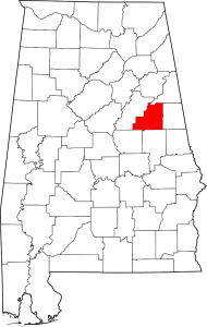
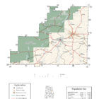
Clay County population is 13,932. Its county seat is Ashland, Alabama. Its name is in honor of Henry Clay, famous American statesman, member of the United States Senate from Kentucky and United States Secretary of State in the 19th century.
Clay County was formed for geographic reasons. The citizens of the area had a difficult time reaching the county seat of Wedowee in Randolph County because of the Tallapoosa River to the east. Talladega was difficult to reach because of the intervening mountains. Even today, Clay County is one of only three counties in Alabama to have no U.S. Highways in its boundaries.
In Clay County, placer gold occurred at the Wesobulga Creek, Crooked Creek, Tallapoosa River, and several unnamed streams throughout the county.
Clay County Alabama Cities:
Lineville Alabama
Lineville is a city in Clay County. At the 2010 census the population was 2,395. The first white settlers in the area were William and Thomas Lundie. Their settlement became known as Lundie’s Cross Roads after a trading post opened in the 1830s to serve pioneers and miners searching for gold. In 1856, Lundie’s Cross Roads became known as County Line.
Lineville Alabama History
Clay County Historical Destinations
Clay County Museum – Ashland Alabama
City of Lineville Museum – Lineville Alabama
Clay County Alabama Towns
Ashland Alabama
Clay County Alabama Communities
Delta Alabama
Delta is a census-designated place and unincorporated community in Clay County. Its population was 197 as of the 2010 census.
Hollins Alabama
Hollins is a census-designated place and unincorporated community in Clay County. Its population was 545 as of the 2010 census.
Hollins Alabama History
Millerville Alabama
Millerville is a census-designated place and unincorporated community in Clay County. Its population was 278 as of the 2010 census.
Corinth Alabama
Corinth is an unincorporated community in Clay County, located 8.1 miles south-southeast of Lineville Alabama.
Cragford Alabama
Cragford is an unincorporated community in Clay County, located 6.3 miles southeast of Lineville Alabama. Cragford has a post office with ZIP code 36255.
Clay County Alabama Ghost Towns
Callabee Battlefield
Clairmont Springs Alabama
Latitude N33 21.021′ Longitude W85 55.812′
33°21’01.3″N 85°55’48.7″W
33.350350, -85.930200
Erin Alabama
Gibsonville Alabama
Gibsonville is a populated place located in Clay County.
Latitude N33 11.631′ Longitude W85 46.919′
33°11’37.9″N 85°46’55.1″W
33.193850, -85.781983
Idaho Alabama
Latitude N33 19.087′ Longitude W85 54.903′
33°19’05.2″N 85°54’54.2″W
33.318117, -85.915050
Oak Lane Alabama
Latitude N33 29.414′ Longitude W85 40.533′
33°29’24.8″N 85°40’32.0″W
33.490233, -85.675550
Weathers Alabama
Latitude N33 20.098′ Longitude W85 57.744′
33°20’05.9″N 85°57’44.6″W
33.334967, -85.962400
Clay County Alabama Zip Codes:
36251, 36255
