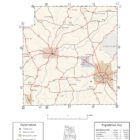
COFFEE COUNTY ALABAMA
Coffee County Alabama
Coffee County Alabama History
The land in Coffee County was originally part of Dale County, which was incorporated in 1824. Coffee County was formed from the western part of Dale County on December 29, 1841. It was named after John R. Coffee, a soldier in the Creek War of 1813—14. The first county seat was in Wellborn. After the courthouse was destroyed by fire in 1851, the county seat was moved to Elba.
Coffee County Historical Destinations
Boll Weevil Monument in Enterprise
The Huey Helicopter and Wall of Freedom in Enterprise
Pea River Historical Society Depot Museum in Enterprise
Coffee County Alabama Cities
Elba Alabama
Elba is a city in Coffee County, Alabama, United States. At the time of the 2010 U.S. census, its population was 3,940. Elba is the county seat of Coffee County; it is located at the juncture of Whitewater Creek and Pea River.
The town was first known as Bridgeville in the early 1830s after a ferry was built to connect east-west traffic across the Pea River; in 1850 the name was changed to Bentonville in honor of Col. Thomas H. Benton, who fought in the Creek War of 1813-14. On December 8, 1851, citizens agreed to choose a different name; suggested names were placed in a hat and Elba, after the island to which Napoleon Bonaparte was exiled, was the one selected. Elba became the official name in 1852, and it was designated the county seat that same year. The town was incorporated officially on April 13, 1853.
Enterprise Alabama
Well known for its Boll Weevil Monument. Enterprise is a city in the southeastern part of Coffee County and the southwestern part of Dale County in southeastern Alabama.
Coffee County Alabama Towns
Kinston Alabama
Kinston is a town in Coffee County. At the 2010 census the population was 540.
New Brockton Alabama
Coffee County Alabama Communities
Alberton Alabama
Basin Alabama
Basin is an unincorporated community in Coffee County. Basin is located along Alabama State Route 189, 6.2 miles southwest of Elba.
Battens Crossroads Alabama
Battens Crossroads, also known as Union Academy, is an unincorporated community in Coffee County. Battens Crossroads is located along Alabama State Route 27, 13.9 miles southeast of Elba.
Brooklyn Alabama
Brooklyn is an unincorporated community in Coffee County, located 5.4 miles east-northeast of Opp.
Central City Alabama
Clintonville Alabama
Curtis Alabama
Damascus Alabama
Danleys Crossroads Alabama
Frisco Alabama
Goodman Alabama
Ino Alabama
Jack Alabama
Jack is an unincorporated community in Coffee County, Alabama, United States. Jack is located on Alabama State Route 87, 11.7 miles (18.8 km) north-northeast of Elba. Jack has a post office with ZIP code 36346.
Java Alabama
Java is an unincorporated community in Coffee County,
Keyton Alabama
Keyton is an unincorporated community in Coffee County, Alabama, United States. Keyton is located along Alabama State Route 167, 2.4 miles (3.9 km) southeast of downtown Enterprise. Most of Keyton lies within the Enterprise city limits.
Pine Level Alabama
Richburg Alabama
Roeton Alabama
Tabernacle Alabama
Victoria Alabama
Fort Rucker Alabama
In 1936, the federal government’s Farm Security Administration, in an effort to increase farm prices, purchased 32,000 acres of land on the eastern border of Coffee County that they planned to transform into a wilderness reservation. Known as Bear Farm, the land was transferred to the War Department in January 1942 to serve as a training site for soldiers during World War II. Named Camp Rucker for Confederate colonel Edmund Rucker, the training base became Fort Rucker in 1955. Fort Rucker became the Army Air Corp’s headquarters when flight training was consolidated at the base in 1973. Air Force helicopter pilots have trained at the base since 1971.
Credit: Encyclopedia of Alabama
Coffee County Alabama Ghost Towns
Alberton Alabama
Clintonvelle Alabama
Damascus Alabama
Dismukes Alabama
Latitude N31 36.372′ Longitude W85 58.066′
31°36’22.3″N 85°58’04.0″W
31.606200, -85.967767
31°36’22.3″N 85°58’04.0″W
31.606200, -85.967767
Java Alabama
Keyton Alabama
Richiburg Alabama
Tabernacle Alabama
Coffee County Alabama Weblinks
For more Alabama County information, visit the Alabama County Index
