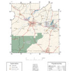
COVINGTON COUNTY ALABAMA
Covington County Alabama

Covington County population is 37,765. Its county seat is Andalusia. Its name is in honor of Brigadier General Leonard Covington of Maryland.
Covington County Alabama Cities
Andalusia Alabama
Opp Alabama
Opp is a city in Covington County. At the 2010 census the population was 6,659. Opp is located in eastern Covington County bordered by the town of Babbie to the west and the town of Horn Hill to the southwest.
Covington County Alabama Towns:
Babbie Alabama
Babbie is a town in Covington County. At the 2010 census the population was 603. It incorporated in 1957.
Carolina Alabama
Carolina is a town in Covington County. It is located about 95 miles south of Montgomery and about 80 miles west of Dothan. At the 2010 census the population was 297.
Florala Alabama
Florala is a town in Covington County. At the 2010 census the population was 1,984. Florala is located along the Alabama–Florida state line bordered by the town of Lockhart to the west and the town of Paxton, Florida, to the south.
As of the census of 2010, there were 1,980 people, 839 households, and 514 families living in the city. The population density was 180.2 people per square mile. There were 1,107 housing units at an average density of 105.0 per square mile. The racial makeup of the city was 80.1% White, 15.8% Black or African American, 0.8% Native American, 0.4% Asian, 0.7% from other races, and 2.3% from two or more races. 2.8% of the population were Hispanic or Latino of any race.
In 1818, Andrew Jackson stopped at the lake with his soldiers, and thus Lake Jackson is named after him. Since 1870, Florala has served as the home of the world’s oldest consecutive annual Masonic Day celebration, through Florala’s Fidelity Masonic Lodge #685 (beginning with Chapel Hill and Lake City Lodge #377), and Chapter #441 of the Order of the Eastern Star. The celebration is in honor of St. John’s Day, June 24, 1717, when the first Grand Masonic Lodge in England was established. The celebration is held each year on the Friday before the 24th of June and concluding on the Saturday after the 24th.
Florala Alabama Weblinks
Gantt Alabama
Gantt is a town in Covington County. Gantt is located in north-central Covington County in the extreme south-central part of the state. Gantt is located in north-central Covington County in the extreme south-central part of the state.
At the 2010 census the population was 222. The racial makeup of the town was 75.93% White, 21.99% Black or African American, 0.83% Native American, 0.41% from other races, and 0.83% from two or more races. 0.83% of the population were Hispanic or Latino of any race.
Gantt Lake, a 2,700-acre reservoir created on the Conecuh River by the Gantt Dam built in the 1920s, offers boating, swimming, skiing, and fishing opportunities.
Heath Alabama
Heath is a town in Covington County. At the 2010 census the population was 254.
Horn Hill Alabama
Horn Hill is a town in Covington County. At the 2010 census the population was 228. It had previously been an incorporated community and was listed on the 1970 and 1980 U.S. Census, but was disincorporated in 1985. It later reincorporated on August 26, 1991.
As of the census of 2000, there were 235 people, 107 households, and 68 families residing in the town. The population density was 88.0 people per square mile. There were 126 housing units at an average density of 47.2 per square mile. The racial makeup of the town was 97.02% White, 1.70% Black or African American and 1.28% Native American. 0.43% of the population were Hispanic or Latino of any race.
Libertyville Alabama
Libertyville, incorporated in 1967, is a town in Covington County. At the 2010 census the population was 117. As of the census of 2000, there were 106 people, 48 households, and 32 families residing in the town. The population density was 202.6 people per square mile. There were 55 housing units at an average density of 105.1 per square mile . The racial makeup of the town was 91.51% White, 3.77% Asian, and 4.72% from two or more races. 0.94% of the population were Hispanic or Latino of any race.
The median income in Libertyville, AL is $63,241 and the median home value is $182,143.
Zip code: 36420
Lockhart Alabama
Lockhart is a town in Covington County. At the 2010 census the population was 516. Lockhart came into being about 1904 when the Jackson Lumber Company mill was constructed there, the community being a company town. Many streets were named for Native American tribes. The mill was erected to handle the dense forests of yellow pine in what was known as the “Jackson Tract”.
In 1912, the mill employed around a thousand workers and ran 24/7. At that time Lockhart was the largest lumber mill in the United States. Flooring for the famous Waldorf-Astoria Hotel in New York City came from Lockhart.
As of the census of 2000, there were 548 people, 229 households, and 147 families residing in the town. The population density was 504.1 people per square mile. There were 264 housing units at an average density of 242.9 per square mile. The racial makeup of the town was 74.82% White, 23.91% Black or African American, 0.36% Native American, 0.36% Pacific Islander, and 0.55% from two or more races. 2.19% of the population were Hispanic or Latino of any race.
Onycha Alabama
Onycha is a town in Covington County. At the 2010 census the population was 184. As of the census of 2000, there were 208 people, 96 households, and 64 families residing in the town. The population density was 249.1 people per square mile. There were 113 housing units at an average density of 135.3 per square mile. The racial makeup of the town was 99.04% White and 0.96% Native American. 0.48% of the population were Hispanic or Latino of any race.
Red Level Alabama
Red Level is a town in Covington County. At the 2010 census the population was 487. As of the census of 2000, there were 556 people, 213 households, and 151 families residing in the town. The population density was 296.1 people per square mile. There were 248 housing units at an average density of 132.1 per square mile. The racial makeup of the town was 88.67% White, 10.07% Black or African American, 0.18% Native American, 0.54% from other races, and 0.54% from two or more races.
River Falls Alabama
River Falls is a town in Covington County. At the 2010 census the population was 526. As of the census of 2000, there were 616 people, 272 households, and 174 families residing in the town. The population density was 88.9 people per square mile. There were 307 housing units at an average density of 44.3 per square mile. The racial makeup of the town was 62.50% White, 36.04% Black or African American, 0.65% Native American, and 0.81% from two or more races. 0.81% of the population were Hispanic or Latino of any race.
Sanford Alabama
Sanford is a town in Covington County. At the 2010 census the population was 241. Sanford was originally incorporated in 1902 and was on the 1910 U.S. Census. It did not appear again on the census until 1960. As of the census of 2000, there were 269 people, 112 households, and 77 families residing in the town. The population density was 67.3 people per square mile. There were 135 housing units at an average density of 33.8 per square mile. The racial makeup of the town was 97.77% White, 0.74% Native American, and 1.49% from two or more races. 1.86% of the population were Hispanic or Latino of any race.
Covington County Alabama Communities:
Antioch Alabama
Beck Alabama
Beck is an unincorporated community in Covington County. Beck was once home to a general store, gristmill, and automotive garage.
Beda Alabama
Beda is an unincorporated community in Covington County. Beda is located on Alabama State Route 137, 18.2 miles south-southeast of Andalusia. The community lies entirely within the Conecuh National Forest.
Bethlehem Alabama
Beulah Alabama
Blairs Alabama
Blue Springs Alabama
Boston Alabama
Boykin Alabama
Brooks Alabama
Cedar Grove Alabama
Chapel Hill Alabama
Clear Springs Alabama
Clearview Alabama
Coldwater Alabama
County Line Alabama
Dunns Alabama
Duvall Alabama
Eoda Alabama
Estothel Alabama
Fairfield Alabama
Falco Alabama
Falco, also spelled Falko, is an unincorporated community in Covington County. The community lies entirely within the Conecuh National Forest. The community’s name is an acronym for the Florida-Alabama Land Company, which harvested timber in the area.
Falco was founded by members of the Florida-Alabama Land Company in 1903. The community was home to a large sawmill, the Falco Bank, Falco Bottling Company, a 40-room hotel, a grist mill and general stores. A two-story railroad depot sat near the logging railroads, which connected to the Central of Georgia and L&N lines. The town began to decline after a fire destroyed the saw mill in 1925. The mill was then moved to Willow, Florida. A post office operated under the name Falco from 1903 to 1955.
Five Points Alabama
Five Points is located in northeastern Chambers County in the east-central part of the state. Five Points was founded in 1887 on a line of the East Alabama Railway (purchased by the Central of Georgia in 1888) that connected Roanoke, Randolph County, with Opelika, Lee County. (The town lies about midway between Roanoke and LaFayette in Chambers County.)
Friendship Alabama
Green Bay Alabama
Harmony Alabama
Harp Point Alabama
Howells Alabama
Huckaville Alabama
Loango Alabama
McRae Alabama
McRae is an unincorporated community in Covington County. A post office operated under the name McRae from 1904 to 1912.
Opine Alabama
Opine, also spelled O’Pine, is an unincorporated community in Covington County. A post office operated under the name Opine from 1880 to 1891.
Covington County Alabama Ghost Towns
Brooks Alabama
Latitude N31 28.917′ Longitude W86 41.103′
31°28’55.0″N 86°41’06.2″W
31.481950, -86.685050
Carolina Alabama
Latitude N31 14.444′ Longitude W86 31.671′
31°14’26.6″N 86°31’40.3″W
31.240733, -86.527850
Duvall Alabama
Latitude N31 16.582′ Longitude W86 14.517′
31°16’34.9″N 86°14’31.0″W
31.276367, -86.241950
McRae Alabama
Latitude N31 03.530′ Longitude W86 15.674′
31°03’31.8″N 86°15’40.4″W
31.058833, -86.261233
South Alabama
Latitude N31 46.662′ Longitude W86 36.783′
31°46’39.7″N 86°36’47.0″W
31.777700, -86.613050
Stedman Alabama
Latitude N31 04.279′ Longitude W86 18.209′
31°04’16.7″N 86°18’12.5″W
31.071317, -86.303483
Wiggins Alabama
Latitude N31 18.956′ Longitude W8619.717′
31°18’57.4″N 86°19’43.0″W
31.315933, -86.328617
Covington County Historical Destinations
Springdale Estate
Andalusia
Three Notch Museum*
Andalusia
Covington County Alabama Zip Codes:
36474, 36028, 36421, 36442, 36483