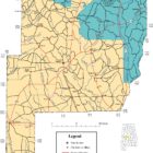
Perry County Alabama
Perry County Alabama

Perry County Alabama, located in the west-central part of the state, was established in 1819 from land acquired from the Creek Indians in the 1814 Treaty of Fort Jackson. The county is named in honor of Commodore Oliver Hazard Perry of The United States Navy. When the area was officially opened to settlement, pioneers came from the Carolinas, Georgia, and Tennessee. The first towns in the area that would become Perry County were Muckle’s Ridge (now known as Marion), Perry Ridge, Uniontown (originally known as Woodville), and Heiberger.
The County seat is Marion Alabama.
Perry County History
Source: Alabama As It Is by Benjamin Franklin Riley, D. D., 1887
Perry county was created in 1819 and named in honor of Commodore Oliver Hazard Perry, of the United States Navy. Here, as throughout this portion of the great Black Belt, are all the evidences of bounty in the deep, rich soil, the increasing flow of streams, the green-clad hills and forests of towering timber. Under a perfect system of labor, these black soils of Perry county would yield astonishingly. For many years in cultivation, these fruitful lands never refuse to bring forth abundantly where the planter is diligent in sowing and reaping. The county has an area of 790 square miles.
Population in 1870, 24,975; population in 1880, 30,741. White, 7,150; colored, 23,591.
Tilled Land: 167,666 acres.—Area planted in cotton, 74,303 acres; in corn, 48,132 acres; in oats, 6,093 acres; in wheat, 440 acres; in rye, 70 acres; in rice, 27 acres; in tobacco, 24 acres; in sugar cane, 20 acres; in sweet potatoes, 1,107 acres.
Cotton Production: 21,627 bales.
The northern end of the county is of an uneven surface. The central and southern portions are level. In the northern portion there are brown loam uplands; in the southern, there is the genuine prairie soil. These are the only two characteristics attaching to the lands of the county. Both these soils possess very great inherent fertility. Upon the highest of the hill lands in north Perry there is a prevalence of sand, in which grows chiefly the yellow or long-leaf pine. Descending to the base of these hills, or rather to the uplands, we find, as was said above, a brown loam soil. Beneath this fertile surface there is a red loam subsoil, said to be twenty or twenty-five feet thick. The prairies proper, which embrace the central and southern portions of Perry, are broken here and there by sandy elevations, upon which are usually located the towns and settlements of the county. These knolls are admirably suited for the location of homes, as they place one beyond the reach of prairie mud, and at the same time furnish him with an abundant supply of excellent water. Corn and cotton are the chief crops, and their yield is oftentimes amazing.
Like many in the adjoining counties, the farmers of Perry are turning their attention to the remunerative pursuit of raising stock. Excellent stock farms can now be seen in the county, superior grasses are being cultivated, and the profits annually realized are most gratifying. These lands can not be surpassed for purposes of stock raising.
Many delicious fruits are grown in the county. Peaches, pears, figs, and grapes, together with strawberries and watermelons, are the principal fruits produced. The timbers of the county are the usual upland oaks, hickory, short and long-leaf or yellow pine.
Besides many smaller streams, there are the Cahaba river, and the Washington, Legreon, Blue Cat, Brush, Belcher’s Five Mile, Big, and Bogue Chitta Creeks in Perry. A bounteous supply of water is furnished from the numerous and copius wells which are found in every portion of the county.
Marion, the county-seat, with a population of near 3,000, Uniontown, and Hamburg are the points of interest. Marion has been long and justly famous for her institutions of learning. The Marion Military Institute is located here. Another magnificent school is the Judson Female Institute. The latter school is operated under the auspices of the Baptist denomination of the State. The Marion Seminary, another college for female education and an institution of merit, is located in this highly-favored town. The society of the place is unexcelled in the South, and the healthfulness of the location good. The Methodist, Presbyterian, Baptist, and other denominations sustain excellent churches. Near Uniontown is one of the Agricultural Experimental stations of the State, in successful operation. Railroad facilities are enjoyed through the lines of the Cincinnati, Selma & Mobile and the East Tennessee, Virginia & Georgia systems.
But the most important highway of transportation will be the Mobile & Birmingham Railroad, which is now being built from Mobile to Birmingham, and other points North. This road will pierce the center both of the most productive agricultural and mineral sections of our State. The removal of the natural obstructions from the Cahaba River will also afford numerous advantages to this section.
Immigrants could now purchase lands in Perry county upon the most favorable terms, not exceeding in price $5 or $15 per acre. Like the adjacent counties, there is a prevalence of marl in different portions of Perry. The discovery of these deposits has had a tendency to increase the valuation of the lands. It is believed that these beds are sufficiently thick to encourage their development for commercial purposes. Whether this be true or not, there is no doubt that they will be of immense profit to the landsof the county. Traces of kaolin and other minerals have been discovered. The people of Perry county would extend a most cordial welcome to thrifty immigrants. In the county are 16,000 acres of public or government land awaiting occupation by settlers.
PERRY COUNTY
Source: Northern Alabama – Historical and Biographical by Smith & De Land, Birmingham, Ala 1888
Population: White 7,500; colored 22,591. Area, 790 square miles. Woodland, all. Gravelly hills, with long-leaf pine, 460 square miles. Prairie region, 325 square miles.
Acres – In cotton 75,303; in corn 48,132; in oats 6,003; in wheat 440; in rye 70; in rice 27; in tobacco 24; in sugar-cane 20: in sweet potatoes 1,107. Approximate number of bales of cotton, 22,000.
County Seat – Marion; population 2,500; located 30 miles northwest of Selma, on Cincinnati, Selma, & Mobile branch of the Western Railroad.
Newspapers published at County Seat – Standard, Normal Reporter, Howard Collegian and Judson Echoes.Post offices in County – Augustin, Bush Creek, Chadwick, Cruess, Felix, Hamburgh, Ironville, Jericho, Le Vert, Marion, Morgan Springs, Museville, Oakmulgee, Perryville, Pine Tucky, Scott’s Station, Sprott, Talmage, Theo, Uniontown, Vilula.
Perry was created in 1819, and named in honor of Commodore Oliver Hazard Perry, of the United States Navy.
The county lies between parallels 32 and 33 north latitude, and embraces most of the elevated lands between the Tombigbee and Alabama Rivers. Its maximum elevation is 470 feet, and its minimum 190 feet above sea level.
The face of the country is somewhat broken, though there are no great elevations. The extreme western portion of the country is drained by small streams emptying into the Tombigbee, while the country generally slopes off gently to the east, and its waters shed off into the Cahaba and its tributaries. The highest land is somewhat sandy; the chief growth is the long-leaf pine. Next comes the prairie, “a gently undulating trough-like plain lying between the drift hills on the north and similar ones on the south.”
The northern half of the county has an abundance of freestone water supplied by surface springs and wells: the prairie sections are supplied by pools and artesian wells.
The climate is as mild and salubrious as can be found in the South. Our proximity to the Gulf gives us the benefit of its refreshing breezes. The summers are long, and the days are infrequently very hot, but our nights are cool and pleasant. Sunstroke is very rare.
Mean temperature for fourteen years: spring 65.3: summer 80.6: autumn 65.5: winter 50.4.
No section on the globe can show a better health record than Perry County. The county occupies the high lands lying between the Alabama and Tombigbee Rivers, and it is almost above the miasma line. In the river bottoms there are more or less of chills and fever in the summer and fall. There is but little pneumonia, and consumption is rare among the whites.
The State tax this year is levied on the basis of 5 ½ mills, the county on 4 mills. There is a constitutional prohibition against any county levying a tax of more than 5 mills.
County school funds for the year ending September 30, 1886, were $11,032.
Number of schools: white, 35; colored, 53; total, 88. Average number of teachers: white, 33; colored, 50; total. 83.
Average number of pupils to teacher, 42.
Average monthly pay of teachers, $30.90.
School age, seven to twenty-one years.
Average length of schools, eighty days.
Marion and Uniontown enjoy very superior public schools.No section enjoys greater advantages than this county in the number and character of its higher educational institutions.
Located at Marion are two institutions of learning that are second to none in the South; Judson Female Institute, founded in 1839, denominational, Baptist: Marion Female Seminary, founded in 1830, non-sectarian.The prairie comprises about one-third of the county area, or about 170,000 acres.
Sandy lands comprise the balance of the county area. There are no special features that are peculiar to these lands.
Bottom lands lie along the branches, creeks and Cahaba River, and are a superior kind of soil.The prairie lands can be bought at from $10 to $15 per acre; the clay lands from $8 to $12 per acre; the sandy lands from $2 to $5, and the bottom lands from $8 to $12l per acre.
TABULAR STATEMENT FOR PERRY COUNTY
Corn, average number of lbs. per acre 840
Cotton, – ” 414
Rye – ” 350
Wheat – ” 400
Oats – ” 450
Barley, – ” 600
Potatoes- ” 4,500
Hay, – ” 4,000
Average number of pounds per acre, 1,444.
Total value of Perry County’s products per acre about $25.Corn, rye, barley and oats do well in this county, and with the proper attention as much can be produced as anywhere else on the globe. Wheat usually suffers with rust. Forty years ago these lands produced, on an average, twenty bushels of wheat per acre. All grasses do well, but especially red clover, meliotus, Johnson grass. Japanese clover and Bermuda. Sorghum cane can be raised here in the greatest abundance, and if it will pay anywhere to raise it, it will pay nowhere better than here. Sugar-cane pays well on our mulatto lands. All kinds of vegetables grow here, and of most of them two crops can be made. Two crops of Irish potatoes, or Irish potatoes first and sweet potatoes next, on the same ground.
The county is doing something in stock raising, and the success that has attended the little that has been done, promises to revolutionize the present surroundings.
There are two railroads through the county; the Alabama Central and the Selma & Memphis: the Alabama Grand Trunk, leading from Mobile to Birmingham, is now under construction, and will be completed in about six months. This road will bisect the county from south to north, giving us direct communication with Mobile on the south, and Birmingham, Bessemer, Anniston, Decatur, Sheffield, etc., on the north. In addition to the above, the following roads have been chartered, and will run through the county: Chicago & Gulf Air Line: Baltimore, Birmingham & Gulf; Bessemer & Selma; Selma & Cahaba Valley, and a through trunk line to Pensacola. The Kansas City & Birmingham Railway will also be built through this county to the Gulf, Cahaba River, for all practical purposes, is past navigating.We have the very best society in this country, and this does not mean aristocracy in any sense.
No section in the Union offers so many inducements to those who are seeking homes in the genial South than Perry County, Ala. With a climate mild and healthy, with the best of soil, and in great variety, with good prices for products and low prices for land and labor; with unsurpassed educational surroundings: with plenty of markets near at hand and good facilities to reach them; with great timber resources; with the best of society; with the greatest iron, limestone and coal beds in the world in the counties joining us on the north; with pure water, purer atmosphere, high and dry, we extend to the northern farmers a most cordial welcome to come and live amongst us, and reap the great harvest that is ready and waiting for the intelligent and progressive farmer. We say, and it is beyond the possibility of contradiction, that every acre of land in this county will yield enough in crop products to pay for itself in one year. If you have the means to buy our land and sustain yourself for one year, you need have no misgivings on this score. The land will pay for itself in one year, acre for acre, that is cultivated. It will do it now, and if more could be asked of any land it is an unreasonable demand.
Besides many smaller streams, there are the Cahaba River, and the Washington, Legreon, Blue Cat, Brush, Belcher’s, Five Mile, Big and Bogue Chitta Creeks in Perry. A bounteous supply of water is furnished from the copious wells which are found in every portion of the county.
The valuation of taxable property in Perry County, for the year 1887, is $2, 977,890, as shown by the abstract of assessment filed with the Auditor.
WATER MILLS OF PERRY COUNTY IN 1886
Source: Bulletin, Geological Survey of Alabama, by Truman H. Aldrich, 1886
The following is a list of the water powers that are utilized. The most of these powers are small, but they make a large aggregate, and they represent only an insignificant part of the power that is capable of development.
PERRY COUNTY H.P.
Henry C. Nichols, (Dobynes Creek). Theo, flour and grist mill. 20
Mary G. Wallace, Marlon, flour and grist mill 4
Hodger’s Mill, Newbern, flour and grist mill 15
W. F. Moore, Marion, flour and grist mill 4
Downey’s Saw Mill, Greensboro, lumber and timber 15
Stevenson’s Saw & Water Mills. Newbern, lumber and timber 20
Lucindy Washburn, (Taylor Creek), Jericho, lumber and timber 18
W. T. Downey. (Limestone Creek), Folsom, grist mill 6
James Wallace. (Legroane Creek), Jericho, grist mill 8
Dr. J. B. Tucker, (Taylors Creek), Jericho, grist mill 6
Lucindy Washburn. (Taylors Creek), Jericho, grist mill 18
S. M. Boiling, (Branch of Oakmulgee Cr.), Pinetucky. grist mill 8
C. C. Cosby, (Oakmulgee Creek), Perryville, grist mill 8
Thomas J. Fountain, (Little Creek), Oakmulgee, gin, saw and grist mill 8
Pann Patterson, (Little Creek), Oakmulgee. gin, saw and grist 8
Sarah Fountain, (Little Creek), Oakmulgee. gin, saw and grist 8
Thaddeus Smith, (Little Creek), Active, grist mill 8
W. M. Eiland, (Fords Mill Creek), Marlon, grist mill 20
J. F. Morton, (Potato Patch Creek), Levert. grist mill 6
Elijah Smith. (Beaver Creek), Bliss, grist mill 6
Noah Coker, (Beaver Dam Creek), Bethlehem, grist mill 6
W. A. Fountain. (Oakmulgee Creek), Oakmulgee, rice mill 10
Perry County Alabama Cities:
Marion Alabama
Located in West Central Alabama, Marion was established in 1817. Marion is the county seat of Perry County. Marion is adjacent to the Talladega National Forest and The Cahaba River lying beautifully along the scenic yet country highway views of Highways 5, 14, and 45. Marion’s population records at 3600 (United States Census, 2010). Marion was first called Muckle Ridge, and then was renamed in honor of Francis Marion, the “Swamp Fox,” hero of the American Revolution. History abounds in Marion: Sam Houston, later of Texas fame, was married to a local girl in 1840. Coretta Scott King was born in Perry County and attended the Lincoln Normal School in Marion. The Southern and Northern Baptists split in 1845 in Marion with the adoption of the “Alabama Revolution,” by the Baptist State Convention.
Uniontown Alabama
Uniontown is situated in the southwestern part of Perry County, Alabama,
and lies in the western section of the area known as the Canebrake, a
portion of the Black Belt Prairie traditionally recognized as one of the
richest farming areas in Alabama.
Perry County Alabama Communities:
Adler Alabama
Adler is an unincorporated community in Perry County. A post office operated under the name Adler from 1887 to 1905. Adler lies entirely within the Oakmulgee District of the Talladega National Forest.
Augustin Alabama
Augustin is an unincorporated community in Perry County.
Cleveland Mills Alabama
Coleman Alabama
Cunningham Alabama
Ellards Alabama
Folsom Alabama
Folsom, also spelled Folsolm, is an unincorporated community in Perry County. Folsom was originally named Cleveland Beat and was a voting precinct during Grover Cleveland’s first presidency. The name was then changed to Folsom in honor of Cleveland’s wife, Frances Folsom. A post office operated under the name Folsom from 1887 to 1904.
Hamburg Alabama
Heiberger Alabama
Heiberger, Alabama is a small settlement located about 10 miles north of Marion Alabama. It is best known for being the birthplace of civil rights leader Coretta Scott King.
Hillcrest Alabama
Jericho Alabama
Levert Alabama
Morgan Springs Alabama
Nave Alabama
Norman Alabama
Oakmulgee Alabama
Osborn Alabama
Panhandle Alabama
Perryville Alabama
Radford Alabama
Sprott Alabama
Suttle Alabama
Taylor Alabama
Taylor is a town in Geneva and Houston counties. Taylor was first settled in the 1870s, named after an early family that helped secure the first post office. It was not incorporated until almost a century later in June 1967. At the 2010 census the population was 2,375,[4] up from 1,898 in 2000.
Vaiden Alabama
Vilula Alabama
Zimmerman Alabama
Perry County Alabama Parks
Perry Lake Park
A natural river bottomland and one of Alabama’s most beautiful areas. This 600-acre park offers excellent outdoor recreation in an undeveloped river bottom. Perry Lakes Park is a featured birding site on the Alabama Birding Trails. This park is located in Perry County approximately 7 miles northeast of Marion (GPS Coordinates 32.694584, -87.243529).
Perry County Alabama Communities & Places
|
COMMUNITY / PLACE NAME
|
LOCATION
|
| Adler | 32.763056, -87.168333 |
| Antioch (historical) | 32.540278, -87.476944 |
| Ash Grove Plantation (historical) | 32.501389, -87.404167 |
| Athahatchee (historical) | 32.676389, -87.247222 |
| Augustin | 32.506111, -87.107778 |
| Bethlehem | 32.806944, -87.109722 |
| Blackburn (historical) | 32.722222, -87.343056 |
| Bliss (historical) | 32.736111, -87.041667 |
| Bolling Mill (historical) | 32.758333, -87.089167 |
| Bordens Mill (historical) | Unknown |
| Browns Store and Mill (historical) | 32.548056, -87.450000 |
| Brush Creek | 32.791111, -87.463611 |
| Buck Snort Post Office (historical) | Unknown |
| Bull Mountain | 32.776944, -87.082222 |
| Bushy Oak (historical) | 32.366667, -87.468611 |
| Cahaba Old Town (historical) | 32.713889, -87.256944 |
| Canebrake Agricultural Experimental Station (historical) | 32.464167, -87.504167 |
| Carmacks Ferry (historical) | Unknown |
| Cedar Lawn Plantation (historical) | 32.458611, -87.508611 |
| Chadwick (historical) | 32.709444, -87.080556 |
| Chestnut Hill (historical) | 32.593056, -87.050000 |
| Church Square | 32.632778, -87.315278 |
| Cleveland Mills | 32.704167, -87.198889 |
| Cleveland Store (historical) | 32.634722, -87.430556 |
| Coleman | 32.600556, -87.478056 |
| Cruess Post Office (historical) | Unknown |
| Curbville | 32.706944, -87.371944 |
| DeYampert Plantation (historical) | 32.537500, -87.440278 |
| Ebenezer (historical) | 32.833889, -87.171389 |
| Edith Post Office (historical) | Unknown |
| Ellards | 32.814722, -87.260833 |
| Ellawhite | 32.438056, -87.499167 |
| Fairhope Plantation (historical) | 32.445278, -87.490833 |
| Fall Line Hills | 32.666667, -86.666667 |
| Flatwood (historical) | 32.440278, -87.453333 |
| Folsom | 32.682500, -87.405833 |
| Freetown | 32.388056, -87.511111 |
| Gayles Store (historical) | 32.568889, -87.388056 |
| Griffin Springs | 32.802778, -87.036667 |
| Grove Cottage Post Office (historical) | Unknown |
| Hamburg | 32.527778, -87.286389 |
| Harris Store (historical) | 32.816667, -87.112500 |
| Heiberger | 32.758056, -87.286667 |
| Henton (historical) | 32.482778, -87.431111 |
| Hillcrest | 32.451389, -87.474722 |
| Independence Bridge | 32.500556, -87.100833 |
| Indian Hill Post Office (historical) | Unknown |
| Ironville | 32.800556, -87.342778 |
| Jericho | 32.773889, -87.275278 |
| Levert | 32.759167, -87.241389 |
| Long Bridge | 32.591111, -87.053333 |
| Marion | 32.632222, -87.319167 |
| Medline (historical) | 32.715556, -87.028333 |
| Midway Plantation (historical) | 32.570833, -87.429167 |
| Morgan Springs | 32.745278, -87.415833 |
| Mount Carmel (historical) | 32.706111, -87.458889 |
| Museville Post Office (historical) | Unknown |
| Nave | 32.485833, -87.266944 |
| New Hope (historical) | 32.414722, -87.475000 |
| Norman | 32.556667, -87.298056 |
| North Perry | 32.784722, -87.405556 |
| Oak Grove (historical) | 32.534722, -87.120556 |
| Oak Lawn Plantation (historical) | 32.420000, -87.514722 |
| Oakmulgee | 32.796389, -87.043889 |
| Oasis Post Office (historical) | Unknown |
| Osborn | 32.683611, -87.143056 |
| Panhandle | 32.686111, -87.025833 |
| Perry County Airport (historical) | 32.558333, -87.309722 |
| Perryville | 32.616667, -87.114167 |
| Pinetucky | 32.759722, -87.084167 |
| Pisgah (historical) | 32.649167, -87.107222 |
| Pollard Store (historical) | 32.503333, -87.498611 |
| Porters Crossroads | 32.568056, -87.443056 |
| Providence (historical) | 32.495833, -87.386111 |
| Rabbityard | 32.454167, -87.520833 |
| Radford | 32.589167, -87.200000 |
| Rogers Store (historical) | 32.778611, -87.119167 |
| Rural Hill Plantation (historical) | 32.413056, -87.473889 |
| Scott Station | 32.608333, -87.439167 |
| Scotts Prairie | 32.605278, -87.438889 |
| Severe Post Office (historical) | Unknown |
| Sprott | 32.676667, -87.221389 |
| Sugar Hill Plantation (historical) | 32.355556, -87.500278 |
| Sugarville | 32.531944, -87.440278 |
| Sunnyside Plantation (historical) | 32.537500, -87.479167 |
| Suttle | 32.536111, -87.179722 |
| Talmage Post Office (historical) | Unknown |
| Tayloe | 32.448056, -87.438056 |
| Taylor Station (historical) | 32.440278, -87.438611 |
| The Cedars (historical) | 32.439444, -87.513333 |
| Theo | 32.722222, -87.188889 |
| Uniontown | 32.449444, -87.514167 |
| Uniontown Municipal Airport (historical) | 32.431389, -87.499167 |
| Vaiden | 32.519722, -87.371111 |
| Vilula | 32.549722, -87.270556 |
| Walkers Prairie | 32.543333, -87.438333 |
| Walkers Quarter (historical) | 32.351389, -87.450000 |
| Walter C Givhan Bridge | 32.774444, -87.273889 |
| Walthalls Post Office (historical) | Unknown |
| Wares Grove (historical) | 32.450556, -87.473611 |
| Waterfall Post Office (historical) | Unknown |
| Waters Store (historical) | 32.598333, -87.201667 |
| Weaver Plantation (historical) | 32.462500, -87.515278 |
| Welcome (historical) | 32.701389, -86.045000 |
| Westwood Plantation (historical) | 32.459722, -87.514444 |
| Willard Grove (historical) | 32.533333, -87.386667 |
| Woodlawn (historical) | 32.500556, -87.406667 |
| Wooleys Mill (historical) | 33.301944, -87.248611 |
| Zimmerman | 32.615556, -87.382500 |
Things To Do in Perry County Alabama
Alabama Military Hall of Honor Museum
Alabama Women’s Hall of Fame
Auburn Rural Studio’s Antioch Baptist Church
Historic Downtown Marion
Coretta Scott King Memorial
Fin & Feather Farm
Harry the Slave’s Gravesite
Holmestead Farms
Judson College
Lincoln Normal School
Marion Female Seminary Building
Marion Military Institute
Moore-Webb-Homes Plantation
Old Marion Railway Depot
Perry Lakes Park
Smith Building Art Gallery
The Green Street District
Perry County Alabama Historic Destinations
Lincoln School – Marion Alabama
Coretta Scott King Memorial – Marion Alabama
Civil Rights Memorial Center – Marion Alabama
Marion Female Seminary – Marion Alabama
Moore-Webb-Holmes Plantation – Marion Alabama
Alabama Women’s Hall of Fame – Marion Alabama
Reverie Historic Home – Marion Alabama
Alabama Military Hall of Honor – Marion Alabama
Perry County Alabama Schools
|
SCHOOL NAME
|
LOCATION
|
| Antioch School (historical) | 32.541111, -87.475278 |
| Barnett School (historical) | 32.760278, -87.180556 |
| Bell School (historical) | Unknown |
| Bethany School (historical) | 32.584167, -87.205000 |
| Bethlehem School (historical) | 32.806111, -87.109444 |
| Blackbelt School (historical) | Unknown |
| Bliss School (historical) | 32.738333, -87.042222 |
| Bolling School (historical) | Unknown |
| Brush Creek School (historical) | Unknown |
| Caffee School (historical) | 32.753611, -87.115833 |
| Center School (historical) | 32.547222, -87.184722 |
| Crawford School (historical) | 32.747222, -87.418056 |
| Crenshaw School (historical) | Unknown |
| Curbville School (historical) | 32.701389, -87.343889 |
| Daniel School (historical) | Unknown |
| Eagles Grove School (historical) | 32.555000, -87.322778 |
| East Perry High School | 32.576111, -87.193611 |
| Ellard School (historical) | 32.813889, -87.262500 |
| Ellawhite Elementary School (historical) | 32.442500, -87.495278 |
| Francis Marion High School | 32.631389, -87.335000 |
| Freetown School (historical) | 32.390833, -87.509722 |
| Friendship School (historical) | Unknown |
| Green Liberty School (historical) | 32.513611, -87.286667 |
| Hamburg Academy (historical) | 32.548611, -87.269444 |
| Hanna School (historical) | Unknown |
| Hatch High School | 32.445278, -87.515556 |
| Heiberger Elementary School | 32.782778, -87.277500 |
| Hinton School | 32.485000, -87.431389 |
| Hopewell School (historical) | 32.633889, -87.387222 |
| Jericho School (historical) | Unknown |
| Judson College | 32.630000, -87.315000 |
| Judson College | 32.630556, -87.315556 |
| King School (historical) | Unknown |
| Levert School (historical) | 32.760556, -87.240833 |
| Lewis School (historical) | 32.452778, -87.514722 |
| Lilly Grove School (historical) | 32.523889, -87.218333 |
| Lincoln Normal School (historical) | 32.625556, -87.330000 |
| Little Canaan School (historical) | 32.320278, -87.489444 |
| Marietta Number 2 School (historical) | Unknown |
| Marietta School (historical) | 32.715000, -87.280000 |
| Marion Academy | 32.606667, -87.335000 |
| Marion Baptist Academy | 32.636944, -87.330833 |
| Marion Elementary School | 32.634444, -87.321944 |
| Marion Female Seminary (historical) | 32.634444, -87.321111 |
| Marion Institute | 32.623611, -87.322222 |
| Marion Public School (historical) | 32.626111, -87.318889 |
| Melton School (historical) | 32.536667, -87.090278 |
| Morning Star School (historical) | 32.671111, -87.396944 |
| Mount Ararat School (historical) | 32.580000, -87.308889 |
| Mount Gilead School (historical) | 32.755556, -87.127778 |
| Mount Olive School (historical) | Unknown |
| Mount Pilgrim School (historical) | Unknown |
| New Home School (historical) | Unknown |
| North Perry School (historical) | 32.788333, -87.407778 |
| Oak Grove Number 26 School (historical) | Unknown |
| Oak Grove Number 29 School (historical) | Unknown |
| Oak Grove Number 34 School (historical) | Unknown |
| Oak Grove School | 32.691389, -87.131667 |
| Oak Grove School (historical) | 32.533333, -87.122500 |
| Oak Grove School (historical) | 32.641667, -87.472500 |
| Old Cross School (historical) | 32.583056, -87.495000 |
| Perry County High School (historical) | 32.634722, -87.323611 |
| Perry County Training School (historical) | 32.444722, -87.516389 |
| Perry Ridge School (historical) | Unknown |
| Perry School | 32.610556, -87.316944 |
| Perryville School (historical) | 32.614444, -87.120833 |
| Pine Chapel School (historical) | Unknown |
| Pine Flat School (historical) | Unknown |
| Pisgah School (historical) | 32.648611, -87.116667 |
| Pleasant Grove School (historical) | Unknown |
| Pleasant Hill School (historical) | Unknown |
| Popes Beat School (historical) | 32.354444, -87.468056 |
| Poplar Grove School (historical) | Unknown |
| Porters Crossroads School (historical) | 32.568611, -87.442500 |
| Prairie School (historical) | Unknown |
| Provewell School | 32.680556, -87.217500 |
| Radford School (historical) | Unknown |
| Reynolds Chapel School (historical) | 32.619167, -87.485000 |
| Shady Grove School (historical) | Unknown |
| Springhill School (historical) | Unknown |
| Stone School (historical) | Unknown |
| Suttle School | 32.553056, -87.190000 |
| Taylor-Moore School (historical) | Unknown |
| Temple School (historical) | 32.451111, -87.512778 |
| Union Academy (historical) | Unknown |
| Uniontown District Academy (historical) | 32.446389, -87.516389 |
| Uniontown Elementary School | 32.445000, -87.515833 |
| Uniontown Female Academy (historical) | 32.448056, -87.513056 |
| Uniontown Male Academy (historical) | 32.451944, -87.514167 |
| Uniontown Middle School | 32.456667, -87.511944 |
| Vaiden School (historical) | 32.503889, -87.487222 |
| Vilula School (historical) | 32.548611, -87.269722 |
| Wallace School (historical) | Unknown |
| Walnut Grove School (historical) | Unknown |
| Warren Academy (historical) | 32.724444, -87.188889 |
| Welcome School (historical) | 32.702778, -87.044444 |
| West High School | 32.666111, -87.386389 |
| West Perry School (historical) | 32.661944, -87.425278 |
| White Hill School | 32.406111, -87.455833 |
| Willow Grove School (historical) | 32.532778, -87.393611 |
| Woodland School (historical) | 32.502222, -87.407500 |
Perry County Alabama Churches
|
CHURCH NAME
|
LOCATION
|
| Aimwell Baptist Church | 32.315556, -87.457500 |
| Antioch Baptist Church | 32.822500, -87.458889 |
| Antioch Church (historical) | 32.406111, -87.451389 |
| Antioch Methodist Church | 32.540556, -87.479444 |
| Asbury Methodist Church (historical) | 32.406667, -87.456111 |
| Bethany Church | 32.764722, -87.443611 |
| Bethany Church | 32.584722, -87.204722 |
| Bethel Church | 32.590556, -87.340556 |
| Bethesda Presbyterian Church (historical) | 32.754444, -87.308056 |
| Bethlehem Baptist Church | 32.803333, -87.310833 |
| Bethlehem Missionary Baptist Church | 32.820278, -87.114722 |
| Calvary Church | 32.733889, -87.356944 |
| Canaan Baptist Church | 32.321111, -87.498611 |
| Church of Christ | 32.633889, -87.315556 |
| Church of Christ | 32.582778, -87.486389 |
| Church of God | 32.621667, -87.317500 |
| Cleveland Mills Church | 32.705833, -87.198333 |
| Coffee Springs Cumberland Presbyterian Church (historical) | 32.433889, -87.515278 |
| Coles Chapel | 32.573611, -87.343333 |
| Concord Baptist Church | 32.625556, -87.160556 |
| Craig Chapel Methodist Church (historical) | 32.548333, -87.390278 |
| Crossroad Church | 32.639444, -87.017778 |
| Eagle Grove Church | 32.555833, -87.322500 |
| Ephesus Baptist Church | 32.730833, -87.198056 |
| Fairview Presbyterian Church (historical) | 32.656111, -87.428611 |
| Faith Chapel | 32.568611, -87.290833 |
| Faith Chapel Baptist Church | 32.785833, -87.412500 |
| Fellowship Baptist Church | 32.691667, -87.448889 |
| Fellowship Church (historical) | 32.754722, -87.436111 |
| First Baptist Church | 32.628611, -87.318889 |
| First Baptist Church | 32.448056, -87.511389 |
| First Methodist Church | 32.634444, -87.318333 |
| First Presbyterian Church | 32.631111, -87.318889 |
| First Presbyterian Church | 32.451667, -87.514167 |
| First United Methodist Church of Uniontown | 32.452778, -87.514722 |
| Foot Washing Baptist Church (historical) | 32.446667, -87.516944 |
| Friendship Baptist Church | 32.803889, -87.026389 |
| Friendship Baptist Church | 32.378333, -87.470278 |
| Friendship Church | 32.643889, -87.288611 |
| Friendship Church (historical) | 32.590278, -87.339167 |
| Green Liberty Church | 32.513333, -87.286667 |
| Greenleaf Church | 32.590278, -87.440556 |
| Harmony Church (historical) | 32.705556, -87.467500 |
| Healing Springs Church | 32.529444, -87.363056 |
| Hebron Baptist Church | 32.337222, -87.508611 |
| Heiberger Methodist Church | 32.774722, -87.276667 |
| Hepzibah Baptist Church (historical) | 32.745000, -87.087500 |
| Hickory Grove Church | 32.555556, -87.390556 |
| Holy Cross Episcopal Church | 32.451389, -87.516667 |
| Hopewell Church | 32.641111, -87.404722 |
| Hopewell Church | 32.643333, -87.404444 |
| Hopewell Presbyterian Church (historical) | 32.448611, -87.512222 |
| Iveys Chapel | 32.698333, -87.176944 |
| Lake Payne Church | 32.828889, -87.447222 |
| Lillie Grove Church | 32.522778, -87.218056 |
| Little Rock Church | 32.792500, -87.275833 |
| Living Hope Baptist Church | 32.384444, -87.444167 |
| Marietta Church | 32.715000, -87.277778 |
| Marion Methodist Church | 32.635278, -87.320278 |
| Mars Hill Baptist Church (historical) | 32.605833, -87.262778 |
| Mary Etta Church | 32.577500, -87.110833 |
| Medline Baptist Church | 32.716944, -87.029167 |
| Missionary Church | 32.544444, -87.267500 |
| Morgan Tabernacle | 32.817222, -87.465278 |
| Morning Star Baptist Church | 32.670556, -87.396944 |
| Morris Hill Church (historical) | 32.595833, -87.274167 |
| Mount Ararat Church | 32.581389, -87.309722 |
| Mount Calvary Church | 32.390278, -87.509444 |
| Mount Carmel Church | 32.689722, -87.457778 |
| Mount Gilead Church | 32.755556, -87.126111 |
| Mount Ivah Church | 32.841944, -87.369167 |
| Mount Mariah Baptist Church | 32.555556, -87.460278 |
| Mount Nebo Church | 32.793611, -87.368611 |
| Mount Nebo Methodist Church | 32.677778, -87.309444 |
| Mount Olive Baptist Church | 32.767778, -87.165556 |
| Mount Olive Church | 32.596111, -87.249444 |
| Mount Olive Primitive Baptist Church | 32.790000, -87.054722 |
| Mount Pilgrim Church | 32.714167, -87.124722 |
| Mount Pisgah Church | 32.714722, -87.125556 |
| Mount Pleasant Freewill Baptist Church | 32.749167, -87.188056 |
| Mount Tabor Church | 32.744722, -87.365556 |
| Mount Zion Church | 32.736111, -87.359444 |
| Nebo Methodist Church | 32.640833, -87.322778 |
| New Hope Church | 32.611111, -87.188611 |
| New Hope Church | 32.414167, -87.474444 |
| New Hope Methodist Church | 32.732222, -87.172500 |
| North Perry Church | 32.828333, -87.430556 |
| Oak Grove Church | 32.811667, -87.425000 |
| Oak Grove Church | 32.691667, -87.138611 |
| Oak Grove Church | 32.675000, -87.129722 |
| Oak Grove Church | 32.534167, -87.123333 |
| Oak Grove Church | 32.495833, -87.497778 |
| Oak Grove Church | 32.641667, -87.472222 |
| Oak Grove Primitive Baptist Church | 32.489167, -87.500000 |
| Ocmulgee Baptist Church | 32.530833, -87.103333 |
| Payne Chapel Methodist Church (historical) | 32.782778, -87.226389 |
| Perryville Baptist Church | 32.606667, -87.124722 |
| Pine Flat Church | 32.572222, -87.166111 |
| Pine Grove Baptist Church | 32.813611, -87.268056 |
| Pineview Church | 32.695000, -87.422778 |
| Pisgah Baptist Church | 32.650000, -87.108889 |
| Pleasant Grove Church | 32.750556, -87.225556 |
| Poplar Grove Church | 32.698889, -87.080278 |
| Provewell Church | 32.680278, -87.217222 |
| Providence Methodist Church | 32.765278, -87.432500 |
| Quinn African Methodist Episcopal Chapel | 32.449167, -87.517222 |
| Reynolds Chapel AME Church | 32.619167, -87.484722 |
| Saint James Church | 32.668333, -87.254722 |
| Saint Marys Baptist Church | 32.468611, -87.426111 |
| Saint Pauls Methodist Church (historical) | Unknown |
| Saint Wilfrids Episcopal Church | 32.635556, -87.318611 |
| Salem Church | 32.833611, -87.382500 |
| Sanctified Church | 32.455000, -87.520833 |
| Santa Felix Church | 32.544444, -87.182500 |
| Sardis Baptist Church | 32.801111, -87.343889 |
| Second Baptist Church | 32.438333, -87.497778 |
| Shady Grove Church | 32.358333, -87.431667 |
| Shiloh Baptist Church (historical) | 32.608333, -87.056667 |
| Siloam Baptist Church | 32.631111, -87.319722 |
| Simpson Chapel | 32.632222, -87.268611 |
| Springhill Church | 32.707500, -87.373056 |
| Star Bethel Church | 32.448056, -87.437500 |
| Stephens Memorial Baptist Church | 32.526667, -87.446944 |
| Turner African Methodist Episcopal Chapel | 32.632778, -87.320278 |
| Union Chapel (historical) | 32.719444, -87.307500 |
| Union Church | 32.720833, -87.332778 |
| Uniontown Baptist Church | 32.448889, -87.513333 |
| Uniontown Church of God | 32.442778, -87.494444 |
| Waycross Bible Methodist Church | 32.830278, -87.438333 |
| Willow Grove Church (historical) | 32.533333, -87.386111 |
| Woodlawn Church | 32.501111, -87.407222 |
| Zion United Methodist Church | 32.632500, -87.317778 |
Perry County Alabama Ghost Towns
Coleman Alabama
Latitude N32 36.036′ Longitude W87 28.682′
32°36’02.2″N 87°28’40.9″W
32.600600, -87.478033
Hamburg Alabama
Latitude N32 31.669′ Longitude W87 17.185′
32°31’40.1″N 87°17’11.1″W
32.527817, -87.286417
Ironville Alabama
Latitude N32 48.048′ Longitude W87 20.567′
32°48’02.9″N 87°20’34.0″W
32.800800, -87.342783
Jericho Alabama
Latitude N32 46.436′ Longitude W87 16.508′
32°46’26.2″N 87°16’30.5″W
32.773933, -87.275133
Nave Alabama
Latitude N32 29.165′ LongitudeW87 16.010′
32°29’09.9″N 87°16’00.6″W
32.486083, -87.266833
Norman Alabama
Latitude N32 33.412′ Longitude W87 17.888′
32°33’24.7″N 87°17’53.3″W
32.556867, -87.298133
Oakmulgee Alabama
Latitude N32 47.799′ Longitude W87 02.637′
32°47’47.9″N 87°02’38.2″W
32.796650, -87.043950
Scott Station Alabama
Latitude N32 36.504′ Longitude W87 26.353′
32°36’30.2″N 87°26’21.2″W
32.608400, -87.439217
Scotts Prairie Alabama
32.607070146267624, -87.43880414278529
Zimmerman Alabama
Latitude N32 36.944′ Longitude W87 22.955′
32°36’56.6″N 87°22’57.3″W
32.615733, -87.382583
Perry County Alabama Cemeteries
|
CEMETERY NAME
|
LOCATION
|
| Asbury Cemetery | 32.406389, -87.455833 |
| Barnett Cemetery | 32.779444, -87.103056 |
| Barron-Wells Cemetery | 32.645278, -87.202500 |
| Bethany Cemetery | 32.581111, -87.204722 |
| Bethesda Cemetery | 32.754444, -87.308611 |
| Bethlehem Number 1 Cemetery | 32.820000, -87.115833 |
| Bethlehem Number 2 Cemetery | 32.808056, -87.109444 |
| Calvary Cemetery | 32.734444, -87.356667 |
| Campbellite Cemetery | 32.730000, -87.281667 |
| Conwill Cemetery | 32.805556, -87.025833 |
| Curry Cemetery | 32.653611, -87.468333 |
| Daniel Cemetery | 32.700278, -87.223056 |
| DeYampert Cemetery | 32.637500, -87.447222 |
| Dobyne-Haggard Cemetery | 32.731944, -87.181667 |
| Edwards Cemetery | 32.615556, -87.189722 |
| Ellawhite Cemetery | 32.441111, -87.498611 |
| Elvins Cemetery | 32.663056, -87.431667 |
| Fairview Cemetery | 32.656111, -87.429722 |
| Faith Chapel Cemetery | 32.786389, -87.412222 |
| Farrer Cemetery | 32.683889, -87.142500 |
| Fellowship Cemetery | 32.754444, -87.438333 |
| Friendship Cemetery | 32.378333, -87.436944 |
| Friendship Cemetery | 32.590278, -87.338611 |
| Fuller Cemetery | 32.630556, -87.105000 |
| Goldman Cemetery | 32.447778, -87.504167 |
| Greenlawn Gardens | 32.421389, -87.517222 |
| Griffin Cemetery | 32.805556, -87.030833 |
| Griffin Cemetery | 32.719444, -87.465278 |
| Harper Cemetery | 32.690278, -87.464167 |
| Harris Cemetery | 32.807500, -87.109167 |
| Hatch Cemetery | 32.594722, -87.520833 |
| Heard Cemetery | 32.657778, -87.273056 |
| Heiberger Cemetery | 32.774167, -87.277500 |
| Hepzibah Cemetery | 32.744722, -87.087500 |
| Holy Cross Cemetery | 32.451389, -87.516944 |
| Hopewell Cemetery | 32.642500, -87.405556 |
| Ivey Cemetery | 32.695833, -87.180000 |
| Iveys Chapel Cemetery | 32.699167, -87.178056 |
| Legal Cemetery | 32.778333, -87.116667 |
| Lily Plummer Cemetery | Unknown |
| Living Hope Cemetery | 32.384444, -87.444722 |
| Marion Cemetery | 32.633333, -87.314444 |
| Mars Hill Cemetery | 32.605833, -87.263611 |
| Medline Cemetery | 32.718333, -87.029444 |
| Midway Cemetery | 32.569722, -87.427222 |
| Morrissette Cemetery | 32.527500, -87.522222 |
| Mount Calvary Cemetery | 32.395278, -87.510556 |
| Mount Gilead Cemetery | 32.756111, -87.125278 |
| Mount Nebo Cemetery | 32.666389, -87.310556 |
| Mount Olive Cemetery | 32.790556, -87.055278 |
| Osburn Cemetery | 32.676944, -87.141667 |
| Paynes Cemetery | 32.780556, -87.224444 |
| Pickens Cemetery | 32.468056, -87.481667 |
| Pinecrest Memorial Cemetery | 32.603333, -87.306389 |
| Pisgah Cemetery | 32.650556, -87.108889 |
| Providence Cemetery | 32.764167, -87.432222 |
| Rosemount Cemetery | 32.455556, -87.515278 |
| Saint Wilfrids Cemetery | 32.636111, -87.318889 |
| Scarborough Cemetery | 32.661944, -87.288889 |
| Shiloh Cemetery | 32.607778, -87.056667 |
| Smith Cemetery | 32.785278, -87.033333 |
| Stewart Cemetery | 32.763333, -87.196389 |
| Suttle Cemetery | 32.603889, -87.155556 |
| Swann Cemetery | 32.698611, -87.171667 |
| Tadlock Cemetery | Unknown |
| Turner Cemetery | 32.686667, -87.410000 |
| Turpin Cemetery | 32.626944, -87.498611 |
| Walthill Cemetery | 32.650000, -87.497778 |
| Waters Cemetery | 32.623611, -87.168333 |
| Waycross Cemetery | 32.830000, -87.438333 |
| White Cemetery | 32.666111, -87.161111 |
| Williams Cemetery | 32.678056, -87.116111 |
| Winfield Cemetery | 32.437778, -87.518611 |
| Wooley Cemetery | 32.827778, -87.263056 |
Perry County Alabama Rivers, Lakes & Streams
|
NAME
|
LOCATION
|
| Barnett Branch | 32.735833, -87.175000 |
| Bear Creek | 32.286111, -87.295556 |
| Beaverdam Creek | 32.741944, -87.111667 |
| Big Prairie Creek | 32.578611, -87.756944 |
| Bingham Creek | 32.512222, -87.185000 |
| Blue Girth Creek | 32.817222, -87.241944 |
| Bogue Chitto Creek | 32.166667, -87.233056 |
| Boiling Mill Creek | 32.750833, -87.084167 |
| Bone Lake | 32.619722, -87.394167 |
| Bonnet Creek | 32.756111, -87.178889 |
| Brush Creek | 32.742500, -87.522222 |
| Brush Creek | 32.415000, -87.371111 |
| Buck Creek | 32.667778, -87.029167 |
| Cahaba River | 32.319167, -87.094722 |
| Camp Branch | 32.723611, -87.185833 |
| Cave Mountain Branch | 32.873333, -87.280833 |
| Chaney Creek | 32.338333, -87.293333 |
| Chilatchee Creek | 32.142778, -87.252222 |
| Coffee Creek | 32.437500, -87.417500 |
| Cottonwood Creek | 32.525000, -87.653889 |
| Cottrell Lake | 32.499722, -87.514444 |
| County Line Branch | 32.486111, -87.206667 |
| Dry Creek | 32.594444, -87.203333 |
| Dry Creek | 32.536944, -87.590833 |
| Dry Creek | 32.455556, -87.181944 |
| Duncan Branch | 32.469444, -87.377500 |
| Dutch Creek | 32.786944, -87.046667 |
| Emily Foster Lake | 32.668333, -87.355000 |
| Fivemile Branch | 32.659722, -87.082222 |
| Floyd Cook Lake | 32.608333, -87.308333 |
| Freetown Creek | 32.302222, -87.471389 |
| Frith Branch | 32.751389, -87.083611 |
| Fullers Branch | 32.728056, -87.110556 |
| Greer Creek | 32.484167, -87.621667 |
| Hilton Mckee Lake | 32.528333, -87.487500 |
| Holley Creek | 32.547222, -87.162222 |
| Holsombech Creek | 32.794167, -87.035278 |
| James A Wheeler Lake | 32.595000, -87.458333 |
| Joe Dozier Lake | 32.606944, -87.398611 |
| Lake Ada | 32.610833, -87.376389 |
| Lake Beth | 32.589444, -87.383056 |
| Lake Betty | 32.599722, -87.371667 |
| Lake Doris | 32.584167, -87.383056 |
| Lake Eva | 32.604167, -87.367222 |
| Lake Heart | 32.600833, -87.367500 |
| Lake Hugh | 32.581667, -87.368611 |
| Lake Ines | 32.604167, -87.372222 |
| Lake Lou | 32.598611, -87.368611 |
| Lake Mary | 32.595833, -87.365556 |
| Lake Miriam | 32.594722, -87.370278 |
| Lake Nett | 32.579167, -87.381667 |
| Lake Rhoda | 32.578056, -87.374444 |
| Lake Sam | 32.581111, -87.373333 |
| Lake Vida | 32.580556, -87.369444 |
| Lake Will | 32.610278, -87.365278 |
| Lakeland Farms Lake Number Eight | 32.606667, -87.380000 |
| Lakeland Farms Lake Number Seven | 32.603333, -87.381667 |
| Lakeland Farms Lake Number Six | 32.600556, -87.382222 |
| Lakeland Farms Pond Number Fifteen | 32.601667, -87.266667 |
| Lakeland Farms Pond Number Fourteen | 32.605000, -87.360000 |
| Lakeland Farms Pond Number Nineteen | 32.600000, -87.250000 |
| Lakeland Farms Pond Number Sixteen | 32.605000, -87.265000 |
| Little Brush Creek | 32.742778, -87.522222 |
| Little Chilatchee Creek | 32.236389, -87.388889 |
| Little Creek | 32.705278, -87.196667 |
| Little Oakmulgee Creek | 32.570000, -87.081111 |
| Little Pryor Creek | 32.659722, -87.082222 |
| MacMillian Bloedell Lake | 32.660000, -87.498333 |
| Marguerite S Howell Lake | 32.578333, -87.463333 |
| Marion Fish Hatchery Number One | 32.690000, -87.253333 |
| Marion Fish Hatchery Number Two P | 32.710000, -87.261667 |
| Middle Lake | 32.695833, -87.240000 |
| Mill Creek | 32.741944, -87.168333 |
| Mill Creek | 32.672500, -87.240556 |
| Miller Brothers Lake Number One | 32.326944, -87.471667 |
| Miller Brothers Lake Number Three | 32.324444, -87.469444 |
| Miller Brothers Lake Number Two | 32.328611, -87.471667 |
| Mitchell Creek | 32.534444, -87.087500 |
| Mud Creek | 32.373056, -87.320278 |
| Oakmulgee Creek | 32.471667, -87.158611 |
| Old Town Creek | 32.717222, -87.259444 |
| Osborn Creek | 32.702222, -87.097500 |
| Perry Lake | 32.694167, -87.241944 |
| Pickett Branch | 32.790833, -87.040556 |
| Polecat Creek | 32.751111, -87.554722 |
| Possum Creek | 32.482778, -87.160556 |
| Potato Patch Creek | 32.750833, -87.258333 |
| Rice Creek | 32.553889, -87.237778 |
| Rogers Creek | 32.243056, -87.414444 |
| Round Lake | 32.697500, -87.241111 |
| Sand Creek | 32.547222, -87.162222 |
| Sand Creek | 32.607500, -87.348889 |
| Sand Creek | 32.269167, -87.445556 |
| Silver Creek | 32.515278, -87.184722 |
| Smiths Branch | 32.434444, -87.452778 |
| Sparks Creek | 32.751389, -87.553889 |
| Stone Branch | 32.725556, -87.180833 |
| Tate Branch | 32.513889, -87.096389 |
| Tayloe Branch | 32.436111, -87.423056 |
| Tayloe Creek | 32.430278, -87.398889 |
| Taylor Creek | 32.804444, -87.245833 |
| Vaughans Lake | 32.504722, -87.176111 |
| W A Hughes Lake | 32.586667, -87.368333 |
| Wallace Creek | 32.741389, -87.264722 |
| Washington Creek | 32.478611, -87.329722 |
| Waters Creek | 32.595556, -87.218611 |
| Watershed Structure Number Eleven | 32.621667, -87.508333 |
| Watershed Structure Number Twelve | 32.631944, -87.484167 |
| Wells Creek | 32.619722, -87.234444 |
| White Branch | 32.741944, -87.168333 |
| Wilbourne Lake | 32.648056, -87.342500 |
| Williams Branch | 32.810833, -87.260556 |
| Williams Creek | 32.775556, -87.052222 |
Important Perry County Alabama Addresses
| Perry County Circuit Clerk P. O. Box 505 Marion, Alabama 36756 Phone: (334) 683-6106Perry County Probate Office P. O. Box 478 Marion, Alabama 36756 Phone: (334) 683-2210Perry County Genealogical Society P. O. Box 310 Uniontown, Alabama 36786Perry County Historical Society P. O. Box 257 Marion, Alabama 36756 Phone: (334) 683-6411Marion Public Library 202 Washington Street Marion, Alabama 36756 Phone: (334) 683-6411 http://marionperrycountylibrary.webs.com/ |
Alabama Department of Archives & History P.O. Box 300100 624 Washington Ave. Montgomery, AL 36130 Phone: 334-242-4435 http://www.archives.alabama.govAlabama Genealogical Society P.O. Box 3921 Samford University 800 Lakeshore Drive Birmingham, AL 35229 http://algensoc.orgAlabama Historical Commission 468 South Perry Street Montgomery, Alabama 36104 Phone: 334-242-3184 http://www.preserveala.orgAlabama Department of Public Health Mailing Address: P.O. Box 303017 Montgomery, AL 36130 Phone: (334) 206-5418 Physical Address: The RSA Tower 201 Monroe Street Montgomery, AL 36104 http://adph.org/default.aspAfrican-American Genealogical Society of Alabama P. O. Box 217 Faunsdale, Alabama 36738 Phone: (334) 627-3772 |
Perry County Alabama Zip Codes:
36793
36701
Perry County Alabama WebLinks: