
Blount County Alabama
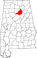
Blount County Alabama Map
Blount County population is 57,322. Its county seat is Oneonta. Blount County was created by the Alabama Territorial Legislature on February 6, 1818, formed from land ceded to the federal government by the Creek Nation on August 9, 1814. This county lies in the northeastern quadrant of the state, which is sometimes known as the mineral region of Alabama.
Cities: Oneonta, Warrior
Towns: Allgood, Altoona, Blountsville, Cleveland, County Line, Garden City, Hayden, Highland Lake, Locust Fork, Nectar, Rosa, Snead, Susan Moore
Communities: Smoke Rise, Bangor, Bright Star, Brooksville, Hopewell, Little Warrior, Mount High, Remlap, Sky Ball, Straight Mountain, Summit
Blount County
loading map - please wait...