The post Gold in Chilton County Alabama appeared first on Digital Alabama.
]]>RETURN TO GOLD IN ALABAMA TABLE OF CONTENTS
Where To Find Gold In Chilton County Alabama
Chilton county sourced its gold from several streams and tributaries that flowed towards Coosa River in Clanton City and the small town of Verbena, Alabama. The tributaries of Blue Creek and Chestnut Creek were early producers of gold. The rock exposures that are limited on the south west by the overlap of the Upper Cretaceous Formation (Tuscaloosa Formation). Nuggets weighing up to 4 ounces have been reported from Blue Creek, a short tributary of the Coosa River in the southeastern part of the county.
Gold in Clanton, Alabama
West of Clanton on Mulberry Creek. West of Clanton 13 miles on the small tributary of Mulberry Creek, The Franklin (Jemison) Mine, small pits in schists and quartz, site of a 10 stamp mill operated until 1923. On the south bank of the creek exposing Hillabee Schist, The B.T. Childers Prospect with pyrite and copper minerals. Also along Mulberry Creek, about 2 miles below Honeycutts Mill for some distance above, the Mulberry Creek Placers, productive in the early days. All the tributaries contain placer gold.
Gold in Verbena Alabama
In the Verbena area all the streams and creeks surrounding the corners of Chilton, Coosa and Elmore Counties contain placer gold. On Blue Creek, the Rippatoe placers, discovered in 1835 to become a famous property with mining continuing vigorously until 1855. The gold gravels extend about 1 mile in a valley and not more than 200 yards wide. Fine gold and Nuggets are reported. On Rocky Creek, there are also some rich placer workings, but it has been worked and reworked often. Large nuggets have been recovered from these sites.
Gold Mines In Chilton County Alabama
‘Alum Bluff Prospect’ in Chilton, AL, Gold Prospect
32.84580-86.44560
“Alum Bluff Prospect” is a prospect deposit site in the Appalachian Highlands of Alabama, The United States. It is a small deposit, not considered to be of world-class significance.1
Gold and silver deposits are documented at “Alum Bluff Prospect.” Gold is present at a grade sufficient to have a strong effect on the economics of an excavation project. It may even be viable as the only commodity mined. The silver at this site is economically interesting but not currently recoverable.
At the time this deposit was surveyed, some surface trenching, adits, shafts, drill holes, geophysics, geochemistry, or geological mapping was conducted to estimate grade and tonnage of the deposit.
‘B.T. Childer’s Prospect’ in Chilton, AL, Gold Occurrence
32.88472-86.75833
“B.T. Childer’s Prospect” is a occurrence deposit site in the Atlantic Plain of Alabama, The United States. It is a small deposit, located in the Chilton County District mining district and is not considered to be of world-class significance.1
Gold and iron deposits are documented at “B.T. Childer’s Prospect.” Gold is present at a grade sufficient to have a strong effect on the economics of an excavation project. It may even be viable as the only commodity mined. The iron at this site is economically interesting but not currently recoverable.
At the time this deposit was surveyed, ore mineralization was documenting in and outcrop, shallow pits, or isolated drill hole. Aside from routine maintenance, there has been no production and little or no activity since discovery. This also means that details including grade, tonnage, and extent of mineralization are unknown.
‘Flint Hill Mine’ in Chilton, AL, Gold Past Producer
32.89167-86.47917
“Flint Hill Mine” is a past producer vein deposit site in the Appalachian Highlands of Alabama, The United States. It is a small deposit, not considered to be of world-class significance.1
Gold deposits are documented at “Flint Hill Mine.” Gold is present at a grade sufficient to have a strong effect on the economics of an excavation project. It may even be viable as the only commodity mined.
This depost has opperated in the past as a small scale production but was closed at the time it was surveyed. There were no known plans to reopen it.
Franklin Jemison Mine
32.89725 -86.83039 S
West of Clanton 13 miles on the small tributary of Mulberry Creek, the Franklin (Jemison) Mine, small pits in schists and quartz, site of a 10 stamp mill operated until 1923.
Honeycutt’s Mill Placer
13 miles West of Clanton, Chilton County Alabama, on Mulberry Creek Tributary. Along the little branches that make into the creek, out of 30 pans, 25 had gold. The gold is held in a mottled red and white clay, sandy and carrying angular fragments of quartz. This clay is under laid by a stiff white clay devoid of gold. Over laid by 4-6ft of soil & red clay, free of gold. The thickness of the gold-bearing stratum is from 1-2ft. No gold has been found in the soft slates which are free of gravel. The quartz seams themselves, show free gold in the pan now and then. The clays resulting from the decomposition of the slates are of two sorts, a soft-smooth clay with no gravel and no gold, and a sandy, gravelly clay with many angular pieces of quartz and half decomposed pyrite, carrying fine gold. Pyritous Quartz Seams are the origin of gold here. Gold is to be found in every little branch running into Mulberry Creek.
The most westerly exposure of the crystalline schists which I was able to observe is near Honeycutt’s Mill in the western part of Chilton county, Sec. 17, T. 22, R. 13, E, 13 miles from Clanton, on Mulberry creek. At this place the creek has cut its way down .through the overlying clays of the Tuscaloosa Formation and the underlying rock is well exposed. It is a greenish and bluish green slate, in places quite hard and [crystalline. It strikes in a general north east course (N. 75E. near the mill) and dips 15 to 20 degrees south east. The bed of the creek is 125 feet below the general level of the country. In places the slate is soft and rotten, breaks down readily and gives a stiff reddish soil.* It frequently carries small veins of quartz, from one-half an inch to eight inches in thickness running parallel to the slate. It would appear that many of these quartz seams formerly carried pyrite, for there are evident traces of this mineral still to be found, with now and then a fairly good piece but partially decomposed. As a rule, however, the pyrite has disappeared, the quartz is cellular and, for the most part, barren, showing neither gold nor pyrite. It is noticeable that wherever the slate carries quartz it is harder and more crystalline than when the quartz is absent.
Placer mi&ing has been carried on along this creek in a very small way for the last fifty years, beginning about two miles below the mill and extending about eight miles up the creek.
Along the little branches that make into the creek I panned thirty pans, finding gold in twenty-five and failing to find it in five. The gold is held in a mottled red and white clay, sandy and carrying angular fragments of quartz. This clay is underlaid by a stiff white clay devoid of gold. It is exposed in the bottom of the branches and is overlaid by from 4 to 6 feet of soil and reddish clay, free of gold. In every pan there was left at the last a heavy black sand, sprinkled with minute fragments of garnets and clear quartz. The thickness of the gold bearing stratum is from one to two feet.
The origin of the gold here is to be sought in the thin seams of quartz (formerly pyritous) between the layers of slate. The gold content of the pyritous quartz has been distributed in the clays resulting from the decomposition of the slates.
I remark here
1. No gold has been found in the soft slate.s which are free of gravel.
2. The quartz seams themselves show free gold in the pan now and then.
3. The clays resulting from the decomposition of the slates are of two sorts, a soft smooth clay with no gravel and no gold, and a sandy, gravelly clay with many angular pieces of quartz and half decomposed pyrite, carrying free gold.
4. The unfailing association of the gold with black iron sand and quartz, with occasional fragments of pyrite, points to the pyritous quartz seams as the origin of the gold.
Although gold is to be found in nearly every little branch running into Mulberry Creek, in the vicinity of Honeycutt’s mill, yet I do not think that it occurs in sufficient quantities to warrant any further investigation. The gravel in which it is found is not continuous nor is it rich enough at any place that was examined for it, to be considered more than an interesting distribution of the metal. This is the most western point at which gold has been found in situ, and its association with quartz and pyrite is but another proof of the close companionship of these minerals in the Southern gold fields.
Between Honeycutt’s Mill and Clanton I observed no exposure of the underlying rocks; they are doubtless overlaid by the Tuscaloosa clays which extend in an unbroken sheet across the State from Tuscaloosa to the south-east, obscuring the crystalline rocks entirely except where some stream has cut its way through.
On the west side of the Louisville and Nashville Railway the crystalline rocks are but seldom seen, as I went carefully over that part of Chilton County almost to the Autauga line without seeing auy sign of them at all. None of the wells dug iu that part of the county have penetrated to the old rocks, although some of them have been sunk through forty and fifty feet of soil and clay. The Tuscaloosa clays must be more than one hundred feet in thickness in this part of the State, in certain localities doubtless nearer two hundred feet than one hundred. No gold is to be found in that part of Chilton County below Clanton and on the west of the L. & N. R’^, which demands a more detailed examination. Near Verbena, a station on the Railway below Clanton, some prospecting for gold was carried on many years ago, but no evidence could be found that it was profitable or even encouraging. Some isolated placer washings may still be heard of but I do not think that we need pause to consider them. This part of the county is not to be regarded as a gold district, for, it is not until we reach the old Rippatoe Mines near the Coosa River that we come upon any sound basis for even a preliminary testing.
About one-half a mile north from Verbena, at the old Floyd Mil), there is a fine out crop of micaceous hornblende schist, tough and well crystallized. It strikes N. 50° E. and dips 15 degrees S. E. It is found also on the west side of the L. and N. R’y one mile S. W. of Verbena and there disappears beneath the clays.
Mulberry Creek Placer
32.88861 -86.79 S
Mulberry Creek, near Clanton, Alabama, about two miles below Honeycutts Mill, produced placer gold. Gold is present at a grade sufficient to have a strong effect on the economics of an excavation project. It may even be viable as the only commodity mined. This depost has opperated in the past as a production but was closed at the time it was surveyed. There were no known plans to reopen it. A placer operation was at this site or proposed for it.
Rippatoe Mine & Placer
32.79805 -86.53333 S
“Rippatoe Mine and Placer” is a past producer vein deposit site in the Atlantic Plain of Alabama, The United States. It is a small deposit, not considered to be of world-class significance.1
Gold deposits are documented at “Rippatoe Mine and Placer.” Gold is present at a grade sufficient to have a strong effect on the economics of an excavation project. It may even be viable as the only commodity mined.
This depost has operated in the past as a small scale production but was closed at the time it was surveyed. There were no known plans to reopen it.
This famous property is situated in Sec. 17, T. 21, R. 16 E., Chilton County. It was extensively worked prior to 1860, work having been beguu here as early as 1835 and continued with but little interruption for twenty-five years. By far the greater amount of placer mining carried on west of the Coosa River has been done at this place.
The gravel lies on both “sides of Blue Creek and is of the same nature as the Rocky Creek gravel. For a mile up the creek from Jas. Mims’s, on both sides, there are innumerable old pits, trenches and ditches. These are now so fallen in that I had to sink two new pits in order to examine the gravel at all. Following is a vertical section of a pit in the bottom of which we came upon a layer of auriferous gravel, very poor but of the same character as the richer gravel, as I was informed by Wm. Howard:
The gravel is imbedded in a reddish clay, at times somewhat indurated, but generally of a loosely compacted nature, yielding readily to the pick and shovel. From Wm. Howard and others who worked at these diggings I ascertained that the gravel was generally not less than six feet beneath the surface, varying from this depth to eight and even nine feeti As the deposit neared the adjacent hills the gold became scarcer and the gravel thinner and at greater depth.
A great deal of the gold obtained was found in the run of the creek, caught against upturned edges of the slate. Several pieces of gold valued at $1, $5, one valued at $20 and one at $70 were found at these diggings. It is impossible at this time to give any reliable estimate of the amount of gold obtained at the Rippatoe. An approximate statement could be given if it were known what the average yield of gold per bushel of gravel was, for it could be calculated how much gravel was removed. But there are no statistics and no reliable sources of information. The property was not worked by a regularly organized company, the different gangs of men were associated together for the more economical treatment of the gravel, they kept no permanent accounts, disbanding when they pleased and each going its own way without regard to the others. From first to last, however, there must have been a large amount of gold removed. The extent of the old workings proves that, for in those days when the miners did not find pay gravel they quit and went to some other place. It was not the custom to spend either time or money in prospecting on such an elaborate scale. There was enough water in the creek for their purposes, although not enough for a large business, and they kept at work in a small way for many years, accomplishing in the twenty-five years an astonishing amount. When the California gold fever came upon the country most of these miners were attacked by it and started for that Eldorado forthwith, and there has been no gold washing in this vicinity worthy of mention since 1855.
Only one placer mining company is now at work in the State, the Arbacoochee, in Cleburne Co. I have not visited the place, but understand that of late a better gravel has been found and that the operators are hopeful of good profits. Cleburne County belongs to the Upper Gold Belt and I have not yet visited that part of the State, and can not therefore speak of my own personal observation. But so far as concerns the old placer mines of the Lower Belt, lower Chilton, Coosa and Tallapoosa Counties, I do not think that any revival of the industry is likely to take place. The best gravel has been worked over as with a comb and nothing remains now that would attract capital, for it requires a large amount of money to operate such washings on a profitable scale.
At the Rippatoe the gold was derived from the small quartz veins tying between and in micaceous hornblende schists and clay slates. The creek has cut its way down through the schists and slates, undermining the quartz seams and distributing the resulting gravel along its course. The average width of the valley along which the gravel is found is less than two hundred yards, in linear extent three quarters of a mile. The relation of the gold gravel to the country rocks appears to be as follows:
The schists themselves are pyritous and also enclose small seams of pyritous quartz. They lie to the Eastward of the clay slates.” The slates are softer and more easily broken down by atmospheric agencies and by running water. The schists, overlying the slates, are in this way undermined and finally give down more or less, and allow their quartz seams to be distributed as gravel along the bed of the creek. This result is accelerated by the occurrence of thin seams of pyrite between the quartz and the schists. In places the schists are so impregnated with pyrite that it, can be seen plainly with the naked eye. In other places they present the appearance of a true gossan. On panning there is always left in the pan a mixture of black iron sand with small fragments of clear quartz, garnets and pyrite more or less decomposed.
The tendency of the clay slates in this part of the county to present the appearance of a gossan is shown on quite a large scale on the road from Verbena to Higgins’ Ferry about one and one-quarter miles from the Rippatoe Mines. At this place a large seam of brown iron ore crosses the road and can be traced for several miles in a N. E. and S. W. direction. Some samples of the ore are very good and the outcrop is bold. There may be enough of this ore above water level to justify a development shaft or drift; it would appear that is is derived from the infiltration of ferruginous waters obtaining their iron from the oxidation of pyrite. I observed numerous cavities of pyrite crystals in the accompanying quartz. Several years ago the Sloss Iron and Steel Co. of Birmingham opened a deposit of this ore lying four miles north of this place, but abandoned the undertaking after going to considerable expense in the construction of a branch road from the L. and N. Ry. It may be, however, that the lower part of the deposit near Rippatoe is of better quality and in greater quantity.
On the land of James Mims in Sec. 16 is to be seen the same kind of gravel accompanied by the same ferruginous slates as appear on the Rippatoe property. Here also the gold gravel has been thoroughly worked over, and although a considerable amount of gold was obtained prior to I860, nothing of consequence has been done since. I sampled a small seam of sugary quartz on the Rippatoe place near Tiernan’s house below James Minis’ and found it to contain, in gold, $2.06 per ton. The gravel washings at the Rippatoe have been practically exhausted, but it is probable that by careful investigation workable quartz could be found. The owners of the land should have it examined with this purpose, and I would recommend that they examine especially the western part of the property towards the upper waters of Blue Creek, for as one approaches the Coosa River the schists become much coarser and the dip rises. I observed neither gneiss nor granite on the west side of Coosa River in this part of Chilton County, but it is quite noticeable that the granitic and gneissic soils begin to appear in Sec. 15, T. 22, R. 16 E. In this section also on the land of Jackson Mims numerous pieces of magnetic iron ore have been picked up on the surface. Mr. Mims has prospected for the vein with drift and shaft, but has not yet come upon it. The magnetite is associated with a coarse hornblende schist carrying mica and garnets. No gold has been found in connection with it, nor in fact has gold been found on Blue Creek below the Rippatoe place.
Between the Rippatoe and Higgins’ Ferry, about one half mile from the ferry gate, there crosses the road a seam of iron ore partly limonitic and partly of higher oxidation. It appears to have been derived from the oxidation of pyrite and the infiltration of iron-holding waters. The remains of pyrite crystals’are to be seen in the associated quartz. The 6eam can be traced for a quarter of a mile, but does not show any reliable indication of increased richness. A similar ore is to be found in Coosa County also as in Sec. 31, T. 23, R. 20 E. and in Sec. 1, T. 22, R. 19, and in Sec. 6, T. 23, R. 1°, where it is partly converted into magnetite.
Rocky Creek Placer(1)
32.76888 -86.50694 S
“Rocky Creek Placer” is a past producer placer deposit site in the Atlantic Plain of Alabama, The United States. It is a small deposit, not considered to be of world-class significance.
Gold deposits are documented at “Rocky Creek Placer.” Gold is present at a grade sufficient to have a strong effect on the economics of an excavation project. It may even be viable as the only commodity mined.
This depost has operated in the past as a small scale production but was closed at the time it was surveyed. Doubtless a considerable amount of gold was obtained along the creek fifty years ago with the simple appliances then in use, such as the pan, cradle, and Long Tom. There were no known plans to reopen it.
Rocky Creek Placer(2)
32.77115 -86.5014
Rocky Creek Placer Mine
32.77027 -86.5 S
Rippatoe Placer
32.79416 -86.48056 S
“Rippatoe Mine and Placer” is a past producer vein deposit site in the Atlantic Plain of Alabama, The United States. It is a small deposit, not considered to be of world-class significance.1 Gold deposits are documented at “Rippatoe Mine and Placer.” Gold is present at a grade sufficient to have a strong effect on the economics of an excavation project. It may even be viable as the only commodity mined. This depost has opperated in the past as a small scale production but was closed at the time it was surveyed. There were no known plans to reopen it.
Unnamed Prospect
32.75638 -86.5
William Howard Prospect in Chilton, AL, Gold Prospect
32.80025 -86.5019
“William Howard Prospect” is a prospect deposit site in the Atlantic Plain of Alabama, The United States. It is a small deposit, not considered to be of world-class significance.
Gold deposits are documented at “William Howard Prospect.” Gold is present at a grade sufficient to have a strong effect on the economics of an excavation project. It may even be viable as the only commodity mined.
At the time this deposit was surveyed, some surface trenching, adits, shafts, drill holes, geophysics, geochemistry, or geological mapping was conducted to estimate grade and tonnage of the deposit.
In the S. W. i of Sec. 29, T. 21, R. 16 E., Chilton County, at Wm. Howard’s, there is a good exposure of quartz interstratified with clay slate. It is of the sugary variety, very white and granular. A sample taken from a vein of eight inches thickness at Howard’s gate gave in gold $6.20. A vein of similar appearance, however, at Tom Howard’s in Sec. 29, T. 21, R. 16 EA gave only $2.06 per ton.

Embedded map - show in fullscreen mode
The post Gold in Chilton County Alabama appeared first on Digital Alabama.
]]>The post Blue Creek Alabama: Placer Gold Deposits appeared first on Digital Alabama.
]]>Placer gold has been collected from Blue Creek in Chilton County, Alabama. The website, www.mindat.org commented “the ripatoe placer produced nuggets weighing 109.11 grams . Circular 38 of the Geological Survey of Alabama (Daniel and others , 1966 , p. 47 .“
Rocks and Minerals of Alabama – Circular 38 – Geological Survey of Alabama
Blue Creek, a short tributary of the Coosa River in the southeastern part of the county, is in the Streams category for Chilton County. Blue Creek is displayed on the Mitchell Dam USGS quad topo map. The approximate elevation is 312 feet (95 meters) above sea level.

Placer Gold Deposits Found in Blue Creek , Chilton County Alabama
Placer gold deposits are popular with small-scale miners and prospectors because of the low financial investment needed. Another factor to be considered is larger-sized mining companies might pass by placer deposits due to the lower return on their investment.
Placer gold deposits can be quite lucrative for a smaller-scale mining program. Nuggets weighing up to 4 ounces have been reported from Blue Creek.
Latitude & Longitude (WGS84): 32° 48′ 45” North , 86° 27′ 28” West
Latitude & Longitude (decimal): 32.8125, -86.4577777778
The post Blue Creek Alabama: Placer Gold Deposits appeared first on Digital Alabama.
]]>The post CHILTON COUNTY ALABAMA appeared first on Digital Alabama.
]]>
Chilton County Alabama
Chilton County is a county of the U.S. state of Alabama. As of the 2010 census, the population was 43,643. The county seat is Clanton, Alabama.
Chilton County Alabama History
Chilton County was named in honor of William Parish Chilton, Sr. (1810–1871), a lawyer who became Chief Justice of the Alabama Supreme Court and later represented Montgomery County in the Congress of the Confederate States of America.
In 2010, the center of population of Alabama was located in Chilton County, near the city of Jemison, Alabama, an area known as Jemison Division – The Jemison Division is a County Subdivision of Chilton County. The subdivision has a Z5 Census Class Code which indicates that the Jemison Division is a statistical county subdivision.
The county is known for its peaches and its unique landscape. It is home to swamps, prairies and mountains due to the foothills of the Appalachians which end in the county, the Coosa River basin, and its proximity to the Black Belt Prairie.
The Southwestern part of the Alabama gold belt includes portions of Chilton County. Nuggets weighing up to 4 ounces have been reported from Blue Creek, a short tributary of the Coosa River in the southeastern part of the county.
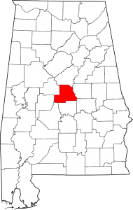
Chilton County Alabama Map
Chilton County, Alabama population is 43,643. The county seat is Clanton, Alabama. Chilton County was originally named Baker County when created in 1868 but was renamed in 1874.
The county is known for its peaches and its unique landscape. It is home to swamps, prairies and mountains due to the foothills of the Appalachians which end in the county, the Coosa River basin, and its proximity to the Black Belt Prairie that was long a center of cotton production.
Chilton County Alabama Cities:
Calera, Alabama
Calera is a city in Shelby and Chilton counties. The city limits extend southward into Chilton County along U.S. Route 31, the main highway through the city. Interstate 65 passes through the eastern side of the city, with access from exits 228, 231, and 234. It is the location of the Shelby County Airport. Calera’s population in 2010 was11,620.
Clanton, Alabama
Clanton is a city in Chilton County, Alabama. At the 2010 census the population was 8,619. The city is the county seat of Chilton County. Clanton is the site of the geographic center of Alabama.
Nearby Lay Lake Dam and Mitchell Dam became Alabama Power’s first two dams in the state.
Jemison, Alabama
Jemison is a city in Chilton County, Alabama. At the 2010 census the population was 2,585. The center of population of Alabama is located outside of Jemison, an area known as Jemison Division.
Jemison, is located at the geological end of the Appalachians and was originally inhabited by the Creek Indians for the springs located in the area. In 1869, R.J. Langston built the first house in area and it was made famous by stagecoach drivers who would stop to rest on their travels between North and South Alabama, calling the area Langston Station, or Langstonville, later known as “Jemison Springs,” and finally, Jemison, Alabama.
Chilton County Towns:
Maplesville, Alabama
Maplesville is a town in Chilton County. At the 2010 census the population was 708.The town of Maplesville first began to grow in a location 3 miles east of its present location, near Mulberry Creek. European settlers migrated to the area from Georgia and the Carolinas following the Battle of Horseshoe Bend in 1814, after the Native Americans who had been living there were defeated.
The town was located at the crossroads of two important trading routes: the Elyton Road from Selma to Birmingham, and the Fort Jackson Road from Tuscaloosa to Montgomery.
Thorsby, Alabama
Thorsby is a town in Chilton County, Alabama. As of the 2010 census, the population of the town was 1,980. Thorsby was first settled in 1895 and incorporated in 1901 by Scandinavian immigrants who had originally settled in the midwestern United States. The town grew quickly, with two hotels, a sawmill and lumber company, and two wineries being built within the first couple of years.
Chilton County Communities:
Isabella, Alabama
Isabella, also known as Benson or Bensen, is an unincorporated community in Chilton County, Alabama.
Jumbo, Alabama
Jumbo is an unincorporated community in Chilton County, Alabama.
Mountain Creek, Alabama
Mountain Creek is an unincorporated community in southeastern Chilton County, Alabama. Mountain Creek was the site of the Alabama Confederate Soldiers Home from 1902 to 1939, which is now the Confederate Memorial Park. The 102-acre park has a museum, research facility, historic structures, ruins and two cemeteries with the graves of over 300 Confederate soldiers.
Stanton, Alabama
Stanton is an unincorporated community in Chilton County, Alabama.
Verbena, Alabama
Verbena, also known as Summerfield, is an unincorporated community in southeastern Chilton County, Alabama. Named for the indigenous flower, Verbena developed into a popular resort location for the more affluent citizenry of Montgomery, the state’s capital, during the yellow fever outbreaks of the late 19th and early 20th centuries.
If you would like to become a sponsor, advertise a related location, service or vacation spot that would add to the usefulness of this site, please email us: staff@digitalalabama.com.
Chilton County Alabama Sites Of Interest
Embedded map - show in fullscreen mode
The post CHILTON COUNTY ALABAMA appeared first on Digital Alabama.
]]>