civil war
Deatsville Alabama
|
Address
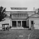
6980 Al Highway 143
Deatsville, Alabama 36022
Phone (334) 285-9881
Digital Alabama (/topic/civil-war/page/3)
Address
6980 Al Highway 143
Deatsville, Alabama 36022
Phone (334) 285-9881

The Battle of Day’s Gap, fought on April 30, 1863, was the first in a series of American Civil War skirmishes in Cullman County, Alabama, that lasted until a battle on May 2nd, known as Streight’s Raid.
In March, 1819, the United States granted to the state of Alabama in trust
for its people five sections of salt lands, two sections in Township 5 North,
Range 2 East, and three sections in Township 7 North, Range 1 East.
Between December 1862 and October 1863, several skirmishes took place in Barton as part of the American Civil War. Confederate forces sought to prevent the Union Army from invading the Tennessee Valley from their stronghold in Corinth, Mississippi.
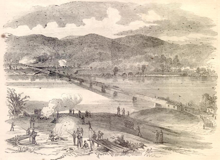
Bridgeport was the site of a major skirmish on April 29 and August 26, 1862, and numerous other small actions took place in the area. In the latter part of the war, Bridgeport was the site of a major shipyard building gunboats and transports for the Union Army.
Compiled in 1921 by Thomas McAdory Owen, LL.D.
Post office and station at the crossing of the Louisville & Nashville Railroad and the Southern Railway; in the northern suburbs of Anniston, 2 miles from the center of the city. It is one of the cotton-mill and iron-mining sections of the city of Anniston. Population: 1910-528. The locality was settled by the Hudgins family in the late thirties and for years was the terminus of the Selma, Rome and Dalton Railroad, being the shipping station for the Oxford furnace. During the War, the Confederate Government operated both the railroad and the furnace, the iron being shipped to Selma to make “Ironclads” for the Confederacy.
On April 30 at Day’s Gap on Sand Mountain, Forrest caught up with Streight’s expedition and attacked his rear guard. Streight’s men managed to repulse this attack and as a result they continued their march to avoid any further delays and envelopments caused by the Confederate troops.

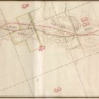
Map shows route taken by Union Admiral Farragut in August 1864 as well as that in March 1865, when his fleet provided naval support to land forces under Frederick Steele and E.R.S. Camby. Camby captured Spanish Fort and Blakely, across the bay from Mobile, entering that city on April 18. This map pays attention to the Confederates use of spikes and torpedoes (naval mines) as defenses against an invasion by water.

A regional view of Mobile and environs, encompassing Mobile, Blakely, Spanish Fort, Alabama City, Williamsburg, Fort Morgan, Fort Gaines, and Fort Orwell. Also shows defenses of Mobile Bay, including use of torpedoes (mines), spikes, and sunken logs. The city of Mobile was abandoned by the Confederates on the night of April 11-20th, 1865.