The post CALHOUN COUNTY ALABAMA appeared first on Digital Alabama.
]]>Return to Alabama County Index
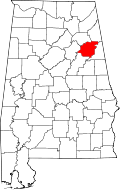 Calhoun County is a county in the east central part of the U.S. state of Alabama. As of the 2010 census, the population was 118,572. Its county seat is Anniston. Calhoun County is home to two major military installations, the now-decommissioned Fort McClellan and Anniston Army Depot.
Calhoun County Alabama History
During the territorial period, the county was home to the Creek and Cherokee Indians. In 1813, the county was the site of one of the first battles of the Creek War of 1813-1814 when Gen. Andrew Jackson ordered Gen. John Coffee to destroy the Creek town of Tallasseehatchee, located in the present-day community of Alexandria.
Calhoun County was created by legislative act on December 18, 1832. The county was initially named Benton County in honor of Missouri senator Thomas Hart Benton, an arch defender of westward expansion and slavery. After Benton declared himself an opponent of slavery in the 1850s, Alabama supporters of slavery voted to change the county’s name to Calhoun in honor of radical secessionist John C. Calhoun.
In 1917, the U.S. War Department established Camp McClellan to train soldiers for World War I. In 1929, the army changed the name to Fort McClellan, and in 1940 the first of approximately 500,000 World War II soldiers arrived for training. In addition to Fort McClellan, the War Department also added the Anniston Army Depot in 1940.
Calhoun County Alabama American Indian History
Calhoun county lies within the domain of the Creek Indians. It was traversed by De Soto in 1540 on his way to Cosa. Three miles southwest of Jacksonville on Tallasseehatchee Creek was the town of Tallasseehatchee, where General Coffee defeated the Creeks, November 3, 1813. About 12 miles south of Jacksonville on the north side of Big Shoal Creek, in the vicinity of Wolfskull Creek on the south was Chinnaby’s Fort, and some three miles below it, on the same side of the creek was an Indian village, whose name has not been preserved. Scattered along the Coosa River are many evidences of very aboriginal occupancy. Near Choccolocco Creek, three miles southwest of Oxford on the Carver place is a large isolated mound. The site has not been identified. In the southwestern corner of the county, on Coosa River at the influx of Cane Creek is a large village site, where chipped implements and pottery are quite numerous. This is the location of Tali of De Soto’s time. Several sites are noted above this point, but none are associated with any places of historic times.
Alexandria Alabama
The locality was settled about 1834, or earlier. Among its prominent settlers and citizens have been Dr. Atkinson Pelham, Dr. John H. Vandiver, Col. John M. Crook, S. D. McClelen, Elisha McClelen, Robert A. McMillan, Daniel Crow, Jacob R. Green, Lewis D. Jones, Seaborn Whatley, Floyd Bush, Daniel Bush, Rev. J. J. D. Renfroe, and Frank Woodruff. “The Gallant Pelham,” son of Dr. Pelham, was born and reared near Alexandria.
Anniston, Alabama
Anniston, in the foothills of the Appalachian Mountains, is the county seat for Calhoun County. Founded in 1872 and incorporated as a city in 1879, Anniston was a company town, built by the Woodstock Iron Company. In fact, the town was not opened for general settlement until 1883. Anniston was the first city in Alabama to be lighted with electricity in 1882.
Glencoe, Alabama
Glencoe is located in southern Etowah and northern Calhoun counties in the northeast section of the state, bordering the city of Gadsden. Glencoe began as a farming community. The community began to grow after a rock quarry located in the area in 1853 and began to build around the Louisville and Nashville Railroad that also had come through the area.
Jacksonville, Alabama

Creek Indian Chief “Du-Hoag” Ladiga
Jacksonville was founded in 1833 on land purchased from Creek Indian Chief “Du-Hoag” Ladiga. First called Drayton, the town was renamed to honor President Andrew Jackson in 1834. There are a couple Civil War monuments in town, including a statue of Major John Pelham in the city cemetery and a statue of a Confederate soldier in the middle of the square. Jacksonville served as the county seat for Calhoun County until the 20th century when it moved to Anniston. Jacksonville State University was founded here in 1883.
Jacksonville arose on the site of a Native American settlement. In its early days, the town was known as Drayton and then as Madison. It became the seat of Benton County, and a courthouse was constructed in 1833. (Benton County would be renamed Calhoun County in 1858.
Oxford, Alabama
Founded in the early 1850s, Oxford was the first city in Calhoun County to be incorporated, in 1852. The name “Oxford” was due to the presence of a narrow crossing of Choccolocco Creek that allowed farmers to ford cattle from one side of the creek to the other.
Oxford, Alabama Public Library
Oxford, Alabama Performing Arts Center
Piedmont, Alabama
Piedmont is a city in Calhoun and Cherokee counties in the U.S. state of Alabama. Piedmont is located primarily in Calhoun County, although part of the city also is located in Cherokee County, in the northeast part of the state. The population was 4,878 at the 2010 census. It is included in the Anniston-Oxford, Alabama Metropolitan Statistical Area. The area now known as Piedmont is a community that began in the early 1840s, located at the crossroads of two early post roads. Major Jacob Forney Dailey of North Carolina came to Alabama in 1848 and bought land in present-day Piedmont. Major Dailey named the area Cross Plains, and an official post office with that name was established on September 22, 1851.
The Chief Ladiga Trail, part of the longest paved bicycle trail in the nation, runs through Piedmont. The 33-mile (53 km) trail stretches from the Alabama-Georgia state line to Weaver. The Chief Ladiga is on the same rail corridor as the Silver Comet Trail in Georgia as far as Piedmont, Alabama. From there it parallels an abandoned Southern Railway line for a few miles west of town until it leaves the old Seaboard rail line, heading south on the Southern Railway route until the trail ends just north of Anniston. In 2008, the Ladiga and Silver Comet trail were connected. A new gateway marks the connecting point at the state line. Now that the Chief Ladiga and the Silver Comet trails are connected, there is a 90-mile (145 km) paved corridor for non-motorized travel from just west of Atlanta, Georgia to Anniston, making it the 2nd longest paved trail in the U.S (the longest being the Paul Bunyan State Trail in Minnesota).
Southside, Alabama

Southside Alabama
Southside is a city in Etowah and Calhoun counties in the U.S. state of Alabama. It is included in the Gadsden Metropolitan Statistical Area. It incorporated in 1957. The population was 8,412 at the time of the 2010 United States Census. Located 8 to 12 miles (13 to 19 km) south of downtown Gadsden, Southside is one of the fastest growing cities in northeast Alabama.
Weaver, Alabama

DemocraticLuntz
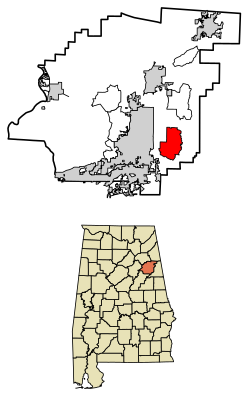
Location of Weaver Alabama in Calhoun County, Alabama
Weaver is a city in Calhoun County. At the 2010 census the population was 3,038. It is included in the Anniston-Oxford, Alabama Metropolitan Statistical Area.
Calhoun County Alabama Towns
Hobson City, Alabama

By DemocraticLuntz at English Wikipedia, CC BY-SA 4.0, https://commons.wikimedia.org/w/index.php?curid=63665826
Location of Hobson City in Calhoun County, Alabama
The town was incorporated on August 16, 1899. Records from an Alabama newspaper, The Peoples’ Journal, described the municipality as “the only municipality controlled and governed entirely by colored people anywhere in the United States.” The newspaper further commented, “The whole country will doubtless be interested in the result of this experiment.” Under the leadership of the first mayor, S. L. Davis, and the first police chief, James Duran, police protection was restored to the area. The town was named after Richmond P. Hobson, a white naval hero and member of Congress.
According to Town Hall records, much of the area now included in the corporate limits of the Hobson City was once within the city of Oxford, Alabama. During the late 19th century, the area was known as “Mooree Quarter”. The black vote from that area was a controlling factor during municipal elections. An account provided by an early settler of the community has been passed down through the years. In that account, a black person was elected as the Oxford justice of the peace. As a result, and in keeping with campaign promises, Mayor Whitehead of Oxford, AL went to the state capitol and had the corporate boundaries of Oxford redrawn to exclude Mooree Quarter and the black vote. Wikipedia
At the 2010 census the population was 771.
Ohatchee, Alabama
Ohatchee is located in Calhoun County in the northeastern portion of the state. The area around Ohatchee reportedly was used by General Andrew Jackson as a staging area for the Battle of Talladega during the Creek War. During the Civil War, nearby Janney Furnace, built to produce pig iron for the Confederacy but never used, drew raiding Union Army troops. Finding the furnaces unused, the soldiers left them largely untouched. Ohatchee was incorporated in 1956. Cartoonist Tom Sims, who co-wrote the comic strip Popeye from 1938 to 1955, was born in Ohatchee.
Calhoun County Alabama Courthouse
The Calhoun County Courthouse is a historic county courthouse in Anniston, Alabama. It was designed by Atlanta architect J. W. Golucke and built in 1900, when the county seat of Calhoun County was moved from Jacksonville. It is one of the earliest Neoclassical courthouses in Alabama. An annex with a jail was added on the north side of the building in 1924. The courthouse was rebuilt after a 1931 fire, albeit with a slightly different clock tower.
Calhoun County Alabama Jail
Sheriff Matthew Wade
400 West 8th Street
Anniston, Alabama 36201
(256)-236-5561
Jail Administrator, Eric Starr
(256)-241-8023
Calhoun County Alabama Links
Alabama Department of Revenue – Property Tax Calhoun County
Anniston Alabama Museum of Natural History
Things to do in Anniston AlabamaOpen-air exhibits place you face to face with majestic--and often deadly--animals! See one of the country's oldest exhibits of birds in their habitats, and explore the children's discovery room for hands-on experiences with Alabama's natural wonders.
Calhoun County – Alabama Zip Code Boundary Map (AL)
Calhoun County Alabama Chamber of Commerce Working Living Doing Business | Calhoun County Chamber of Commerce Alabama
Calhoun County Alabama Chamber of Commerce Working Living Doing Business | Calhoun County Chamber of Commerce Alabama
Calhoun County Alabama Chamber of Commerce Working Living Doing Business | Calhoun County Chamber of Commerce Alabama
Calhoun County Alabama History
Calhoun County School District / Homepage
Calhoun County | Alabama Department of Public Health (ADPH)
City of Anniston, Alabama
City of Anniston, Alabama Official WebsiteCity of Piedmont Alabama
Historical Maps of Alabama: Calhoun County
Jail Inmate Roster | Sheriff Matthew Wade
Sheriff Matthew Wade | Calhoun County, Alabama
Welcome | Barry E. Robertson Commissioner Of Licenses of Calhoun County, Alabama
Calhoun County Alabama Map

Embedded map - show in fullscreen mode
The post CALHOUN COUNTY ALABAMA appeared first on Digital Alabama.
]]>The post Choccolocco Alabama appeared first on Digital Alabama.
]]>
Choccolocco Alabama
Choccolocco is an unincorporated community and census-designated place in Calhoun County, Alabama. As of the 2010 census, its population was 2,804. It was founded in 1832.
Choccolocco Meaning
Choccolocco is an Indian word, chahko- meaning “shoals”, and lago meaning“big” or a shallow creek with big shoals.
Choccolocco Monster
Choccolocco is home to the Choccolocco Monster.
Wikipedia:
The community gained brief notoriety in 2001 when The Daily Show aired a piece on the “Choccolocco Monster,” a part of local folklore concerning sightings of a mysterious creature in the area in the late 1960s. An October 2001 article in the Anniston Starnewspaper revealed that the creature was, in fact, local resident Neal Williamson dressed in a cow skull and a sheet. As a teenager, Williamson would don his costume and gain the attention of passing cars by jumping out of the woods onto the roadside, often startling motorists.
Choccolocco Creek
Choccolocco Creek is a large, beautiful creek that is an excellent sport fishery and the state record redeye bass comes from this stream. It is also a scenic float. A free put-in is available to the public further downstream at the Hwy 77 bridge.
Choccolocco Alabama Zip Code
36245
Choccolocco WMA

Choccolocco Wildlife Management Area
Choccolocco Mountains
Choccolocco is the Anglicization of the Creek words, choko rakko, which mean “house big.” By the 1700s, the term referred to the Creek ceremonial square, which was bounded by wooden bleachers with awnings. It was at that time, too large to have a roof, but was still called a building.
ARCHAEOLOGISTS IDENTIFY HUNDREDS OF STONE STRUCTURES IN ALABAMA’S CHOCCOLOCCO MOUNTAINS
People of One Fire:
On June 2, 2017 several TV stations, newspapers and Alternative Perceptions Magazine announced the discovery of many more Native American stone structures in the mountainous region of Alabama, east of the Coosa River and north of Interstate 85. The concentration of stone structures extends eastward into Georgia across Metro Atlanta to the Savannah River. Archaeologist, Dr. Greg Little, believes there may be thousands of more stone structures to be discovered in the Choccolocco and Talladega Mountains of Alabama.
Choccolocco Falls
The waterfall area on Bain’s Gap Road includes a picnic pavilion and foot-bridge as well as a short walking trail. The area is also a historical site with the chimney remains of an old lodge.
The many forest roads provide excellent opportunities for both biking and hiking trails, bird and wildlife watching, or just taking a short trip to enjoy the scenic mountains, secret coves and sparkling creeks and streams. There is an unimproved camping area for hunters on Joseph Springs Parkway, just west of the hunter’s check-in station.
Bain’s Gap Waterfall Area
The Anniston Star Article on Bain’s Gap Waterfall Area
Choccolocco State Forest
Nestled in the foothills of the Appalachian Mountains in Northeast Alabama is one of our state’s best kept treasures; Choccolocco State Forest.
Named for the Choccolocco Creek which runs through the valley, Choccolocco is rich in history, including Native Americans who settled the area 2500 years ago. Near the northern boundary of the mighty Creek nation, the tribe named the creek “Choccolocco.” In the Creek language “Chahko” means “shoals” and “lago” means “big. Choccolocco Creek is a wide shallow stream with big shoals, which runs north to south, roughly dividing the forest in half. Choccolocco Creek is one of the larger tributaries of the Coosa River.
Located in south eastern Calhoun County, Choccolocco State Forest comprises approximately 4,406 acres of land with around 4,392 acres being in some type of forest cover. The remaining 14 acres consists of various openings. Four major paved roads cross Choccolocco. Alabama Highway 9 runs north-south through the eastern portion of the property and Choccolocco Road runs north-south on the west side of the forest. Joseph Springs Parkway and Bain’s Gap Road run east-west through the middle.
More About Choccolocco State Forest
Choccolocco Weather
Choccolocco Map
Old Downing Mill
Eight miles east of Sh 21 at Oxford, Alabama, turn left off US 78 onto Riddle Farm Road, go to “T”, turn left on Old Downing Mill Road. The mill is 1/4 mile on right.
The post Choccolocco Alabama appeared first on Digital Alabama.
]]>The post Piedmont Alabama appeared first on Digital Alabama.
]]>Compiled in 1921 by Thomas McAdory Owen, LL.D.
Post office and incorporated town, on the Southern Railway and the Seaboard Air Line Railway, in the northeast corner of Calhoun County, 13 miles northeast of Jacksonville and about 25 miles northeast of Anniston.
Altitude: 705 feet.
Population: 1880 – 381; 1890 – 711; 1900 – 1,745; 1910 – 2,226; 1916 – 3,000.
Its banks are the First National and the Farmers & Merchants Bank (State). The Piedmont Journal, a Democratic weekly, established in 1907, is published there. Its industries are large cotton mills, 2 cotton ginneries, and a rim-binding factory. It was first called Cross Plains, from its situation on the edge of a plain and at the crossing of two important stagecoach roads. The name was changed to Piedmont about 1880. The first settlers were Neal Ferguson, Jacob F. Daily, Hampton Graham, Gilbert Craig, John W. Ledbetter, James Price, Dr. R. G. Teague and Dr. John B. Cowden.
References. – Polk’s Alabama gazetteer, 1888-9, p. 291; Lippincott’s gazetteer, 1913, p. 1444; Alabama Official and Statistical Register, 1915.
The post Piedmont Alabama appeared first on Digital Alabama.
]]>