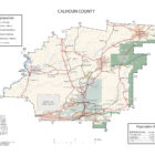
CALHOUN COUNTY ALABAMA
Calhoun County Alabama
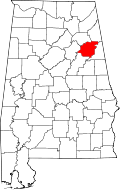 Calhoun County is a county in the east central part of the U.S. state of Alabama. As of the 2010 census, the population was 118,572. Its county seat is Anniston. Calhoun County is home to two major military installations, the now-decommissioned Fort McClellan and Anniston Army Depot.
Calhoun County is also home to Jacksonville State University, the Anniston Museum of Natural History, the Berman Museum of World History and the Coldwater Covered Bridge. It also contains a portion of the Talladega National Forest.
Calhoun County Alabama History
During the territorial period, the county was home to the Creek and Cherokee Indians. In 1813, the county was the site of one of the first battles of the Creek War of 1813-1814 when Gen. Andrew Jackson ordered Gen. John Coffee to destroy the Creek town of Tallasseehatchee, located in the present-day community of Alexandria.
Calhoun County was created by legislative act on December 18, 1832. The county was initially named Benton County in honor of Missouri senator Thomas Hart Benton, an arch defender of westward expansion and slavery. After Benton declared himself an opponent of slavery in the 1850s, Alabama supporters of slavery voted to change the county’s name to Calhoun in honor of radical secessionist John C. Calhoun.
In 1917, the U.S. War Department established Camp McClellan to train soldiers for World War I. In 1929, the army changed the name to Fort McClellan, and in 1940 the first of approximately 500,000 World War II soldiers arrived for training. In addition to Fort McClellan, the War Department also added the Anniston Army Depot in 1940.
Calhoun County Alabama American Indian History
Calhoun county lies within the domain of the Creek Indians. It was traversed by De Soto in 1540 on his way to Cosa. Three miles southwest of Jacksonville on Tallasseehatchee Creek was the town of Tallasseehatchee, where General Coffee defeated the Creeks, November 3, 1813. About 12 miles south of Jacksonville on the north side of Big Shoal Creek, in the vicinity of Wolfskull Creek on the south was Chinnaby’s Fort, and some three miles below it, on the same side of the creek was an Indian village, whose name has not been preserved. Scattered along the Coosa River are many evidences of very aboriginal occupancy. Near Choccolocco Creek, three miles southwest of Oxford on the Carver place is a large isolated mound. The site has not been identified. In the southwestern corner of the county, on Coosa River at the influx of Cane Creek is a large village site, where chipped implements and pottery are quite numerous. This is the location of Tali of De Soto’s time. Several sites are noted above this point, but none are associated with any places of historic times.
Alexandria Alabama History
The locality was settled about 1834, or earlier. Among its prominent settlers and citizens have been Dr. Atkinson Pelham, Dr. John H. Vandiver, Col. John M. Crook, S. D. McClelen, Elisha McClelen, Robert A. McMillan, Daniel Crow, Jacob R. Green, Lewis D. Jones, Seaborn Whatley, Floyd Bush, Daniel Bush, Rev. J. J. D. Renfroe, and Frank Woodruff. “The Gallant Pelham,” son of Dr. Pelham, was born and reared near Alexandria.
Post office and station, in the central part of Calhoun County, secs. 34 and 35, T. 14, R. 7, E., on the Louisville & Nashville Railroad, 10 miles northwest of Anniston, and 25 miles southeast of Gadsden. It was first called Coffeeville, in honor of Gen. Coffee, who fought a battle with the Indians in 1813, 2 1/2 miles west of Alexandria. Later it was changed to the present name.
Altitude: 555 feet. Population: Alexandria Precinct, 1870 – 1,689; 1880 – 121; 1888 – 100; 1910 – 90; Alexandra Precinct, including the town, 1910 – 2219.
The locality was settled about 1834, or earlier. Among its prominent settlers and citizens have been Dr. Atkinson Pelham, Dr. John H. Vandiver, Col. John M. Crook, S. D. McClelen, Elisha McClelen, Robert A. McMillan, Daniel Crow, Jacob R. Green, Lewis D. Jones, Seaborn Whatley, Floyd Bush, Daniel Bush, Rev. J. J. D. Renfroe, and Frank Woodruff. “The Gallant Pelham,” son of Dr. Pelham, was born and reared near Alexandria.
References. – Brewer, Alabama (1872); Northern Alabama (1888), p. 112; Polk’s Alabama gazeteer, 1888-9, p. 71; Alabama Official and Statistical Register, 1915.
Source: compiled in 1921 by Thomas McAdory Owen, LL.D
Anniston Alabama History
Anniston, in the foothills of the Appalachian Mountains, is the county seat for Calhoun County. Founded in 1872 and incorporated as a city in 1879, Anniston was a company town, built by the Woodstock Iron Company. In fact, the town was not opened for general settlement until 1883. Anniston was the first city in Alabama to be lighted with electricity in 1882.
County seat of Calhoun county; on the main lines of the Southern Railway, the Seaboard Air Line Railway, and the Louisville & Nashville Railroad. It is situated in an amphitheater of the Blue Ridge Mountains, in the southern part of the country, in secs. 5 and 6, and 7 and 8, T. 16, R. 8; 63 miles northeast of Birmingham, 148 miles north of Montgomery, 104 miles west of Atlanta, and 142 miles south of Chattanooga, Tenn. Altitude: 800 feet. Average temperature: 80 degrees in summer and 40 degrees in winter. Population: 1880 – 942; 1890 – 9,998; 1900 – 9,695; 1910 – 12,794; 1915 – 20,000.
The town was first known as Woodstock. It was incorporated as Anniston in 1873, under the general laws, and by the legislature, February 4, 1879. The town was created as a separate school district by act of February 3, 1883. The charter was amended and greatly amplified by act of February 23, 1889. The Woodstock company threw the town open to outsiders in 1883, and its growth to 1890 was phenomenal. The corporate limits comprise a 3-mile circle, whose center is at the crossing of Noble Avenue, and 17th Street. It has waterworks, built in 1881; fire department, consisting of 3 stations, each with a motor truck; privately owned electric light and power plant, and gas plant; city hall; jail; 30 mile of sanitary sewerage; 2 miles of bithulitic and 35 miles of macadamized streets; cement sidewalks; and 15 miles of electric street railway.
Churches: Anniston has been called “the Brooklyn of the South,” or “the City of Churches.” In 1881 the Episcopalians established a mission under Rev. W. Carnahan, and soon afterward erected a $35,000 building. They now have two churches – Grace Church, and St. Michael and All Angels. In 1883, the Methodist Episcopal Church, South, under Rev. T. H. Davenport, established the First Methodist Church. Later the McCoy Memorial, Oxanna, St. Pauls, and Wesley Chapel were built. In the same year the Baptists built the Parker Memorial, The First Baptist Church, Blue Mountain, Glen Addie and West End churches. In 1884, the Presbyterians established their first church organization in the town. They now have the First, Second, and Glen Addie Churches. Besides these, there are Northern Methodist, Congregational, Cumberland Presbyterian, Church of Christ, Catholic, Jewish, 7 Negro Baptist, 8 Negro Methodist, and 2 Negro Presbyterian Churches.
Anniston has 18 small parks and playgrounds distributed over the city; Oxford Lake park; the country club and golf links.
In 1862, the land on which Anniston now stands was owned by D. P. Gunnells of Oxford, who sold it to the Oxford Furnace Company. In 1872, Samuel Noble and Daniel Tyler bought the ruins of old Oxford Furnace, and rebuilt it, and organized the Woodstock Furnace Co., which was one of the few southern industries that survived the financial panic of 1873. Its fires were never banked, and its product always found a market. Samuel Noble, to whom Anniston has erected a fitting memorial, laid out its broad streets, conserving the parks, providing sewerage and waterworks, planting its splendid avenues of trees and making a model city. In 1883, the demand from outside was so insistent, that the manufacturing city was formally opened to the public. Henry W. Grady the gifted Georgia editor, of Atlanta, presided for the company. The county seat was removed to Anniston in 1895.
The earliest settlers of this region were the Gunnells and Edmondson families. The most notable residents were Samuel, James, John and William Noble, and Daniel, Alfred L. and E. L. Tyler. General Daniel Tyler died in New York City, 1882, but his body was brought to Hillside Cemetery, Anniston. He was the grandfather of Mrs. Theodore Roosevelt, sr. (Edith Carew).
References. – Acts, 1878-79, pp. 353-359; 1882-83, pp. 335-337, 461; 1888-89, pp. 601-624; Armes, Story of coal and from in Alabama (1910), pp. 179, 180-185, 310 et seq.;Northern Alabama (1888), pp. 470-477; Anniston Chamber of Commerce, Folders and pamphlets.
Source: compiled in 1921 by Thomas McAdory Owen, LL.D
Blue Mountain History
Post office and station at the crossing of the Louisville & Nashville Railroad and the Southern Railway; in the northern suburbs of Anniston, 2 miles from the center of the city. It is one of the cotton-mill and iron-mining sections of the city of Anniston. Population: 1910-528. The locality was settled by the Hudgins family in the late thirties and for years was the terminus of the Selma, Rome and Dalton Railroad, being the shipping station for the Oxford furnace. During the War, the Confederate Government operated both the railroad and the furnace, the iron being shipped to Selma to make “Ironclads” for the Confederacy. The town was burned in 1864.
Source: compiled in 1921 by Thomas McAdory Owen, LL.D
References. – Armes, Story of coal and iron in Alabama (1910), pp. 180-182, 206.
Camp McClellan History
United States Army Camp, located 5 miles north of Anniston which was founded in 1917. Upon the agreement of the citizens of Anniston to furnish land, water mains, electric lights, etc., the government of the United States agreed to locate a military camp at that point, where soldiers were to be trained for participation in World War I.
The 29th Division consisting of the headquarters troop; the military police; two brigades of infantry; three regiments of artillery; sanitary trains; French motor battery; field signal battalion; engineer regiment; engineer trains; ammunition and supply trains were trained at Camp McClellan before embarking in May for France.
A remount station, No. 309, was maintained, and a base hospital was constructed with a capacity of 1,256 beds. The Southern and Louisville and Nashville railways had sidings which led into the camp.
The Red Cross, Knights of Columbus, Salvation Army, War Camp Community service and Hostess Houses gave places for amusement and entertainment.
The American Library Association maintained a library known as Camp McClellan Library.
Camp McClellan was renamed to Fort McClellan in 1929 and was the training ground for half a million soldiers during World War II.
References. – Manuscripts in the files of Alabama Department of Archives and History.Source: compiled in 1921 by Thomas McAdory Owen, LL.D
Chinnaby’s Fort History
An old Creek Indian defense in Calhoun County. There is a difference of opinion as to its exact location. Drake states that in 1813 a friendly Creek chief named Chinnaby had a kind of fort at Ten Islands on the Coosa River, and to which his name was given. The map accompanying the Eighteenth Annual Report of the Bureau of American Ethnology, however, places it at a point on the north side of Choccolocco Creek, and near the influx of the Wolfskull Creek.
Source: compiled in 1921 by Thomas McAdory Owen, LL.D
References. – Gatschet, in Alabama History Commission, Report (1901), vol. 1, p. 395; Drake, Book of Indians (1848), p. 55; Bureau of American Ethnology, Eighteenth Annual Report (1899); pt. 2, map 1; Handbook of American Indians (1907), vol. 1, p. 272.
Calhoun County Historical Destinations
Anniston Freedom Riders Murals
Anniston
Centennial Memorial Park
Anniston
Coldwater Covered Bridge
Oxford
Janney Furnace Civil War and Native American Museum
Ohatchee
Anniston Museum of Natural History*
Anniston
Berman Museum of World History
Anniston
Calhoun County Alabama Cities
Anniston Alabama
Anniston is the county seat of Calhoun County. As of the 2010 census, the population of the city was 23,106.Named “The Model City” by Atlanta newspaperman Henry W. Grady for its careful planning in the late 19th century, the city is situated on the slope of Blue Mountain.
Glencoe Alabama
Glencoe is located in southern Etowah and northern Calhoun counties in the northeast section of the state, bordering the city of Gadsden. Glencoe began as a farming community. The community began to grow after a rock quarry located in the area in 1853 and began to build around the Louisville and Nashville Railroad that also had come through the area.
Jacksonville Alabama

Jacksonville was founded in 1833 on land purchased from Creek Indian Chief “Du-Hoag” Ladiga. First called Drayton, the town was renamed to honor President Andrew Jackson in 1834. There are a couple Civil War monuments in town, including a statue of Major John Pelham in the city cemetery and a statue of a Confederate soldier in the middle of the square. Jacksonville served as the county seat for Calhoun County until the 20th century when it moved to Anniston. Jacksonville State University was founded here in 1883.
Jacksonville arose on the site of a Native American settlement. In its early days, the town was known as Drayton and then as Madison. It became the seat of Benton County, and a courthouse was constructed in 1833. (Benton County would be renamed Calhoun County in 1858.
Post office and incorporated town in the east-central part of Calhoun County, and on the Southern Railway, about 12 miles north of Anniston, about 50 miles southwest of Rome, Ga., and about 20 miles southeast of Gadsden. Altitude: 720 feet. Population: 1870 – 958; 1888 – 2,000; 1890 – 1,237;
1900 – 1,176; 1910 – 2,231. It was incorporated in 1836. Its corporate limits were enlarged to their present dimensions in 1860, and in 1907 the town adopted the general municipal code. It has a city hall and a jail, erected in 1906, a volunteer fire department, and several miles of cherted streets. There are parks and playgrounds covering several blocks. The city installed a waterworks system in 1868, which was later sold to private persons. It also has a privately owned electric light plant. The city tax rate is three-fourths of 1 per cent, and its bonded indebtedness $32,000 – $10,000 for waterworks, $10,000 for State normal college, and $12,000 for city high school. The First National is the only bank. The Jacksonville Record, a Democratic weekly established in 1906, and the Bulletin of the State normal college, a quarterly established in 1905, are published there. Its industries are the Profile Cotton Mills, capitalized at $1,000,000 and spinning thread only, cotton ginneries, cotton warehouses, fertilizer plant, cottonseed oil mills, heading mills, 2 flouring mills, grain mills, waterworks plant, electric light plant, and iron ore, kaolin, and lead mines in the vicinity. There are also marble and limestone quarries nearby. The Jacksonville State Normal College, established in 1884, is located in the town.
In 1833 Jacksonville built the county courthouse in the center of a large square. When the county seat was removed to Anniston in 1895, the Jacksonville people placed a handsome Confederate monument in the center of one square.
Among the early settlers of the locality, were the Forney, Foster, Crook, Stevenson, Abernathy, Gardner, Pelham, Walker, and Ellis families.Source: compiled in 1921 by Thomas McAdory Owen, LL.D
References. – Brewer, Alabama (1872), pp. 152 et seq.; Northern Alabama (1888), p. 111; Polk’s Alabama gazetteer, 1888-9, p. 440; Alabama Official and Statistical Register, 1915Oxford Alabama
Founded in the early 1850s, Oxford was the first city in Calhoun County to be incorporated, in 1852. The name “Oxford” was due to the presence of a narrow crossing of Choccolocco Creek that allowed farmers to ford cattle from one side of the creek to the other.
Post office and incorporated town, on the Southern Railway and the Louisville & Nashville Railroad, in the southern part of Calhoun County, on Big Shoal Creek, 3 miles south of Anniston, and 22 miles northeast of Talladega. Altitude: 640 feet. Population: 1870 – 1,147; 1880 – 780; 1890 – 1,473; 1900 – 1,372; 1910 – 1,090. It is incorporated under the municipal code of 1907. It rents all its municipal buildings except the jail and fire department buildings. It has privately owned gas and electric light plants, municipally owned waterworks, 8 miles sanitary sewerage, paved sidewalks laid in 1912 and 1913 at a cost of $6,000, and a volunteer fire department. Its tax rate is 5 mills, and its bonded indebtedness, $22,000, maturing in 20 years – $10,000 for waterworks, and $12,000 for sewerage. There is an electric street car system between Oxford and Anniston, and to Oxford Lake, the site of the plant of the Alabama Power Co. The First National Bank is the only banking institution, and the Oxford Tribune, a weekly, its only newspaper. Its industries are a cottonseed oil mill, a linter ginnery, a fertilizer plant, a cotton ginnery, a firebrick plant, a cotton-cord and twine mill, a Farmer’s Alliance warehouse, and iron ore and coal mines in the vicinity. It is the location of the Calhoun County High School. There is a playground or park, occupying a large block in the city, and under the supervision of the school improvement association. Oxford Lark Park, owned by the Alabama Power Co., is convenient to the town.
The locality was known in pioneer days as “Lick-Skillet,” but for what reason no one now knows. It was settled by the Kelly, Snow, Gunnells, Dudley, and Don families. In 1868 John L. Dodson founded Oxford College there (q. v.).Source: compiled in 1921 by Thomas McAdory Owen, LL.D
References. – Armes, Story of coal and iron in Alabama (1910), pp. 179 et seq.; Brewer, Alabama (1872), p. 152; Northern Alabama (1888), p. 112; Polk’s Alabama gazetteer, 1888-9, p. 640; Alabama Official and Statistical Register, 1915.Oxford Alabama Public Library
Oxford Alabama Performing Arts Center
Piedmont Alabama
Piedmont is a city in Calhoun and Cherokee counties in the U.S. state of Alabama. Piedmont is located primarily in Calhoun County, although part of the city also is located in Cherokee County, in the northeast part of the state. The population was 4,878 at the 2010 census. It is included in the Anniston-Oxford, Alabama Metropolitan Statistical Area. The area now known as Piedmont is a community that began in the early 1840s, located at the crossroads of two early post roads. Major Jacob Forney Dailey of North Carolina came to Alabama in 1848 and bought land in present-day Piedmont. Major Dailey named the area Cross Plains, and an official post office with that name was established on September 22, 1851.
The Chief Ladiga Trail, part of the longest paved bicycle trail in the nation, runs through Piedmont. The 33-mile (53 km) trail stretches from the Alabama-Georgia state line to Weaver. The Chief Ladiga is on the same rail corridor as the Silver Comet Trail in Georgia as far as Piedmont, Alabama. From there it parallels an abandoned Southern Railway line for a few miles west of town until it leaves the old Seaboard rail line, heading south on the Southern Railway route until the trail ends just north of Anniston. In 2008, the Ladiga and Silver Comet trail were connected. A new gateway marks the connecting point at the state line. Now that the Chief Ladiga and the Silver Comet trails are connected, there is a 90-mile (145 km) paved corridor for non-motorized travel from just west of Atlanta, Georgia to Anniston, making it the 2nd longest paved trail in the U.S (the longest being the Paul Bunyan State Trail in Minnesota).
Post office and incorporated town, on the Southern Railway and the Seaboard Air Line Railway, in the northeast corner of Calhoun County, 13 miles northeast of Jacksonville and about 25 miles northeast of Anniston. Altitude: 705 feet. Population: 1880 – 381; 1890 – 711; 1900 – 1,745; 1910 – 2,226; 1916 – 3,000. Its banks are the First National and the Farmers & Merchants Bank (State). The Piedmont Journal, a Democratic weekly, established in 1907, is published there. Its industries are large cotton mills, 2 cotton ginneries, and a rim-binding factory. It was first called Cross Plains, from its situation on the edge of a plain and at the crossing of two important stagecoach roads. The name was changed to Piedmont about 1880. The first settlers were Neal Ferguson, Jacob F. Daily, Hampton Graham, Gilbert Craig, John W. Ledbetter, James Price, Dr. R. G. Teague and Dr. John B. Cowden.
Source: compiled in 1921 by Thomas McAdory Owen, LL.D
References. – Polk’s Alabama gazetteer, 1888-9, p. 291; Lippincott’s gazetteer, 1913, p. 1444; Alabama Official and Statistical Register, 1915.
Southside Alabama

Southside is a city in Etowah and Calhoun counties in the U.S. state of Alabama. It is included in the Gadsden Metropolitan Statistical Area. It incorporated in 1957. The population was 8,412 at the time of the 2010 United States Census. Located 8 to 12 miles (13 to 19 km) south of downtown Gadsden, Southside is one of the fastest growing cities in northeast Alabama.
Weaver Alabama

Weaver is a city in Calhoun County. At the 2010 census the population was 3,038.
Prior to the territorial period, what is now Weaver was located in a region of the state controlled by the Cherokee Indians. After their forced removal in the mid-1830s, white settlers began to move in to the area. Among these early residents were brothers Simeon and Linzey Weaver, whose family name the town eventually adopted.
The Chief Ladiga Bicycle Trail passes through Weaver. Weaver City Park features a BMX bicycle track as well as basketball and tennis courts, picnic and playground facilities, a walking trail, a skate park, and a remote-controlled vehicle track.
Calhoun County Alabama Towns
Hobson City Alabama

The town was incorporated on August 16, 1899. Records from an Alabama newspaper, The Peoples’ Journal, described the municipality as “the only municipality controlled and governed entirely by colored people anywhere in the United States.” The newspaper further commented, “The whole country will doubtless be interested in the result of this experiment.” Under the leadership of the first mayor, S. L. Davis, and the first police chief, James Duran, police protection was restored to the area. The town was named after Richmond P. Hobson, a white naval hero and member of Congress.
According to Town Hall records, much of the area now included in the corporate limits of the Hobson City was once within the city of Oxford, Alabama. During the late 19th century, the area was known as “Mooree Quarter”. The black vote from that area was a controlling factor during municipal elections. An account provided by an early settler of the community has been passed down through the years. In that account, a black person was elected as the Oxford justice of the peace. As a result, and in keeping with campaign promises, Mayor Whitehead of Oxford, AL went to the state capitol and had the corporate boundaries of Oxford redrawn to exclude Mooree Quarter and the black vote. Wikipedia
At the 2010 census the population was 771.
Ohatchee Alabama
Ohatchee is located in Calhoun County in the northeastern portion of the state. The area around Ohatchee reportedly was used by General Andrew Jackson as a staging area for the Battle of Talladega* during the Creek War. During the Civil War, nearby Janney Furnace, built to produce pig iron for the Confederacy but never used, drew raiding Union Army troops. Finding the furnaces unused, the soldiers left them largely untouched.# Ohatchee was incorporated in 1956. Cartoonist Tom Sims, who co-wrote the comic strip Popeye from 1938 to 1955, was born in Ohatchee.
Calhoun County Alabama Census-designated Places
Alexandria Alabama
lexandria is a census-designated place and unincorporated community in Calhoun County.Alexandria is located near the center of the county. Alexandria first appeared as an incorporated town on the 1880.
Bynum Alabama
Bynum is a former census-designated place in Calhoun County. At the 2000 census the population was 1,863. The area is now part of the city of Oxford.
Choccolocco Alabama
Choccolocco is an unincorporated community and census-designated place in Calhoun County.
Nances Creek Alabama
Nances Creek is a census-designated place and unincorporated community in Calhoun County. Its population was 407 as of the 2010 census.
Saks Alabama
Saks is a census-designated place (CDP) and Unincorporated community in Calhoun County. At the 2010 census the population was 10,744.
West End-Cobb Town
West End-Cobb Town is a census-designated place (CDP) and unincorporated community in Calhoun County. At the 2010 census the population was 3,465.
White Plains Alabama
White Plains is a census-designated place and unincorporated community in Calhoun County. Its population was 811 as of the 2010 census.
Calhoun County Alabama Unincorporated Communities
Chosea Springs
Chosea Springs, also known as Chosa, Joseph Springs, Hannatown, Hickory Springs, or Hickory Town, is an unincorporated community in Calhoun County. A post office called Chosa was established in 1889, and remained in operation until it was discontinued later that year.
DeArmanville Alabama
DeArmanville is an unincorporated community in Calhoun County located on the southeast boundary of Anniston. DeArmanville has a post office with ZIP code 36257.
Eastaboga Alabama
Eastaboga is an unincorporated community on the border of Talladega and Calhoun counties. It was previously called McFall and incorporated in 1898, only to be disincorporated in 1901. The original community of Eastaboga was to the south and became known as Old Eastaboga after McFall’s name was changed to Eastaboga.
Iron City Alabama
ron City, also spelled Ironcity, is an unincorporated community in Calhoun County. Iron City was named after the iron ore found in the area. It was located on the Southern Railway route between Muscadine and Birmingham. A post office called Ironcity was established in 1889, and remained in operation until it was discontinued in 1935.
Merrellton Alabama
Merrellton, also known as East and West Junction, Junction, and Merrelton, is an unincorporated community in Calhoun County. A post office was established in 1884 and closed in 1923.
Peaceburg Alabama
Peaceburg is an unincorporated community in Calhoun County. A post office was established in the former town of Peaceburg, Alabama, in 1885, and remained in operation until it was discontinued in 1905. Peaceburg (as well as the nearby town of Morrisville) was part of a purchase of 26,912.17 acres by the War Department in 1941. The area was evacuated by its residents and served the purpose of training for World War II. Originally it was called the Morrisville Maneuver Area but later was renamed as the Pelham Range Area.
Possum Trot Alabama
Possum Trot is an unincorporated community in Calhoun County.
Wellington Alabama
Wellington is an unincorporated community in Calhoun County.
Calhoun County Alabama Ghost Towns
Bera Alabama
Choccolocco Alabama
Coldwater Alabama
Iron City Alabama
Jenkins Alabama
Laney Alabama
Mink Alabama
Nances Creek Alabama
Peeks Hill Alabama
Vigo Alabama
Wellington Alabama
Calhoun County Alabama Courthouse
The Calhoun County Courthouse is a historic county courthouse in Anniston, Alabama. It was designed by Atlanta architect J. W. Golucke and built in 1900, when the county seat of Calhoun County was moved from Jacksonville. It is one of the earliest Neoclassical courthouses in Alabama. An annex with a jail was added on the north side of the building in 1924. The courthouse was rebuilt after a 1931 fire, albeit with a slightly different clock tower.
Calhoun County Alabama Jail
Sheriff Matthew Wade
400 West 8th Street
Anniston, Alabama 36201
(256)-236-5561
Jail Administrator, Eric Starr
(256)-241-8023
Return to Alabama County Index
Calhoun County Alabama WebLinks
- Alabama Department of Revenue – Property Tax Calhoun County
- Anniston Alabama Museum of Natural History
Open-air exhibits place you face to face with majestic--and often deadly--animals! See one of the country's oldest exhibits of birds in their habitats, and explore the children's discovery room for hands-on experiences with Alabama's natural wonders.
- Anniston Museum of Natural History | Facebook
- Calhoun County – Alabama Zip Code Boundary Map (AL)
- Calhoun County Alabama Chamber of Commerce Working Living Doing Business | Calhoun County Chamber of Commerce Alabama
- Calhoun County Alabama Chamber of Commerce Working Living Doing Business | Calhoun County Chamber of Commerce Alabama
- Calhoun County Alabama Chamber of Commerce Working Living Doing Business | Calhoun County Chamber of Commerce Alabama
- Calhoun County Alabama History
- Calhoun County School District / Homepage
- Calhoun County | Alabama Department of Public Health (ADPH)
- City of Anniston, Alabama
- City of Glencoe | Glencoe, Alabama | A City of Patriotism
- City of Jacksonville
- City of Jacksonville Alabama
- City of Piedmont Alabama
- City of Weaver | Calhoun County, Alabama
- Historical Maps of Alabama: Calhoun County
- Hobson City Alabama
Hobson City Hall
610 Martin Luther King Drive
Hobson City, Alabama 36201
Phone: 256.831.4940
Email: hobsoncityhall@bellsouth.net - Jail Inmate Roster | Sheriff Matthew Wade
- Oxford Alabama
- Sheriff Matthew Wade | Calhoun County, Alabama
- Welcome | Barry E. Robertson Commissioner Of Licenses of Calhoun County, Alabama