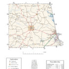
CHAMBERS COUNTY ALABAMA
Chambers County Alabama

Chambers County population is 34,215. Chambers County was established on December 18, 1832. Its county seat is Lafayette. Its name is in honor of Henry H. Chambers, who served as a United States Senator from Alabama.
Prior to contact with people of European descent, what is now Chambers County was inhabited by the Creek Indian Nation.
Pat Garrett, the lawman famed for killing outlaw Billy the Kid, was born near the town of Cusseta in 1850.
Joe Louis “The Brown Bomber”, renowned heavyweight boxing champion, was born near LaFayette, on Buckalew Mountain, May 13, 1914.
Chambers County joined the four mill cities to make The Valley (which is now the largest city). Valley is rapidly increasing in size and located between Montgomery, Alabama and Atlanta, Georgia.
Chambers County Historical Destinations
Iron Bridge
Valley
Joe Louis Statue
Lafayette
Chambers County Museum
Lafayette
Chambers County Alabama Cities
Cusseta Alabama
Named for the ancient Creek Indian town of Cusseta. The community was believed to be unincorporated until 2006, when rediscovered documents indicated that Cusseta had been incorporated as a city in 1853. In April, 2007 it was re-instated as a town in 2010.
LaFayette Alabama
LaFayette, the county seat for Chambers County, is located in east-central Alabama on a ridge that divides the Chattahoochee and Tallapoosa river basins. The town was first called Chambersville, but by the time of incorporation on January 7, 1835, the town name had been changed to LaFayette. LaFayette is located near West Point Lake in Georgia, 15 minutes to the east, and Alabama’s Lake Martin, 30 minutes to the west. In addition to these major lakes, LaFayette has fishing opportunities at the 90-acre City Lake and the 183-acre Chambers County Lake.
Lanett Alabama
Lanett is located on the Alabama-Georgia line in the east-central part of the state. Lanett was originally named Bluffton and was incorporated in 1865 or 1866. The town changed its name to Lanett in February 1895. The site of Fort Tyler, the last Confederate fort to fall during the Civil War, is partially located within the city limits of Lanett.
Valley Alabama
Two large textile mills were built in the 1860s resulting in creation of mill towns of Langdale and Riverview. In the early 1900s two more mills were built, spawning the villages of Shawmut and Fairfax. On April 22, 1980, the four municipalities merged and incorporated as a city. Because the general area had long been referred to as the The Valley, the city took the name Valley.
Chambers County Alabama Towns
Waverly Alabama
Waverly is a town in Chambers and Lee counties. It was incorporated in 1910. The town population is 145. Waverly was settled in the 1830s, but saw little growth until the 1870s. The name of Waverly, Alabama first appeared on Alabama maps in 1853. It was given the nickname, Pea Ridge, but this was never its official name. The second Saturday of each October, the Town of Waverly hosts the Annual Waverly BBQ.
Five Points Alabama
In 1885, Five Points was named because of the five roads converging at a single point. Before this, the post office was known as “Lystra”. The town was incorporated in 1915, making it Chambers County’s oldest incorporated town. The Baptist Church was the first to take the name of “Five Points” on its building in 1929.
Five Points holds the distinction of being the first town of its size to receive electricity from Alabama Power in 1925. In order to receive power, citizens were required to erect their own poles from Stroud to White Plains.
Chambers County Alabama Communities
Abanda Alabama
Abanda is a census-designated place and unincorporated community in Chambers County. Its population was 192 as of the 2010 census. The community got its name from the initials of the Atlanta Birmingham and Atlantic Railroad (ABandA) that was constructed through the area in the early 1900s.
Fredonia Alabama
Fredonia is an unincorporated community. Its population is 199.Other names for the community have included “Freedona” and “Hursts Store”. It is the location of the New Hope Rosenwald School, which is listed on the National Register of Historic Places.
A Brief History of Fredonia
Huguley Alabama
Huguley is located in southeastern Chambers County at 32°50’16.811″ North, 85°13’59.300″ West (32.838003, -85.233139). It is bordered by the city of Lanett to the east and the city of Valley to the southeast.
Penton Alabama
Penton is a census-designated place and unincorporated community in Chambers County. Its population was 201 as of the 2010 census.
Standing Rock Alabama
Oak Bowery, Alabama
Oak Bowery is an unincorporated community in southern Chambers County. It lies along U.S. Route 431, north of Auburn.
Oakland Alabama
Oakland is an unincorporated community in Chambers County.
Stroud Alabama
Stroud is an unincorporated community in Chambers County, located along U.S. Route 431.
White Plains Alabama
White Plains is a census-designated place and unincorporated community in Calhoun County, Alabama, United States. Its population was 811 as of the 2010 census. The community is located in eastern Calhoun County along Alabama Highway 9.
Chambers County Alabama Ghost Towns
Blackman Alabama
Cedric Alabama
Chambers Alabama
Dates From: 1830
Danway Alabama
Denson Alabama
Doublehead Alabama
Dates From: 1888
Fordyce Alabama
Marcoot Alabama
Moorefield Alabama
Oakland Alabama
Standing Rock Alabama
Chambers County Alabama Weblinks
Valley, Alabama was incorporated in 1980 combining the four textile mill villages of Fairfax, Langdale, Riverview, and Shawmut. We are located on Interstate 85 halfway between Montgomery, Alabama and Atlanta, Georgia. Valley is only 75 miles southwest of Atlanta-Hartsfield International Airport (Google Map) and 85 miles northeast of Montgomery Regional Airport-Dannelly Field (Google Map) Airport in Montgomery. Our population is 9,200. The city lies on the banks of the Chattahoochee River - the state border between Alabama and Georgia. Valley is an "Alabama Community of Excellence", one of only eight in the state.