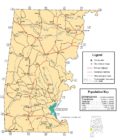
CHOCTAW COUNTY ALABAMA
Choctaw County Alabama
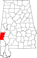
Choctaw County Alabama’s population is 13,859. Its county seat is Butler, Alabama. The county was established on December 29, 1847 and named for the Choctaw tribe of American Indians.
Choctaw County Alabama Geography
The Tombigbee River flows along the eastern edge of the county, and several of its tributaries, including Wahalak, Big Tallawampa, and Turkey creeks, cross the area. US 84 runs east-west in the southern part of the county, and State Highway 17 runs north-south through the center of the county.
Choctaw County Alabama History
Most of the early pioneers of Choctaw County were farmers from North and South Carolina. Choctaw County was created by an act of the Alabama State Legislature on December 29, 1847, from land formerly within the Choctaw Nation. Located in the southwestern part of the state, the county was named for the Choctaw Indians, some of whom had settlements near the present-day town of Pushmataha, named for the noted Choctaw chief. Early settlers in Choctaw County produced cotton and other agricultural goods that they floated down the Tombigbee River to Mobile. The forestry industry has been the economic backbone of the county since its creation in 1847.
Choctaw County Alabama Events and Places of Interest
Choctaw County is home to the Choctaw County Heritage Festival, an annual event held every Memorial Day weekend. The county is also home to Choctaw National Wildlife Refuge, located along the Tombigbee River. The refuge, which includes nearly 4,500 acres, is home to alligators, numerous bird species, beavers, deer, turkey, raccoon, and several endangered or threatened species including bald eagles and wood storks.
Choctaw County Historical Destinations
Old Naheola Bridge
Pennington
Wilson’s Grist Mill and Broadhead Memorial Park
Needham
Choctaw County Historical Museum *
Gilbertown
Choctaw County Alabama Towns:
Butler Alabama
When Choctaw County was formed in 1847, Butler was created as the county seat. The town was located and settled in 1848. It is named in honor of Colonel Pierce Butler, a soldier killed in the Mexican–American War.
If you are a visitor to our area, you have chosen a destination that has a wealth of heritage and cultural diversity. Our town is rich in community spirit with a strong sense of civic consciousness. Our residents benefit from a first-rate Volunteer Fire Department; a dedicated police force; modern utilities and communications amenities; and exemplary healthcare services ranging from the top-notch paramedics & EMTs of our ambulance service to the professional personnel of our new medical facility, Choctaw General Hospital. On behalf of the town council, the entire staff, and myself, we hope you will enjoy your visit to our website and we invite you to personally experience our lovely town and partake of our hospitality and attractions. Perhaps, you may even choose to live or invest here.
Gilbertown Alabama
The first permit to drill an oil well in Alabama, the A. R. Jackson Well No. 1, was granted to the Hunt Oil Company on January 2, 1944, near Gilbertown. Drilling started January 10, 1944, and struck in chalk of the Selma Group approximately one month later at a depth of 2,580 feet.
Lisman Alabama
Lisman was named after a 19th-century railroad investor at the time of construction of the nearby rail line.
Needham Alabama
Needham is located near the center of Choctaw County at 31°59’10.817″ North, 88°20’19.662″ West (31.986338, -88.338795). It incorporated in 1981. As of the census of 2000, there were 97 people, 39 households, and 32 families residing in the town. The population density was 169.4 people per square mile (65.7/km²). There were 46 housing units at an average density of 80.3 per square mile (31.2/km²). The racial makeup of the town was 100.00% White.
Pennington Alabama
Pennington is a town in northeastern Choctaw County at 32°12’13.208″ North, 88°3’8.982″ West (32.203669, -88.052495).
According to the U.S. Census Bureau, the town has a total area of 2.0 square miles (5.1 km2), all land. As of the census of 2000, there were 353 people, 142 households, and 103 families residing in the town. The population density was 188.6 people per square mile (72.9/km²). There were 197 housing units at an average density of 105.3 per square mile (40.7/km²). The racial makeup of the town was 64.31% White, 34.84% Black or African American, 0.28% Native American, 0.57% from other races.
At the 2010 census the population was 221, down from 353 in 2000.
Silas Alabama
Silas is located in southern Choctaw County, in the southwest part of the state on the Alabama-Mississippi border. Silas was names for early settler Silas Shoemaker, who would become the first postmaster in 1890. Prior to 1880, only four families lived in the area; between them they ran a cotton gin, a sawmill, and a dry goods store. In 1911, the Alabama, Tennessee, and Northern Railroad built a line through the area, and the center of the town shifted closer to the railroad. U.S. Highway 84 runs east-west through Silas, and State Highway 17 runs north-south through town.
Toxey Alabama
Toxey is a town in Choctaw County. Toxey is located south of the center of Choctaw County at 31°54’49.118″ North, 88°18’30.485″ West (31.913644, -88.308468).
According to the U.S. Census Bureau, the town has a total area of 0.69 square miles (1.8 km2), all land. As of the census of 2000, there were 152 people, 61 households, and 45 families residing in the town. The population density was 221.9 people per square mile (85.1/km²). There were 74 housing units at an average density of 108.0 per square mile (41.4/km²). The racial makeup of the town was 86.84% White and 13.16% Black or African American.
Choctaw County Alabama Communities:
Cullomburg Alabama
Cullomburg is a census-designated place and unincorporated community in Choctaw and Washington counties. Its population was 171 as of the 2010 census.
Bladon Springs Alabama
Bladon Springs is an unincorporated community in Choctaw County. The community grew up around and gained its name from the mineral springs that once were operated as a renowned hotel and spa, now within the modern Bladon Springs State Park. The community itself featured many ornate homes and cottages built as summer residences by people from other parts of the state and elsewhere.
Jachin Alabama
Melvin Alabama
Melvin is an unincorporated community in Choctaw County. Its ZIP code is 36913.
Coordinates: 31°55′50″N 88°27′32″W

Mount Sterling Alabama
Pushmataha Alabama
Pushmataha is an unincorporated community in Choctaw County. It was named in honor of famed Choctaw chief Pushmataha. Much of the community is part of the Pushmataha Historic District, listed on the Alabama Register of Landmarks and Heritage.
Spring Hill Alabama
Robjohn Alabama
Yantley Alabama
If you would like to become a sponsor, advertise a related location, service or vacation spot that would add to the usefulness of this site, please email us: staff@digitalalabama.com.