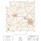
Coffee County Alabama Ghost Towns
Coffee County Alabama Ghost Towns
Alberton Alabama
Alberton is an unincorporated community in Coffee County. Alberton is located along Alabama State Route 134, 9.7 miles (15.6 km) south-southwest of Elba. A post office operated under the name Alberton from 1878 to 1904.
Latitude N31 16.670′ Longitude W86 07.545
31°16’40.2″N 86°07’32.7″W
31.277833, -86.125750
Clintonville Alabama
Clintonville, also known as Indigo Head, is an unincorporated community in Coffee County. Clintonville is located at the junction of Alabama State Route 51 and Alabama State Route 122, 2.5 miles (4.0 km) northeast of New Brockton. The community was originally called Indigo Head, due to the indigo plants in the area. The name was later changed to Clintonville, in honor of the local Clinton family. A post office operated under the name Clintonville from 1860 to 1921.
Company F (known as “The Covington and Coffee Grays”) of the 33rd Regiment Alabama Infantry was organized at Clintonville in March 1862 by Captain Daniel Horn. A portion of the 15th Regiment Alabama Infantry also came from Clintonville.
Latitude N31 24.434′ Longitude W85 53.643′
31°24’26.0″N 85°53’38.6″W
31.407233, -85.894050
Damascus Alabama
Damascus is an unincorporated community in Coffee County,
Latitude N31 19.231′ Longitude W86 00.270′
31°19’13.9″N 86°00’16.2″W
31.320517, -86.004500
Dismukes Alabama
Latitude N31 36.372′ Longitude W85 58.066′
31°36’22.3″N 85°58’04.0″W
31.606200, -85.967767
Java Alabama
Java is an unincorporated community in Coffee County. A post office operated under the name Java from 1900 to 1907.
Latitude N31 33.473′ Longitude W85 50.625′
31°33’28.4″N 85°50’37.5″W
31.557883, -85.843750
Keyton Alabama
Keyton is an unincorporated community in Coffee County, Alabama, United States. Keyton is located along Alabama State Route 167, 2.4 miles (3.9 km) southeast of downtown Enterprise. Most of Keyton lies within the Enterprise city limits. A post office operated under the name Keyton from 1892 to 1903.
Latitude N31 16.964′ Longitude W85 49.526′
31°16’57.8″N 85°49’31.6″W
31.282733, -85.825433
Richburg Alabama
Richburg is an unincorporated community in Coffee County. Richburg is located along U.S. Route 84, 2.0 miles (3.2 km) west-northwest of New Brockton. A post office operated under the name Richburg from 1900 to 1913.
Latitude N31 23.807′ Longitude W85 57.639′
31°23’48.4″N 85°57’38.3″W
31.396783, -85.960650
Tabernacle Alabama
Tabernacle, also spelled Tabanacle, is an unincorporated community in Coffee County. Tabernacle is located along Alabama State Route 51, 5.7 miles (9.2 km) north-northwest of New Brockton. A post office operated under the name Tabernacle from 1890 to 1904.
Latitude N31 27.072′ Longitude W85 52.281′
31°27’04.3″N 85°52’16.9″W