Where To Find Gold In Chilton County Alabama
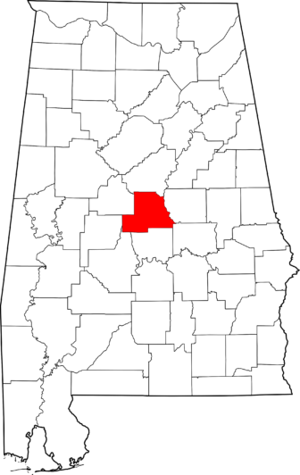
Map of Alabama Highlighting Chilton County
Chilton county sourced its gold from several streams and tributaries that flowed towards Coosa River in Clanton City and the small town of Verbena, Alabama. The tributaries of Blue Creek and Chestnut Creek were early producers of gold. The rock exposures that are limited on the south west by the overlap of the Upper Cretaceous Formation (Tuscaloosa Formation). Nuggets weighing up to 4 ounces have been reported from Blue Creek, a short tributary of the Coosa River in the southeastern part of the county.
Gold Mines In Chilton County Alabama
B.T. Childer Prospect
Flint Hill Mine
Franklin Mine
Honeycutt’s Mill Placer
Rippatoe Mine and Placer
Rocky Creek Pacer
William Howard Property, Chilton Co., Alabama, USA
Unnamed Gold Placer (MRDS – 10081318), Chilton Co., Alabama, USA
Mulberry Creek Placer, Chilton County Mining District, Chilton Co., Alabama, USA
32.89072N 86.78999 W
The Following Excerpt taken from:
A Preliminary Report on a Part of the Lower Gold Belt of Alabama: In the …
By William Battle Phillips
The most westerly exposure of the crystalline schists which I was able to observe is near Honeycutt’s Mill in the western part of Chilton county, Sec. 17, T. 22, R. 13, E, 13 miles from Clanton, on Mulberry creek. At this place the creek has cut its way down through the overlying clays of the Tuscaloosa Formation and the underlying rock is well exposed. It is a greenish and bluish green slate, in places quite hard and crystalline. It strikes in a general north east course (N. 75E. near the mill) and dips 15 to 20 degrees south east. The bed of the creek is 125 feet below the general level of the country. In places the slate is soft and rotten, breaks d0Wn readily and gives a stiff reddish soil.* It frequently carries small veins of quartz, from one-half an inch to eight inches in thickness running parallel to the slate. It would appear that many of these quart’z seams formerly carried pyrite, for there are evident traces of this mineral still to be found, with now and then a fairly good piece but partially decomposed. As a rule, however, the pyrite has disappeared, the quartz is cellular and, for the most part, barren, showing neither gold nor pyrite. It is noticeable that wherever the slate carries quartz it is harder and more crystalline than when the quartz is absent.
Placer mining has been carried on along this creek in a very small way for the last fifty years, beginning about two miles below the mill and extending about eight miles up the creek.
Along the little branches that make into the creek I panned thirty pans, finding gold in twenty-five and failing to find it in five. The gold is held in a mottled red and white clay, sandy and carrying angular fragments of quartz. This clay is underlaid by a stiff white clay devoid of gold. It is exposed in the bottom of the branches and is overlaid by from 4 to 6 feet of soil and reddish clay, free of gold. In every pan there was left at the last a heavy black sand, sprinkled with’minute fragments of garnets and clear quartz.
*Limonite (brown iron ore) occurs on the waters of Mulberry creek above Honeycutt’s, in considerable masses.
The thickness of the gold bearing stratum is from one to two feet.
The origin of the gold here is to be sought in the thin seams of quartz (formerly pyritous) between the layers of slate. The gold content of the pyritous quartz has been distributed in the clays resulting from the decomposition of the slates.
I remark here
1. NO gold has been found in the soft slates which are free of gravel.
2. The quartz seams themselves show free gold in the pan now and then.
3. The clays resulting from the decomposition of the slates are of two sorts, a soft smooth clay with no gravel and no gold, and a sandy, gravelly clay with many angular piecesof quartz and half decomposed pyrite, carrying free gold.
4. The unfailing association of the gold with black iron sand and quartz, with occasional fragments of pyrite, points to the pyritous quartz seams as the origin of the gold.Although gold is to be found in nearly every little branch running into Mulberry Creek, in the vicinity of Honeycutt’s mill, yet I do not think that it occurs in sufficient quantities to warrant any further investigation. The gravel in which it is found is not continuous nor is it rich enough at any place that was examined for it, to be considered more than an interesting distribution of the metal. This is the most western point at which gold has been found in’ situ, and its association with quartz and pyrite is but another proof of the close companionship of these minerals in the Southern gold fields.
HONEYOUTT‘S MILL
Between Honeycutt’s Mill and Clanton I observed no exposure of the underlying rocks; they are doubtless overlaid by the Tuscaloosa clays which extend in an unbroken sheet across the State from Tuscaloosa to the south-east, obscuring the crystalline rocks entirely except where some stream has cut its way through.
On the west side of the Louisville and Nashville Railway the crystalline rocks are but seldom seen, as I went carefully over that part of Chilton County almost to the Autauga line without seeing any sign of them at all. None of the wells dug in that part of the county have penetrated to the old rocks, although some of them have been sunk through forty and fifty feet of soil and clay. The Tuscaloosa clays must be more than one hundred feet in thickness in this part of the State, in certain localities doubtless nearer two hundred feet than one hundred. N0 gold is to be found in that part of Chilton .County below Clanton and on the west of the L. & N. R’y, which demands a more detailed examination. Near Verbena, a station on the Railway below Clanton, some prospecting for gold was carried on many years ago, but no evidence could be found that it was profitable or even encouraging. Some isolated placer washings may still be heard of but I do not think that we need pause to consider them. This part of the county is not to be regarded as a gold district, for, it is not until we reach the old Rippatoe Mines near the Coosa RiVer that we come upon any sound basis for even a preliminary testing.
About one-half a mile north from Verbena, at the old Floyd Mil], there is a fine out crop of micaceous hornblende schist, tough and well crystallized. It strikes N. 50° E. and dips 15 degrees S. E. It is found also on the west side of the L. and N. R’y one mile S. W. of Verbena and there disappears beneath the clays.
WILLIAM HOWARD’S
In the S. W. i- of Sec. 29, T. 21, R. 16 E., Chilton County, at Wm. Howard’s, there is a good exposure of quartz interstratified with clay slate. It is of the sugary variety, very white and granular. A sample taken from a vein of eight inches thickness at Howard’s gate gave in gold $6.20. A vein of similar appearance, however, at Tom Howard’s in Sec. 29, T. 21, R. 16 E., gave only $2.06 per ton.
ROCKY CREEK
On Rocky Creek, in Sec. 30, T. 21, R. 16 E., Chilton county, two miles east of Verbena, extensive washings for gold have been carried on in the gravel. Heavy ledges of a dark, fine grained hornblende schist, carrying biotite, crOss the creek, bearing N. 15° E. and dipping 20 degrees to the S. E. These schists enclose bands of quartz, in places somewhat pyritous, which are rarely of greater thickness than a few inches. In the immediate vicinity of the quartz seams the schists are harder and more crystalline. The gold gravel underlies the soil at depths varying from 3 to 6 feet and extends on both sides of the creek for about one hundred yards. It is rarely more than twelve inches in thickness and is composed of rounded peices of reddish quartz from one-half inch diameter to six inches. The pay gravel lies on a greenish clay slate. Rocky Creek runs in a general N. E. course and the quartz seems bear in the same direction. The shifting of the creek bed from side to side has doubtless distributed the gold gravel over the area mentioned.
William Howard, an experienced gravel washer of the vicinity, told me that in about ten weeks he himself had obtained $200 worth of gold along Rocky Creek; in one day securing $19, The only apparatus used was the pick and pan. This was twenty years ago. Per contra, he says that a few years ago a stray miner worked there two months and got only $60.
Rocky Creek would not afford sufficient water for extensive operations, and, besides the pay gravel appears to have been pretty well worked over. A considerable amount of work has been done along the Creek from first to last, but none within the last twenty years. Most of the work was done before 1860, when through this part of the State there was much interest shown in gold mines and especially in placer mines. I saw no evidence of the existence of a workable seam of quartz on Rocky Greek near thmold workings. At Howard’s there is a better prospect for quartz mining than on Rocky Greek, for the existence of gold bearing sugary quartz at Wm. Howard’s is an encouraging sign. It does not seem to me that Rocky Greek will afford pay gravel in sufficient amount and of sufficient richness to warrant any extensive investigations. Doubtless a considerable amount of gold was obtained along the creek fifty years ago with the simple appliances then in use, such as the pan, cradle, and Long Tom. The best of it has, however, been thoroughly worked so that it is now difficult to find a place from which good panning can be had.
THE RIPPATOE MINE
This famous property is situated in Sec. 17, T. 21, R. 16 E., Chilton County. It was extensively worked prior to 1860, work having been begun here as early as 1835 and continued with but little interruption for twenty-five years. By far the greater amount of placer mining carried on west of the Coosa River has been done at this place.
The gravel lies on both sides of Blue Creek and is of the same nature as the Rocky Creek gravel. For a mile up the creek from J as. Mims’s, on both sides, there are innumerable old pits, trenches and ditches. These are now so fallen in that 1 had to sink two new pits in order to examine the gravel at all. Following is a vertieal section of a pit in the bottom of which we came upon a layer of auriferous grave], very poor but of the same character as the richer gravel, as I was informed by Wm. Howard:The gravel is imbedded in a reddish clay, at times somewhat indurated, but generally of a loosely compacted nature, yielding readily to the pick and shovel. From Wm. Howard and others who worked at these diggings I ascertained that the gravel was generally not less than six feet beneath the surface, varying from this depth to eight and even nine feet. As the deposit neared the adjacent hills the gold became scarcer and the gravel thinner and at greater depth.
A great deal of the gold obtained was found in the run of the creek, caught against upturned edges of the slate. Several pieces of gold valued at $1, $5, one valued at $20 and one at $70 were found at these diggings. It is impossible at this time to give any reliable estimate of the amount of gold obtained at the Rippatoe. An approximate statement could be given if it were known what the average yield of gold per bushel of gravel was, for it could be calculated how much gravel was removed. But there are no
statistics and no reliable sources of information. The property was not worked by a regularly organized company, the different gangs of men were associated together for the more economical treatment of the gravel, they kept no permanent accounts, disbanding when they pleased and each going its own way without regard to the others. From first to last, however, there must have been a large amount of gold removed. The extent of the old workings proves that, for in those days when the miners did not find pay gravel they quit and went to some other place. It was not the custom to spend either time or money in prospecting on such an elaborate scale. There was enough water in the creek for their purposes, although not enough for a large business, and they kept at work in a small way for many years, accomplishing in the twenty-five years an astonishing amount. When the California gold fever came upon the country most of these miners were attacked by it and started for that Eldorado forthwith, and there has been no gold washing in this vicinity worthy of mention since 1855.Only one placer mining company is now at work in the State, the Arbacoochee, in Cleburne Co. I have not visited the place, but understand that of late a better gravel has been found and that the operators are hopeful of good profits. Cleburne County belongs to the Upper Gold Belt and I have not yet visited that part of the State, and can not therefore speak of my own personal observation. But so far as concerns the old placer mines of the Lower Belt, lower Chilton, Coosa and Tallapoosa Counties, I do not think that any revival of the industry is likely to take place. The best gravel has been worked over as with a comb and nothing remains now that would attract capital, for it requires a large amount of money to operate such washings on a profitable scale.
At the Rippatoe the gold was derived from the small quartz veins lying between and in micaceous hornblende schists and clay slates. The creek has cut its way down through the schists and slates, undermining the quartz seams and distributing the resulting gravel along its course. The average width of the valley along which the gravel is found is less than two hundred yards, in linear extent three quarters of a mile. The relation of the gold gravel to the country rocks appears to be as follows:
The schists themselves are pyritous and also enclose small seams of pyritous quartz. They lie to the Eastward of the clay slates. The slates are softer and more easily broken down by atmospheric agencies and by running water. The schists, overlying the slates, are in this way undermined and finally give down more or less, and allow their quartz seams to be distributed as gravel along the bed of the creek. This result is accelerated by the occurrence of thin seams of pyrite between the quartz and the schists. In places the schists are so impregnated with pyrite that it can be seen plainly with the naked eye. In other places they present the appearance of a true gossan. On panning there is always left in the pan a mixture of black iron sand with small fragments of clear quartz, garnets and pyrite more or less decomposed.
The tendency of the clay slates in this part of the county to present the appearance of a gossan is shown on quite a large scale on the road from Verbena to Higgins’ Ferry about one and one-quarter miles from the Rippatoe Mines. At this place a large seam of brown iron ore crosses the road and can be traced for several miles in a N. E. and S. \V. direction. Some samples of the ore are very good and the outcrop is bold. There may be enough of this ore above water level to justify a development shaft or drift; it would appear that is is derived from the infiltration of ferruginous waters obtaining their iron from the oxidation of pyrite. I observed numerous cavities of pyrite crystals in the accompanying quartz. Several years ago the Sloss Iron and Steel Co. of Birmingham opened a deposit of this ore lying four miles north of this place, but abandoned the undertaking after going to considerable expense in the construction of a branch road from the L. and N. Ry. It may be, however, that the lower part of the deposit near Rippatoe is of better quality and in greater quantity.
On the land of James Mims in Sec. 16 is to be seen thesame kind of gravel accompanied by the same ferruginous slates as appear on the Rippatoe property. Here also the gold gravel has been thoroughly worked over, and although a considerable amount of gold was obtained prior to 1860, nothing of consequence has been done since. I sampled a small seam of sugary quartz on the Rippatoe place near Tiernan’s house below James Mims’ and found it to contain, in gold, $2.06 per ton. The gravel washings at the Rippatoe have been practically exhausted, but it is probable that by careful investigation workable quartz could be found. The owners of the land should have it examined with this purpose, and I would recommend that they examine especially the western part of the property towards the upper waters of Blue Creek, for as one approaches the Coosa River the schists become much coarser and the dip rises. I observed neither gneiss nor granite on the west side of Coosa River in this part of Chilton County, but it is quite noticeable that the granitic and gneissic soils begin to appear in Sec. 15, T. 22, R. 16 E. In this section also on the land of Jackson Mims numerous pieces of magnetic iron ore have been picked up on the surface. Mr. Mims has prospected for the vein with drift and shaft, but has not yet come upon it. The magnetite is associated with a coarse hornblende schist carrying mica and garnets. No gold has been found in connection with it, nor in fact has gold been found on Blue Creek below the Rippatoe place.
Between the Rippatoe and’Higgins’ Ferry, about one half mile from the ferry gate, there crosses the road a seam of iron ore partly limonitic and partly of higher oxidation. It appears to have been derived from the oxidation of pyrite and the infiltration of iron-holding waters. The remains of pyrite crystals are to be seen in the associated quartz. The seam can be traced for a quarter of a mile, but does not show any reliable indication of increased richness. A similar ore is to be found in Coosa County also as in Sec. 31, ‘1‘. 23, R. 20 E. and in Sec. 1, T. 22, R. 19, and in Sec. 6, T. 23, R. 19, where it is partly converted into magnetite.
It is not likely that extensive deposits of good ore’will be found where the evidences of the recent oxidation of pyrite are so numerous and so unmistakable. The limonites of S. E. Chilton and the middle and Southern Coosa are comparatively of recent origin. The rocks in which they occur are clay slates and micaceous graphitic schists more or less impregnated with pyrite. The rocks themselves may be, and doubtless are, of the Archaean Age, but the iron ore is of far more recent production, resulting, as it has, from the atmospheric decomposition of pre-existing beds and stringers of sulphuret of iron. Where the original amount of pyrite was very great or where local causes have led to a concentration of the iron these secondary ores are of value, but I can not speak hopefully of these ores. They do not seem . to me to exist in sufficient quantity for commercial purposes.