Map: La Louisiane

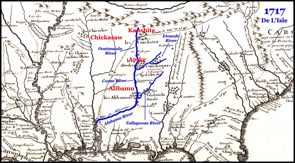
Map La Louisiane
Hand colored. Relief shown pictorially. From the author’s Grosser atlas … [1734?] Includes historical notes and inset of “Les costes de la Louisiane depuis la baye de Ascension jusques acelle de S. Joseph.” Available also through the Library of Congress Web site as a raster image.

Map: The MOBILE & OHIO R.R. AND CONNECTIONS

One of the oldest cities in the United States, Mobile is the seat of Mobile County in the southwestern corner of Alabama along Interstate Highway 10, on the banks of the Mobile River.

As a port city, its influences were shaped by the varied cargoes and exotic travelers that constantly passed through.

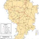
Map: Georgia & Alabama Post Offices, Post Roads, Canals, Rail Roads

Map:
Georgia & Alabama Post Offices, Post Roads, Canals, Rail Roads
Maps created for one purpose often contain a tremendous amount of information useful for purposes other than that intended. The References statement in the top right of this map indicates the map is marked with six types of routes:

Horse Mail Post Coach Roads
Stage
Sulkey
Cross
Rail
Canals

One might think the sulkey routes would be frequently traveled and be composed of locations frequented by local residents.  

This map is available as a high resolution download HERE.

Alabama Metal Detecting Clubs

Alabama Metal Detecting Clubs

Alabama Gold Camp
1398 Co. Rd. 5Lineville  AL  36266Phone:  1.256.396.0389gold@alabamagoldcamp.com
 
CENTRAL ALABAMA ARTIFACTS SOCIETY
Pratt, AlabamaPhone: 205-365-1115
South Alabama Historical Research & Recovery
“Dedicated to the preservation of historical artifacts”
City: Mobile Contact/Phone: (480) 201-1251 or email: Mike Smith
Meeting location: Golden Coral, 5327 Halls Mill Rd, Tillmans Corner, AL Meeting Time: First Tuesday of every month @ 7:00 pm
Southeast Treasure Hunters
Alabama Prospecting Supply789 Brentwood DriveGadsden, AL 35901mismar@att.netmlhudson1970@yahoo.com
Club meets every second and fourth Tuesday of the month. Meetings begin at 7 PM
Tri-State Coin & Relic Hunters Club
Warrior Basin Treasure Hunters Association
City: Birmingham Location: Nikki’s West Restaurant 233 Finley Avenue West Birmingham, AL. 35204Contact/Phone: email: webmaster@wbtha.comMembership: $15 with an annual renewal of $10Website: http://wbtha.com/Comments: The club meets the 1st and 3rd Tuesday nights of each month.

Historical Sites in Clarke County Alabama

Historical Sites in Clarke County Alabama
Return To Historical Sites in Alabama Index 

Choctaw Corner Alabama
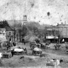
Choctaw Corner was a former town in Clarke County, Alabama. It is named for the nearby Choctaw Corner, which marked the border between the native Choctaw and Creek peoples prior to the Indian removal. The community was one of the earliest settlements in the county. Choctaw Corner had a post office by 1850. It was a prosperous community during the antebellum period and for many years afterwards.

HISTORICAL SITES IN ALABAMA

In order to better provide precise information for our diverse readership, we would like to point out that we differentiate between the words “historic” and “historical.” We use “historic” in the context of describing famous or important places and events.  “Historical” is used  when describing places or events of the past that have no great significance today but may be of interest to some.

Bibb-County-Alabama

Historic Places and Ghost Towns in Bibb County Alabama

Bibb County was established in 1818 and called by the name of Cahaba. Two years later it was changed to that of Bibb, in honor of William W. Bibb, the first Governor of the State.

Bibb County was one of the largest counties in the State; but a great deal of its area has been cut off to make up the surrounding counties established later on in the history of the State.

Fort Williams to Horseshoe Bend

Metal Detecting Talladega County Alabama:

Fort Williams to Horseshoe Bend

 
In March 1814, General Andrew Jackson mobilized the Tennessee Militia, made up of Volunteers from the East and West Tennessee Militias and the Thirty-Ninth U.S. Infantry for a full-scale campaign against the Red Sticks. General Jackson’s army totaled about 3,000 men. Jackson’s army left Fort Williams on the Coosa River (Mississippi Territory) and marched 52 miles through the forest in three days. Fort Williams, located at the mouth of Cedar Creek and the Coosa River in what is now Talladega County, Alabama was constructed in 1814 to serve as a supply depot preparatory to the Battle of Horseshoe Bend on March 27, 1814. Jackson and his troops made camp six miles north of Horseshoe Bend.

White Bluff

Chalk, a soft, extremely fine-textured variety of limestone, occurs in the Coastal Plain section of west-central Alabama. Originally formed as the floor of an ancient sea, the chalk can be seen along prominent bluffs on the Tombigbee River. White Bluff is a historic site located in Demopolis, AL, which owes its character and natural beauty to the underlying chalk rocks.

Men Panning Gold Created / Published [between ca. 1900 and 1927]

GOLD IN ALABAMA

Significant amounts of gold have come from Alabama, making it one of the better gold producing states east of the Mississippi River. Gold has been found in both lode and placer deposits. Gold has been found throughout Talladega, Tallapoosa, Chambers, Coosa, Clay, Chilton, Elmore, Cleburne, and Randolph Counties.

Alabama-Treasure-Legends

ALABAMA TREASURE LEGENDS

Some sites listed here may have prohibitions against prospecting. Always seek permission from property owners and obtain any necessary permits prior to treasure hunting, panning, dredging, or metal detecting.