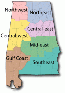
Alabama Mid-East Region Maps

Autauga County Alabama Map
Autauga County is located in the central part of the state, wholly within the coastal plain. It comprises 597 square miles. The first county seat was established at Washington, on the site of the Indian village of Atagi, in 1819. In 1830 the county seat was moved to Kingston. In 1868 the legislature removed the county seat to Prattville, which was named after cotton gin manufacturer Daniel Pratt.
Bibb County Alabama Map
The county is located near the center of the state and is drained by the Cahaba River. The terrain is very hilly and there are significant mineral deposits in the northern part of the county. Bibb County encompasses 625 square miles.Bibb County was originally created as Cahawba County by the Alabama Territorial Legislature on 1818 Feb. 7. Alterations were made to the boundaries in 1818, 1819, 1820, 1821 and 1868. The county name was changed to Bibb on 1820 Dec. 4, in honor of Alabama’s first governor, William Wyatt Bibb.
Chambers County Alabama Map
Chambers County was created by an act of the Alabama General Assembly on 1832 Dec. 18, from former Creek Indian territory. It is located in the east-central portion of the state, and is bounded on the east by the Chattahoochee River. Chambers County encompasses 596 square miles.
Chilton County Alabama Map
Chilton County is located in the central part of the state. It was created by the Alabama legislature on 1868 Dec. 30, from lands taken from Autauga, Bibb, Perry, and Shelby counties. Chilton County encompasses 695 square miles. The Coosa River forms the eastern boundary of the county. Originally named Baker Co., Chilton Co. received its present name on 1874 Dec. 17, in honor of Judge William Parish Chilton, chief justice of the Alabama Supreme Court and a member of the provisional and regular Congress of the Confederacy.
Coosa County Alabama Map
Coosa County lies in the east-central part of the state. It currently comprises 675 square miles.Coosa County was created by the Alabama legislature on 1832 Dec. 18, from lands included in the Creek Indian Treaty of Cusseta, 1832 Mar. 24. It was named for the Coosa River, which forms its western boundary.
Dallas County Alabama Map
Dallas County is located in what has become known as the Black Belt region of the west-central portion of the state. The name referred to its fertile soil, and the area was largely developed for cotton plantations, worked first by enslaved African Americans. After emancipation, many of the African Americans who stayed in the area worked as sharecroppers and tenant farmers. Dallas County was created by the Alabama territorial legislature on February 9, 1818, from Montgomery County. This was a portion of the Creek cession of lands to the US government of August 9, 1814. The county seat is Selma, Alabama.
Elmore County Alabama Map
Elmore County was established on February 15, 1866, from portions of Autauga, Coosa, Tallapoosa, and Montgomery counties. Its county seat is Wetumpka, Alabama.
Lee County Alabama Map
Lee County is located in east-central Alabama, The county was created by an act of the Alabama legislature on December 5, 1866. The land that would eventually become Lee County came from a land cession to the United States by the Creek Indians in the 1832 Treaty of Cusseta. Lee County was created from lands carved out from Macon, Russell, Chambers, and Tallapoosa Counties.
