Cheaha State Park
Cheaha State Park
|
Cheaha State Park
Clay County Alabama
Cleburne County Alabama
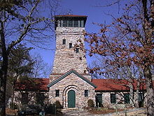
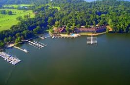
Cheaha State Park is a 2,799-acre state park in Alabama, located in northern Clay and southwestern Cleburne counties. The park, which is Alabama’s oldest continuously operating state park, encompasses Cheaha Mountain, the highest point in the state. Park facilities include a lodge, restaurant, general store, campsites, hiking trails, and other amenities. Day-use: The park has day-use areas for picnicking, swimming, and fishing. Scenic overlooks: Cheaha Mountain is topped with Bunker Tower, a stone building with an observation deck on top. Near the peak, Bald Rock has a wheelchair-accessible wooden walkway that provides an overlook of the surrounding region.