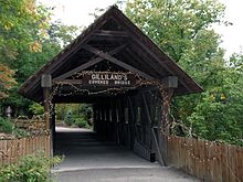
Chief Pathkiller, was a Cherokee warrior, town chief, and Principal Chief of the Cherokee Nation. He also served as a colonel under Andrew Jackson in the Tennessee militia during the Creek War.

Turkeytown

Turkeytown Alabama
Turkeytown, also called Turkey’s Town, was a Native American settlement found in 1788 by the Chickamauga Cherokee chief, Little Turkey. It was the largest Cherokee town in Alabama – at one time it covered 25 miles along both banks of the Coosa River. Little Turkey built the settlement as a refuge for his people because of the ongoing hostilities between the Cherokee Indians and the whites. Turkeytown Alabama History
During the Creek War of 1813, specifically in October, the Red Stick Indians were planning an attack on Turkey Town, The Cherokee Chief at that time, Pathkiller, send word to Andrew Jackson for help. Jackson sent a detachment let by General James White.

Maraella Winery Hokes Bluff AL Etowah County Alabama

Maraella Winery

Maraella Winery
Hokes Bluff Al
Etowah County Alabama
Located in Hokes Bluff Alabama at the foothils of the Appalachia Mountains is family owned and operated since 2005. Maraella Winery5296 US Hwy 278 EastHokes Bluff, AL 35903(256) 494-1000

Hokes Bluff Alabama

Hokes Bluff Alabama

Hokes Bluff AL
Etowah County Alabama
Hokes Bluff Alabama is located in the foothills of the Appalachian Mountains near Gadsden Alabama. Only one hour from Birmingham Alabama and Chattanooga Tennessee and two hours from Atlanta, Hokes Bluff is home to just shy of 5,000 lucky residents. Fishing, camping and romance all reside in Hokes Bluff. Crystal clear lakes and spectacular mountain views offer scenic drives beyond compare. City of Hokes Bluff

3301 Alford Bend Road
Hokes Bluff AL 35903
256-492-2414

Gilliland-Reese Covered Bridge | Gadsden AL | Etowah County Alabama

Gilliland-Reese Covered Bridge

Gilliland-Reese Covered Bridge
Gadsden AL
Etowah County Alabama

The Gilliland-Reese Covered Bridge, more simply known as Gilliland’s Covered Bridge, is a locally owned wooden covered bridge that spans a small pond nearBlack Creek in Etowah County, Alabama, United States. It is located at Noccalula Falls Park off Noccalula Road (State Route 211) in the city of Gadsden. Coordinates are 34°02′21.79″N 86°01′26.93″W (34.039386, -86.024147). Noccalula Falls Park is also home to the 90-foot (27 m) Noccalula Falls, part of Black Creek as it cascades down into a ravine from a ledge off Lookout Mountain. There are a couple of sources which state the bridge spans Clayton Fish Pond, but that is over a mile (2 kilometers) west of the park along a rural section of Hinds Road.

Noccalula Falls Park | Gadsden AL | Etowah County Alabama

Noccalula Falls Park

ALABAMA WATERFALLS MAIN PAGE

Noccalula Falls Park is a 250-acre (101-ha) public park located in Gadsden, Alabama (USA). The falls are located on land once owned by R.A. Mitchell, who gave the site to the city of Gadsden, so that the area could be improved, and the public could enjoy the falls. R.A. Mitchell Elementary School, named in his honor, is located across the street from the falls. The main feature of the park is a notable 90-foot (27-m) waterfall with a gorge trail[1] winding through its basin and past caves, an aboriginal fort, an abandoned dam, pioneer homestead, and Civil War carvings. The park also features a petting zoo, mini-golf course, the Gilliland-Reese Covered Bridge (built 1899) and a replica 1863 C. P. Huntington train ride.

Gadsden Alabama

Gadsden was at one time in the 19th century Alabama’s second most important center of commerce and industry, trailing only the seaport of Mobile. The two cities were important shipping centers: Gadsden for riverboats and Mobile for international trade.