CRENSHAW COUNTY ALABAMA
CRENSHAW COUNTY ALABAMA
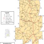
 Crenshaw County was created by an act of the Alabama General Assembly on 1866 Nov. 24. It was formed from parts of Butler, Coffee, Covington, Pike and Lowndes counties. It is located in the south-central section of the state, in the coastal plain area. Crenshaw County encompasses 611 square miles.
The county is named for Anderson Crenshaw, an early settler of Butler County. The first county seat was established in Rutledge in 1867. The county seat was moved to Luverne in 1893. Other significant towns include Highland Home and Brantley.
Crenshaw County Alabama History
The early history of Crenshaw county dates back prior to 1814 when that territory which now forms the county was a part of the Creek Indian Confederacy. The region’s infertile soil and hilly terrain hindered large-scale farming, and settlers focused instead on timbering. Crenshaw County’s economy received a boost in 1886 when the Montgomery and Florida Railroad company began purchasing land, completing a line through the county in 1888. The new town of Luverne sprang up east of Patsaliga Creek and by March of 1890 boasted a population of almost 1,000. Businesses included grocery, hardware, and clothing stores, a saloon and restaurant, a blacksmith shop, telegraph service, several sawmills, a grist mill, a planing mill, a hotel, and a newspaper. The town of Glenwood, created in 1896 after completion of a Central of Georgia Railroad line, soon included a bank, several sawmills, a number of stores, a school, and a cotton gin.
Source: THE ENCYCLOPEDIA OF ALABAMA
Of historical significance to the county is the Old Three Notch Trail, a military road which was to be used by General Jackson’s troops. This road cut across the lower portion of the county near the present site of Dozier. Also in the northern portion of the county, passing near Honoraville, was The Merriweather Trail which is believed to have been a road leading from Greenville to Georgia which was used by military troops and early settlers.
Editor: The Meriwether Trail runs through the southern part of Montgomery County whereas the Old Federal Road ran through the northern part of Montgomery County.
Most researchers believe the Meriwether Trail ended in Butler County near present day Greenville.The terminus of the Meriwether Trail may have intersected the Old Federal Road in the Greenville area.
The Alabama Historical Society has a map showing the approximate location of these historic roads.
Crenshaw County Alabama Demographics
According to 2016 Census estimates, Crenshaw County recorded a population of 13,896. Of that total, 71.5 percent of respondents identified themselves as white, 23.8 percent as African American, 1.7 percent as Asian 1.7, percent as Hispanic, 0.9 percent as Native American, and 0.8 percent as two or more races. The county seat, Luverne, had a population of 2,824.
Crenshaw County Historical Destinations
Highland Home College
Luverne
Luverne Public Library
Luverne
Brantley Hitching Post
Brantley
Brantley Public Library
Brantley
F.M. Douglass House
Luverne
The Flowing Well
Glenwood
Crenshaw County Alabama Cities
Luverne Alabama
Luverne is a city in and the county seat of Crenshaw County. The city describes itself ais “The Friendliest City in the South”, a slogan that appears on its “welcome” signs.
Luverne, later to become the leading town of the county, is located in the central part of the county on the Patsaliga River near the site of an old Indian village. The land where the town was built was at one time part of the Cody plantation. Luverne was named after the wife of M. P. LeGrand of Montgomery who had purchased land in the county for a railroad. In 1888 the Luverne Land Company was organized by S. D. Hubbard, M.P. LeGrand, and George A, Folmar, J. O. Sentell surveyed the land and made a plot laying out the streets for the town. Following this in 1889 the town was incorporated under the laws of Alabama. An election was held the same year in which J. O. Sentell was elected the town’s first mayor. The councilmen elected were Dr. J. R. Horn, G. W. Pope, G. A. Folmar, and G. F. Kirkpatrick. The city clerk was R. P. Fundaburk, and the Marshall was G. W.Turner.
Source: An Early History of Crenshaw County by Joe R. Sport, 1957
Crenshaw County Alabama Towns
Brantley Alabama
Brantley is a town in Crenshaw County. At the 2010 census the population was 809. Brantley was incorporated in 1891 as a city. Welcome to “Front Porch City” where iced tea and front porches are a “must.” Our town was founded June 22, 1891 when forty acres of the Thomas H. Wyatt estate was bought by the Brantley Land Company. The town had two names before it was incorporated. First, it was called Sasserville and later Marcus. It was renamed Brantley after T.K. Brantley moved here and started several businesses.
The town sits on the crossroads of 331 and 29 which is the gateway to the beaches and the Gulf Coast and an hour away from Troy University, Andalusia and historical capital, Montgomery.
Dozier Alabama
Dozier is a town in Crenshaw County. At the 2010 census the population was 329. Dozier was incorporated in 1907. The town of Dozier was named after Daniel Dozier, who was a minister in Searight, Alabama. It arose around a stop on the Mobile and Girard Railroad in the late nineteenth century.
Glenwood Alabama
In 1896, the town of Glenwood was established when the Central of Georgia Railway built a rail line through the area. The population of Glenwood expanded with the increasing traffic along the railway and eventually a hotel, post office, a blacksmith shop, and several sawmills sprang up in the town. In 1905, the town established a school, and the area’s abundance of evergreen ferns gave rise to a commercial nursery industry. Glenwood was incorporated in 1907. In 1909, the town dug a well to provide the local area with drinking water. Known as the Flowing Well, it became a popular gathering place and a recognized landmark for the area.
Petrey Alabama
Petrey is a town in Crenshaw County. Petrey is located in northeastern Crenshaw County in the south-central part of the state. The population was 58 at the 2010 census.
George Petrey and his first wife, Martha Ann Blackwater, settled in the area known now known as Petrey about 1850 after the couple moved west from the Carolinas. The town originally was called Forkland, but the name was eventually changed because so many Petreys were living in the area.
Rutledge Alabama
Rutledge is a town in Crenshaw County. As of the 2010 census, the population of the town was 467. Rutledge began as Barber’s Crossroads. It was originally settled by Jared Phelps Barber. The town was briefly named Crenshaw, but on June 10, 1867, it was changed to Rutledge in honor of Captain Henry Rutledge, Company H. 59th Alabama Infantry, CSA. Rutledge was the first county seat of Crenshaw County and held that position from March 1867 to May 1893. It was incorporated in 1871.
Crenshaw County Alabama Communities
Fullers Crossroads Alabama
Fullers Crossroads is an unincorporated community in Crenshaw County.
Highland Home Alabama
Highland Home is an unincorporated community in Crenshaw County. Highland Home is located on U.S. Route 331, 16.6 miles north of Luverne and has a post office with ZIP code 36041, which opened on July 15, 1837.
Honoraville Alabama
Honoraville is an unincorporated community in Crenshaw County, located 12.5 miles northwest of Luverne.
Lapine Alabama
Lapine is an unincorporated community in Montgomery and Crenshaw counties. Lapine is 27.6 miles south of Montgomery.
Moody’s Crossroads Alabama
Moody’s Crossroads is an unincorporated community in Crenshaw County.
Mulberry Alabama
Mulberry is an unincorporated community in Crenshaw County.
Panola Alabama
Panola is an unincorporated community in Crenshaw County, located 11 miles east of Fort Deposit.
Social Town Alabama
Social Town is an unincorporated community in Crenshaw County.
Social Town is a rural area in Beat 7, one of a number of Beats (or Precincts) in Crenshaw County. The word “Town” in the name is a misnomer, there being no actual town there. The Social Town area is located approximately five miles east of Luverne, the county seat of Crenshaw County. The area is sparsely inhabited today. The intersection of two dirt roads, Golden Road (north-south) and Athens Church Road (east-west), is in the midst of the area. In 1880, the Benjamin Franklin Williams family moved onto their new 40-80 acre farm near the road intersection. They lived and worked on their farm until 1912, when they moved to Luverne. During this period, the farm families in the Social Town area were known for paying their bills on time.
Source: Wikipedia contributors, “Social Town, Alabama,” Wikipedia, The Free Encyclopedia
Theba Alabama
Theba is an unincorporated community in Crenshaw County. Theba is located on U.S. Route 29, 3.3 miles southwest of Brantley.
Weedville Alabama
Weed Crossroad, also known as Weed or Weedville, is an unincorporated community in Crenshaw County. It is located on Alabama State Route 141, 5.1 miles (8.2 km) south-southeast of Brantley.
Crenshaw County Alabama Ghost Towns
Aiken Alabama
Latitude N31 35.010′ Longitude W86 14.179′
31°35’00.6″N 86°14’10.7″W
31.583500, -86.236317
Bradleyton Alabama
Latitude N31 54.112′ LongitudeW86 14.531′
31°54’06.7″N 86°14’31.9″W
31.901867, -86.242183
Cooksstand Alabama
Latitude N31 44.810′ Longitude W86 25.619′
31°44’48.6″N 86°25’37.1″W
31.746833, -86.426983
Live Oak Alabama
Latitude N31 48.518′ Longitude W86 14.861′
31°48’31.1″N 86°14’51.7″W
31.808633, -86.247683
Mt. Ida Alabama
Latitude N31 38.923′ Longitude W86 17.900′
31°38’55.4″N 86°17’54.0″W
31.648717, -86.298333
Salsoda Alabama
Latitude N31 48.808′ Longitude W86 20.171′
31°48’48.5″N 86°20’10.3″W
31.813467, -86.336183
Sports Alabama
Latitude N31 31.539′ Longitude W86 19.483′
31°31’32.3″N 86°19’29.0″W
31.525650, -86.324717
Theba Alabama
Latitude N31 33.339′ Longitude W86 18.208′
31°33’20.3″N 86°18’12.5″W
31.555650, -86.303467
Crenshaw County Historical Places
| Site name | Date listed | City or Town | Built or Established | NRHP/NHL | |
|---|---|---|---|---|---|
| 1 | Bricken Building | January 14, 1982 | Luverne | c. 1893 | |
| 2 | Douglass House (Douglass-Hayden House) | June 30, 1995 | Luverne | 1904–1907 | |
| 3 | W.W. Hudson House | December 15, 2011 | Grady | Mid-to-late 19th century | |
| 4 | Ivy Creek School/Community Center | March 12, 1997 | Rutledge | 1927 | |
| 5 | Jordan House | October 1, 1976 | Highland Home | c. 1889 | |
| 6 | Old Bryan Place | April 1, 2010 | Dozier | 1880–1887 |
Crenshaw County Alabama Weblinks
Return to Alabama Counties Index