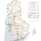
Baldwin County Alabama Ghost Towns
Baldwin County Alabama Ghost Towns
Battles Wharf Alabama
Dates From: 1873
30.48333333333333, -87.91666666666667
Latitude N30 29.664′ Longitude W87 55.664′
Located on the western shore of Mobile Bay, about two miles southwest of Fairhope Alabama and just northwest of U.S. Highway 98A and Baldwin County Road 44.
Also known as Yarborough Alabama and Battles Alabama.
Blakely Alabama
Dates From: 1813. Also known as Bladon Springs. Blakeley was the county seat for Baldwin County from 1820 until 1868. Located west-southwest of Coffeeville Alabama at County Road 5 and County Road 31.
Carney Alabama
Located about five miles northeast of Bay Minette Alabama.
Latitude N30 55.650′ Longitude W87 43.154′
Carpenter Alabama
Dates From: 1898.
About five miles west of Bay Minette Alabama.
30°51’25.9″N 87°51’58.3″W
30.857200, -87.866200
Claire Alabama
Dates From: 1898
Locate about five miles northeast of Bay Minette Alabama.
30°57’44.8″N 87°40’33.8″W
Fort Mims Alabama
Dates From: 1813
Located about four miles west of Tensaw Alabama.
31°10’46.0″N 87°50’19.9″W
31.179444, -87.838861
Fort Morgan Alabama
Dates From: 1559
Located on Mobile Point, twenty miles west of Gulf Shores Alabama.
30°13’42.7″N 88°01’42.7″W
Gasque Alabama
Dates From: 1880
Gasque is an unincorporated community in Baldwin County. Gasque is located on Alabama State Route 180, 7.8 miles (12.6 km) west of Gulf Shores. A post office operated under the name Gasque from 1880 to 1953.
30°15’11.5″N 87°49’11.3″W
Hurricane Alabama
Dates From: 1888
Hurricane is an unincorporated community in Baldwin County on the Tensaw River about 12 miles (19 km) north of Spanish Fort, Alabama. Variant names were “Hurricane Bayou” and “Tensaw Station”. During the Civil War, it was called Tensaw Station,
A post office called Hurricane Bayou was established in 1877, the name was changed to Hurricane in 1895, and the post office closed in 1962.
30°50’28.0″N 87°54’06.7″W
Hollywood Alabama
North of Montrolse Alabama. A former tourist restort. Also Confederate soldiers landed here when traveling from Mobile on their way to Florida and Georgia destinations.
Josephine Alabama
Dates From: 1881
Josephine is an unincorporated community in Baldwin County. A post office operated under the name Josephine from 1881 to 1959.
Raphael Semmes, who served as the captain of the commerce raider CSS Alabama during the Civil War, had a summer home in Josephine. In 1898, the McPherson family bought the Semmes property. They operated the Mexiwana Hotel on the site of the Semmes home until 1935. A school, which served grades 1–6, operated in Josephine from 1903 to 1917. The community was also home to a bakery before it moved to Foley.
Source: Wikipedia contributors, “Josephine, Alabama,” Wikipedia, The Free Encyclopedia
30°19’36.1″N 87°31’51.7″W
30.326683, -87.531033
Latham Alabama
Dates From: 1880
Latham, Alabama is an unincorporated community in Baldwin County.
31°05’05.9″N 87°50’03.2″W
Marlow Alabama
Dates From: 1887
Marlow is an unincorporated community in Baldwin County. A post office operated under the name Marlow from 1887 to 1909.
Marlow is the former site of Marlow Ferry. The ferry was used by Andrew Jackson and his troops during the War of 1812 and by the Union Army during the American Civil War. The ferry crossed the Fish River, and was an originating point for produce headed to Mobile.
30.460950, -87.799100
30°27’39.4″N 87°47’56.8″W
Morriston Alabama
30°58’45.2″N 87°39’23.4″W
30.979233, -87.656500
Oak Alabama
Oak is an unincorporated community in Baldwin County. A post office operated under the name Oak from 1905 to 1923.
30.3178783, -87.70631
Roscoe Alabama
30°17’55.7″N 87°38’01.0″W
30.298813, -87.633598
Roscoe (historical) is a cultural feature (locale) in Baldwin County.
Rosinton Alabama
30°37’08.4″N 87°41’38.4″W
Rosinton is a populated place located in Baldwin County at latitude 30.619 and longitude -87.694.
Shell Banks Alabama
Shell Banks is a cultural feature in Baldwin County. Shell Banks Cemetery along Fort Morgan Road in Gulf Shore, Alabama,behind the Fort Morgan Volunteer Fire Department and Shell Banks Baptist Church, holds several Confederate soldier graves as well as some well known names that helped…
Swift Alabama
Swift is an unincorporated community in Baldwin County. A post office operated under the name Swift from 1882 to 1912.
Van Kirk Alabama
Highway 90 East to County Road 85 North. Continue on dirt road. Large empty field on left near the creek is where the town was located.