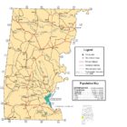
Choctaw County Alabama Ghost Towns
Choctaw County Alabama Ghost Towns
AQUILLA Alabama
Latitude N31 42.749′ Longitude W88 24.827′
BARRYTOWN Alabama
Barrytown, also known as Barryton or Mosely Store, is an unincorporated community in Choctaw County. The name Barrytown comes from the combination of the words barrel and town, as the area was known for the production of turpentine barrels. Barrytown served as the county seat of Washington County from 1842 to 1847 until Choctaw County was formed from parts of Washington and Sumter County. A post office operated in Barrytown from 1833 to 1914.
Latitude N31 50.244′ Longitude W88 15.163′
BERGAMOT Alabama
Bergamot (historical) is a cultural feature (locale) in Choctaw County.
Latitude N32 01.040′ Longitude W88 23.745′
CROMWELL STATION Alabama
Cromwell (also Allen) is an unincorporated community in Choctaw County.
Latitude N32 13.258′ Longitude W88 16.680′
CYRIL Alabama
Cyril is a populated place located in Choctaw County.
The elevation of Cyril is 259 feet. Cyril appears on the Yantley U.S. Geological Survey Map. Choctaw County is in the Central Time Zone (UTC -6 hours).
Latitude N32 10.693′ Longitude W88 25.344′
32°10’41.6″N 88°25’20.6″W
EMORY Alabama
Latitude N31 51.1391 Longitude W88 26.296′
31°51’08.4″N 88°26’17.8″W
31.852318, -88.438267
FAIL Alabama
Latitude N31 44.561′ Longitude W88 23.776′
31°44’33.7″N 88°23’46.6″W
31.742683, -88.396267
HINTON Alabama
Latitude N32 05.523′ Longitude W88 26.530′
32°05’31.4″N 88°26’31.8″W
32.092050, -88.442167
LAND Alabama
Latitude N32 01.729′ Longitude W88 19.700′
32°01’43.7″N 88°19’42.0″W
32.028817, -88.328333
OAKCHIA Alabama
Latitude N32 17.914′ Longitude W88 00.613′
32°17’54.8″N 88°00’36.8″W
32.298567, -88.010217
SOUWILPA Alabama
Latitude N31 49.205′ Longitude W88 19.746′
31°49’12.3″N 88°19’44.8″W
31.820083, -88.329100
TOMPKINSVILLE Alabama
Latitude N32 12.188′ Longitude W88 01.218′
32°12’11.3″N 88°01’13.1″W
32.203133, -88.020300
WEST BUTLER Alabama
Latitude N32 04.131′ Longitude W88 20.112′