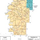
Hale County Alabama Ghost Towns
Hale County Alabama Ghost Towns
Arcola Alabama
Arcola is a ghost town on the Black Warrior River in what is now Hale County, formerly Marengo County, Alabama.
Cypress Alabama
Dates from 1900
Latitude N32 56.880′ Longitude W87 40.20′
32°56’52.8″N 87°40’12.0″W
32.948000, -87.670000
Located about four miles northwest of Havaa on the junction of railroad and County Road 21
Erie Alabama
Erie is a ghost town located in present-day Hale County. Erie was formerly the county seat of a larger Greene County, but the seat was moved to Eutaw in 1838 for the benefits of a more central location in a developing frontier area. Erie declined without the benefit of county government business.
Dates from 1819
Latitude N32 42.919′ Longitude W85 48.252′
32°42’55.1″N 85°48’15.1″W
32.715317, -85.804200
Located about one mile west-northwest of Walnut Hill
Evansville Alabama aka Evans Alabama
Latitude N32 50.287′ Longitude W87 45.148′
32°50’17.2″N 87°45’08.9″W
32.838117, -87.752467
Located about three miles north of Wedgeworth and about one mile west of the junction of Country Road 34 and State Road 60
Far View Plantation
Latitude N32 48.340′ Longitude W87 39.340′
32°48’20.4″N 87°39’20.4″W
32.805667, -87.655667
Located about six miles east of Wedgeworth and one-half mile east of the junction of County Road 32 and County Road 21 and south of Country Road 32
Hatche Alabama
Latitude N32 44.107′ Longitude W87 40.051′
32°44’06.4″N 87°40’03.1″W
32.735117, -87.667517
Located about five miles northwest of Greensboro and on the railroad about one-half mile southeast of the junction of the railroad and Country Road 30.
Hogglesville Alabama
Latitude N32 51.255′ Longitude W87 29.502′
32°51’15.3″N 87°29’30.1″W
32.854250, -87.491700
About thirteen miles northeast of Greensboro, just north of County Road 85 and southwest of the junction of Country Road 85 and County Road 29.
Laneville Alabama
Latitude N32 31.362′ Longitude W87 35.787′
32°31’21.7″N 87°35’47.2″W
32.522700, -87.596450
About five miles east of Prairieville on the junction of State Road 25 and County Road 12.
Phipps Alabama
Latitude N32 55.782′ Longitude W87 30.162′
32°55’46.9″N 87°30’09.7″W
32.929700, -87.502700
Powers Alabama
Dates From: 1886
Latitude N32 57.935′ Longitude W87 39.347′
32°57’56.1″N 87°39’20.8″W
32.965583, -87.655783
LOCATED ABOUT 6 MILES NORTH NORTHWEST OF HAVANA AND ON THE JUNCTION OF THE RAILROAD AND CR 46.
Stewart Alabama
Dates From: 1844
Latitude N32 54.668′ Longitude W87 42.363′
32°54’40.1″N 87°42’21.8″W
32.911133, -87.706050
LOCATED ABOUT 5 MILES WEST OF HAVANA AND ABOUT 2/10 OF THE JUNCTION OF THE RAILROAD AND CR 42.
Sunshine Alabama
Latitude N32 33.590′ Longitude W87 32.916′
32°33’35.4″N 87°32’55.0″W
32.559833, -87.548600
LOCATED ABOUT 5 MILES SOUTH OF NEWBERN, JUST NORTH OF CR 10, AND 3/10 MILE EAST OF THE JUNCTION OF CR 10 AND CR 39, ABOUT 1 MILE FROM THE SOUTHEAST COUNTY LINE.
