Mississippi And Alabama 1835 Map
Mississippi And Alabama 1835 Map Shows Indian land: Cherokee, Chickasaw and Upper Creek.
Continue readingBooks About Alabama
Our investigators and journalists locate and study a huge assortment of maps for a multitude of reasons. We are often employed to verify dates, ownership, geographic features and other matters which can be supported by old family documents and historical official government documents which may include deeds, drawings, sketches and of course, maps.
We also create our own digital maps for various uses. When possible, we like to share all maps and documents with you. Most of the time they will be published without explanation of what we were looking for but they may prove of interest to you.
We have created maps of all Alabama counties and several special purpose maps including a large selection of maps related to Native Americans in Alabama. You can find our maps by searching for them by name and we try to keep the Alabama Maps Index current so check it first.
Mississippi And Alabama 1835 Map Shows Indian land: Cherokee, Chickasaw and Upper Creek.
Continue readingThe map was reissued by the United States Geological Survey in 1993. This map was digitized by the Center for Advanced Spatial Technologies to a scale of 1:5845860 using a Lambert Azimuthal Equal Area Projection. State, and county data were then added. Although better resolution can be gained by viewing a the PDF version, users are urged to use the Schedule of Indian Land Cessions 1784-1894 to search for specific information.
Continue readingThe Indian Claim’s Commission was established by Congress in 1946 to settle land claim disputes between Indians and the U.S. Government. … The map portrays the results of cases before the commission in which an Indian tribe proved its original tribal occupancy of a tract within the continental United States.
Continue readingA Detail Map of the Eastern Part of “Early American Indian Tribes, Culture Areas, and Lingustic Stocks”
Continue reading
Creative, ingenious or indications of a sick mind? You be the judge. Here are some of the unique and unusual finds in Alabama.
Continue readingThere are 5 military bases in Alabama: 3 Army bases, 1 Air Force base and 1 Coast Guard base. This map shows their location and gives basic information on the bases. Links are supplied to additional information.
Continue readingA Map of the American Indian Nations Return To Alabama Maps Index A Map of the American Indian Nations, adjoining
Continue readingAlcohol Sales in Alabama Credit: Copyright © 2003 by Shane Powell: “The purpose of the map is to show the
Continue reading
Talladega National Forest
Continue reading
Alabama Central-West Region Fayette County Alabama Greene County Alabama Hale County Alabama Lamar County Alabama Pickens County Alabama Sumter County
Continue reading
Golf Courses in Alabama Map Alabama Maps Index
Continue readingBe sure to check market and farm websites for current dates and times.
Continue readingAlabama Thrift Stores Map
Continue readingKid Friendly Alabama Map
Continue readingCoosa Valley of Alabama
Continue readingALABAMA HISTORIC SITES and LANDMARKS You may also be interested in Alabama Historical Sites.
Continue reading
Limestone County Alabama Map LIMESTONE COUNTY MAIN PAGE
Continue reading
Shelby County Alabama Map
Continue reading
Perry County Alabama Map PERRY COUNTY MAIN PAGE
Continue reading
Marion County Alabama Map
Continue reading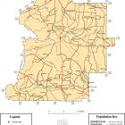
Marengo County Alabama Map Marengo County Alabama Table of Contents Alabama Maps Index
Continue reading