Detecting The Past in Eldridge Alabama

Detecting The Past in Eldridge Alabama
There are occassions when our daily research activities turn into a very focused investigation of an area. Eldridge Alabama is a prime example. Research on Eldridge revealed that the area has many natural springs and travelers would refill their water barrels there. Also, the first state road from the northwest part of Alabama to Tuscaloosa, completed in 1822, passed through the Eldridge area. Additional unconfirmed information states the town of Eldridge took its name from Eldridge Mallard – supposedly the first tollgate keeper on the new state road.
Donna R. Causey, writing for www.alabamapioneers.com, wrote the following about Mr Eldridge:
AN INTELLIGENT FARMER
In 1836 Eldridge Mallard was elected. He was elected again in 1839 and also in 1840. Mr. Mallard was a very intelligent farmer and keeper of a very popular house of entertainment on the Bykler Road. He was a man of fine personal appearance, and of popular manners.
He was a Democrat of the Andrew Jackson school. In fact at that day, in that county, Jacksonianism was Democracy. His family were much more stylish than the people of the county generally, and this fact gave his very plain common sense opponent, James Cain, the advantage in their contest for the Legislature.
Ms. Causey credited the Tuscaloosa Gazette of August 12, 1886 for her information:
Ruth Teaford Baker, writes:
“Three powerful Indian tribes once occupied the territory now known as Walker County, Alabama. The Creeks, Choctaws, and Chickasaws ranged in the area. The Creeks and Choctaws disputed the land between the Tombigbee River and the Warrior River. The Creeks won this area by force, and fought the advance of the white man. The Choctaws, on the other hand, were a friendly tribe.
After the Creeks were driven out of this territory in 1813, a few emigrants came to occupy the land that had been held by these Indians. Settlement in the area was slow, because of its remoteness from navigable waters.
In 1816, Richard Beckenbridge made a horseback trip from Columbus, Mississippi, through this section. His journal states that he traveled two weeks before meeting a soul or seeing a house. On August 20, he came upon a few deserted Indian cabins at the junction of Sipsey and Mulberry Forks.
The amended land-grant law of 1819 (small tracts purchased from the Government for $1.25 an acre) brought a host of settlers into this area. The Indian trails were thronged with people from all classes of the social level seeking land under this new act. From wealthy planters with their slaves to the poorest, walking with their possessions on their backs, they came, each seeking land in this wilderness territory.
It was those of the poorer class, who before 1820, turned aside into the hill country of Walker county. These people, known as squatters, were few and widely separated. Slaveholders sought the valleys.
We continue the story of the earliest of the settlements in Walker County. As we have stated, the lack of navigable waters and roads inhibited the fast movement of people into the area.
On December 16, 1819, the construction of a road from Big Shoals Creek in Lauderdale County to Tuscaloosa was authorized. John Byler was given the contract for construction, and by 1822 the road was completed. This was a toll road. Byler Road entered Walker County from Fayette, passed through Eldridge, and left the county at the Winston County line. This road gave the settlers a way to haul their products to the main trading center in Tuscaloosa, which served as the chief outlet until the railroads came years later.
New settlers now began to flow into Walker County and among them were many who had trades other than farming. Dr. Edward G. Musgrove came in from Blount County before 1822 and settled on the present site of Jasper. John Key came in with his family in 1822 and settled near the community of Hillard, and there erected a gristmill. In 1823 James Cain came from South Carolina and settled on a tributary of Lost Creek, known still as Cain Creek. There he engaged in farming and raising stock. Mr. Cain began the operation of a stave plant, a gin, and a gristmill.
Additional information indicates The Frisco Railroad had a rail line through Eldridge by 1887 which resulted in additional businesses and residents to Eldridge.
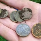
So, we have several assurances that the area around Eldridge was heavily traveled but our research has yet to produce any reference to findings of historical significance. Eldridge is on our list of places to visit and see what we can discover of its past.

Eldridge Alabama, in Walker County Alabama, at one time was called Camp Springs. The population is roughly 130.
There are at least two versions of how the name “Camp Springs” came to be:
(1) It got this name because travelers passing through the area would stop to refill water barrels from one of the many natural springs in the area.
(2) Eldridge was originally an Indian camp site and then a stage-coach stop named “Camp Springs”
Eldridge is located at 33°55′11″N 87°37′16″W. The latitude of Eldridge is 33.922N. The longitude is -87.617W.
Other Walker County towns and cities are:
County seat: Jasper
Cities:
- Carbon Hill
- Cordova (Cordova was originally known as Dent or Dent’s Place and was settled in 1882)
- Dora (Dora used to be known as Sharon and was a stop on the Kansas City-Memphis and Birmingham Railroad), Jasper, Sumiton.
Towns:
- Eldridge
- Kansas
- Nauvoo (originally named Ingle Mills)
- Oakman (originally Day’s Gap, then Marietta, then Oakman)
- Parrish (originally Hewitt)
- Sipsey (originally an Indian settlement known as Warrior Town)
Unincorporated communities:
- Benoit
- Boldo
- Burnwell
- Coal Valley
- Corinth
- Corona
- Curry
- Dogtown
- Empire
- Goodsprings
- Hilliard
- Lupton
- Manchester
- McCollum
- Mount Hope
- Quinton
- Saragossa
- Slicklizzard
- Spring Hill
- Townley
- Union Chapel
The northeast corner of Walker County connects to the William B. Bankhead National Forest which is home to The Sipsey Fork – the state’s only national wild and scenic river. Bankhead National Forest is nicknamed “the land of a thousand waterfalls.”