Map: The MOBILE & OHIO R.R. AND CONNECTIONS
Map
MOBILE & OHIO R.R. AND CONNECTIONS
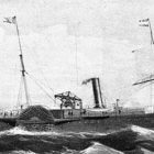
Maps such as this may help explain questions that arise when a found object does not seem to “fit” the time period of other finds. Looking at this map, the creator was proud to indicate the steam ship lines’ destinations. Products from all of these steamship destinations would be loaded on the railroad cars at the port of Mobile, Alabama and from there northward to Whistler, Chunchula, Beaver Meadow, Citronelle, Deer Park, Vinegar Bend, Fruitdale, State Line and points north.

Full Resolution Download of this map HERE