CLEBURNE COUNTY ALABAMA
Cleburne County Alabama

Cleburne County Alabama History
Cleburne County was established on December 6, 1866, by an act of the state legislature. The county was made from territory in Benton (now Calhoun), Randolph, and Talladega counties. Heflin Alabama is the county seat.
The land that makes up Cleburne County was Creek and Cherokee Indian hunting territory. Early white settlers came into the county by way of the McIntosh Trail around 1825, trading with the Indians for land where they began farming and raising cattle. Ranburne, along the McIntosh Trail, is the oldest settlement in the county.
For many years a gold mine has been successfully worked at Arbacoochee. The same ores are also found in other places in the southern portions of the county. In different parts of the county copper, mica, slate, graphite, pyrites, zinc and kaolin are found prevailing. Iron exists in great abundance, and silver has also been discovered .
Cleburne County Alabama Civil War History
In 1861, the Civil War began causing a division between the people in the southern part of the county and the people in the northern part of the county. Historians estimate there were less than 100 slaves in the whole county, as there were few slave owners. Most of the county saw no conflict. The Stone Hill community, suffered from documented Union raids during the war. The area had favored secession, and a good bit of property was destroyed and soldiers carried away whatever livestock they could find during one Union raid.
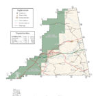
Cleburne County Alabama Geography
Cleburne County is the fourth-smallest county in Alabama by land area and second-largest by total area. Cleburne County is home to Alabama’s highest natural point on Cheaha Mountain which is part of the southernmost mountain range in the Blue Ridge Mountains.
Cleburne County Historical Destinations
Cheaha State Park and Lodge – Delta Alabama
Shoal Creek Church – Fruithurst Alabama
Cleburne County Alabama Cities
Heflin Alabama
Heflin is a city in Cleburne County. At the 2010 census the population was 3,480. The city is the county seat of Cleburne County. It is located approximately halfway between Birmingham and Atlanta on Interstate 20 in the east central part of the state approximately 15 mi west of the Alabama-Georgia state line.
Heflin was first settled in 1882 as a station on the railroad line from Atlanta. The town quickly grew and was incorporated in 1886. Until 1905, the County Seat of Cleburne County had been located at Edwardsville. In 1905, an election was held to move the county seat from Edwardsville to Heflin.
Cleburne County Alabama Towns:
Edwardsville Alabama
Edwardsville is a town in Cleburne County. At the 2010 census the population was 202. From 1867 to 1906, it served as the Cleburne County Seat. In 1880 and 1890, it was the most populous community in the county. It reached its population zenith of 448 in 1900 when it fell behind Heflin, to which it also lost the county seat to six years later. It has not had more than 226 persons since 1920.
Fruithurst Alabama
Fruithurst is a town in Cleburne County. At the 2010 census the population was 284.
Ranburne Alabama
Ranburne is a town in Cleburne County. At the 2010 census the population was 409.

Ranburne is located near the southeast corner of Cleburne County at 33°31′31″N 85°20′36″W.
As of the census of 2000, there were 459 people, 186 households, and 137 families residing in the town. The population density was 289.9 people per square mile . There were 211 housing units at an average density of 133.2 per square mile. The racial makeup of the town was 100.00% White. 0.00% of the population were Hispanic or Latino of any race.
Cleburne County Alabama Communities:
Hollis Crossroads Alabama
Hollis Crossroads is a census-designated place and unincorporated community in Cleburne County. Its population was 608 as of the 2010 census. Hollis Crossroads is located along U.S. Route 431 between Anniston and Wedowee and Alabama State Route 9 between Lineville to Heflin; Routes 431 and 9 intersect here.
Abel Alabama
Abel is an unincorporated community in Cleburne County. A post office was established at Abel in 1889, and remained in operation until it was discontinued in 1907. The community was named after the biblical Abel, the second son of Adam and Eve.
Ai Alabama
Ai is an unincorporated community in Cleburne County.
Arbacoochee Alabama
Arbacoochee is an unincorporated community in Cleburne County. Arbacoochee was named after the old Creek Indian village of “Abihkuchi”, which translates to “a pile at the base.” Gold was discovered here in 1832, and the local mines produced over $5,000,000 worth of gold. In 1845, Arbacoochee had a population of over 5,000 people and was home to twenty general stores, five saloons, a school, two churches, two hotels, two mining supply stores, a fire department, race track, and over 100 homes. Most of the residents departed when news of the California Gold Rush reached Alabama, and only a few families remained.
A post office was operated in Arbacoochee from 1842 to 1904.
Hopewell Alabama
Liberty Hill Alabama
Liberty Hill is an unincorporated community in Cleburne County, Alabama, United States. Liberty Hill is located on County Route 55, 5.7 miles south-southeast of Piedmont.
Muscadine Alabama
Muscadine is an unincorporated community in Cleburne County, Alabama, United States. It is near the Alabama-Georgia state line. Muscadine is 2.75 miles east of Fruithurst. Muscadine has a post office with ZIP code 36269, a general store, and a bar.
Trickem Alabama
Trickem is an unincorporated community in Cleburne County.The community’s name is derived from Tri-Com, which is a shortened form of Tri-Communities Church, which was another name for the local Mt. Giliard Church. The post office operated from 1891 to 1903.
Cleburne County Alabama Ghost Towns
Abel Alabama
Abel is an unincorporated community in Cleburne Count. A post office was established at Abel in 1889, and remained in operation until it was discontinued in 1907.
Latitude N33 32.930′ Longitude W85 42.746′
33°32’55.8″N 85°42’44.8″W
33.548833, -85.712433
Arbacoochee Alabama
Arbacoochee is an unincorporated community in Cleburne County. Arbacoochee was named after the old Creek Indian village of “Abihkuchi”, which translates to “a pile at the base.” Gold was discovered here in 1832, and the local mines produced over $5,000,000 worth of gold. In 1845, Arbacoochee had a population of over 5,000 people and was home to twenty general stores, five saloons, a school, two churches, two hotels, two mining supply stores, a fire department, race track, and over 100 homes. Most of the residents departed when news of the California Gold Rush reached Alabama, and only a few families remained.
A post office was operated in Arbacoochee from 1842 to 1904.[4]
Latitude N33 34.572′ Longitude W85 31.030′
33°34’34.3″N 85°31’01.8″W
33.576200, -85.517167
Beasons Mill Alabama
Latitude N31 37.911′ Longitude W86 18.443′
31°37’54.7″N 86°18’26.6″W
31.631850, -86.307383
Belltown Alabama
Kemps Creek Alabama
Kentuck Alabama
Micaville Alabama
Muscadine Alabama
Oakfuskee Alabama
Palestine Alabama
Shoal Creek Alabama
Cleburne County Alabama Historic Places
Cleburne County Courthouse
John Morgan House
Shoal Creek Church
Cleburne County Alabama Landmarks and Heritage Properties
Arbacoochee Site
Cheaha Observation Tower
Colonial Cottage (John Morgan house)
Edwardsville Cemetery
Heflin Depot
Owen Residence
Striplin Gold Mines and Carr Creek Place
Cleburne County Weblinks
Named for Irish-born Confederate general Patrick R. Cleburne, killed at the Battle of Franklin, Cleburne County was formally established in November 1866, when the state of Alabama carved it out of Benton County, which had included today’s Cleburne, Calhoun, Talladega, and Randolph Counties.
Joyce Robinson Fuller, Revenue Commissioner
120 Vickery Street, Room 102 - County Courthouse, Heflin, Alabama 36264-1199
Phone: (256) 463-2873 - Fax: (256) 463-7780
Our office hours are from 8:00 AM to 4:30 PM Central Time, Monday through Friday, and
visa/mastercard payments are accepted in our office or by phone.
For technical assistance contact GIShelp@FlagshipGIS.com or call (770) 886-4645