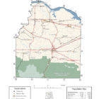
Lawrence County Alabama
Lawrence County Alabama

Lawrence County Alabama has the highest number of residents who identify as Native American of any county in the state. The county seat is Moulton, Alabama. For thousands of years, this area was inhabited by differing cultures of indigenous peoples. People of the Copena culture in the Middle Woodland period (1-500 CE) built complex earthworks as part of their religious and political system. Their burial mound and ceremonial platform mound, the largest in the state, are preserved at Oakville Indian Mounds Park and Museum.
Credit: Wikipedia contributors, “Lawrence County, Alabama,” Wikipedia, The Free Encyclopedia,
The county was created from former Chickasaw lands ceded to the United States in the Treaty of Fort Jackson in 1814 as well as the Turkey Town Treaty of 1816.
Lawrence County Alabama History
Lawrence County was established by European Americans. Numerous Cherokee and mixed-race European-Cherokee descendants, sometimes called “Black Dutch”, have stayed in the Lawrence County area. According to the census, the county has the highest number of self-identified Native Americans in the state.
Civil War Action in Lawrence County Alabama
- TOWN CREEK — Action, April 27-28, 1863. Forrest joins Roddey’s cavalrymen as they fall back fighting to Town Creek. An artillery duel begins along the creek next morning, ending when Union Gen. Grenville M. Dodge’s troops cross the railroad bridge and Forrest’s men retreat eastward towards Jonesborough.
- SPANGLER’S MILL — Action, July 26, 1862. 3rd Mich. Cav., Cos. H, L and M, encounter Confederates at the mill near Jonesborough, loosing two killed, five wounded and ten captured in a brief but deadly fight.
- COURTLAND — Skirmish, July 25, 1862. Brig. Gen. Frank Armstrong’s cavalry attacks a Union camp, killing one, wounding three and capturing 134. A trooper of the 1st Ohio Cav. attests that the rebel yell “would have raised the hair on a Comanche Indian.” July 27, 1864, Col. Wm. T. C. Grower leads a Union force that drives Roddey’s men through town. Holding briefly along Big Nance Creek, they retreat again. Union losses are two killed and four wounded; Southern losses are uncertain. Another skirmish occurs here on Mar. 8, 1864.
- MOULTON — Action, May 29, 1864. Gen. Roddey’s Alabama cavalry makes a pre-dawn attack on camps of Col. Long’s Ohio cavalry brigade. Roddey retires after a hard fight of two hours. Long reports three dead and fourteen wounded; Confederate casualties are higher. A skirmish at nearby Antioch Church occurs on Aug. 18-19, 1864. The 9th Ill. Mtd. reports combats with Roddey’s cavalry nearby on Mar. 8th and 21st, 1864.
- POND SPRINGS — Action, May 27, 1864. Roddey’s Alabama cavalry dismounts to form line of battle on the Garth Farm. Federal infantry emerge to meet them and soon drive the Southerners down the road to Courtland. Marching 50 miles in 36 hours, Federal troops find Col. Patterson’s Alabamians in camp on June 29, 1864. Ten prisoners are taken, along with wagons, equipment and horses. No Federal losses are reported. Another dawn attack on Aug. 9, 1864, secures large numbers of horses, cattle, sheep, negroes and 12 Confederate prisoners.
- HILLSBOROUGH — Skirmish, Dec. 28, 1864. The 15th Pa. Cav. seizes two cannon from Lt. Col. Windes and his Alabama troopers between here and Decatur.
- BROWN’S FERRY — Skirmishes nearby, Feb. 19, 1864.

Lawrence County Alabama Cities:
Moulton Alabama
Moulton, the county seat, is the largest city in Lawrence County with an estimated population of 3,367.
Lawrence County Alabama Towns:
Courtland Alabama
Visitors can tour the historic town of Courtland, which was named to the National Register of Historic Places. The town’s structures offer visitors a range of architectural styles that span nearly two centuries. Visitors can take part in a self-guided driving tour of the district, or they can join a guided walking tour every Saturday between Memorial Day and the Fourth of July.
Hillsboro Alabama
Hillsboro began in the late 1830s as a small community known as “Gilmersville,” which was located east of the current town. The name was inspired by a family of early settlers. When the railroad was constructed through the area in the 1860s, the town shifted to its current location along the tracks. The town developed throughout the latter half of the 19th century as an important refueling stop for trains and a local shipping center. The town’s name was eventually changed to “Hillsborough,” and the current spelling was adopted in 1891.
Credit:Wikipedia contributors, “Hillsboro, Alabama,” Wikipedia, The Free Encyclopedia, https://en.wikipedia.org/w/index.php?title=Hillsboro,_Alabama&oldid=837765853 (accessed June 30, 2018).
North Courtland Alabama
Town Creek Alabama
Town Creek was established in the first half of the 19th century, and was originally known as “Jonesboro.” It incorporated in 1875.
Town Creek has one site listed on the National Register of Historic Places, the Goode-Hall House, to the north of town.
Lawrence County Alabama Commmunities:
Caddo Alabama
Caddo is an unincorporated community along Alabama State Highway 24 between Decatur and Moulton in Lawrence County. Caddo is a feeder community or suburb of Decatur and is part of both the Decatur Metropolitan Area and the Huntsville-Decatur Combined Statistical Area.
Chalybeate Springs Alabama
Chalybeate Springs is an unincorporated community in Lawrence County.The community is named after the chalybeate springs found in the area. The community was formerly home to a hotel, where visitors would stay while using the springs.
Five Points Alabama
Hatton Alabama
Hatton is a census-designated place and unincorporated community in Lawrence County. Its population was 261 as of the 2010 census.
Landersville Alabama
Landersville is an unincorporated community in Lawrence County, located 6.2 miles west of Moulton.
Langtown Alabama
A community almost directly North of Moulton in the northwest Alabama county of Lawrence County.
Loosier Alabama
Loosier is an unincorporated community in Lawrence County. Loosier is located immediately off Alabama State Route 157, 6.9 miles northwest of Moulton.
Mallard Creek Alabama
Mount Hope Alabama
Mount Hope is an unincorporated community in Lawrence County.
Muck City Alabama
Muck City is an unincorporated community in Lawrence County. Muck City has been noted for its unusual place name.
Oakville Alabama
Oakville is an unincorporated community located in the southeast corner of Lawrence County. The community has two parks, one dedicated to 20th-century African-American athlete Jesse Owens and the other to Middle Woodland period and Cherokee Native Americans.
Pittsburg Alabama
Pittsburg is a community in Lawrence County. The community was named after the industrial heritage of Pittsburgh, Pennsylvania.
Red Bank Alabama
Speake, Alabama
Speake (formerly, Hodges Store) is an unincorporated community in Lawrence County.
Wheeler, Alabama
Wheeler is an unincorporated community in Lawrence County.
Wren, Alabama
Wren is an unincorporated community in Lawrence County. It is located at the intersection of Alabama State Route 36 and Alabama State Route 33.
Wolf Springs, Alabama
Wolf Springs is an unincorporated community in Lawrence County, Alabama.
Lawrence County Alabama Jail
Lawrence County Alabama Schools
Lawrence County is home to four high schools: East Lawrence High School (3A), Hatton High School (2A), Lawrence County High School (5A), and R.A. Hubbard High School (1A). Lawrence County also has six elementary schools and two middle schools. Other educational facilities include the Lawrence County Center of Technology and the Judy Jester Learning Center.
Former high schools, Hazlewood High School, Speake High School, and Mt. Hope High School were closed in 2009.
Lawrence County Alabama Historic Destinations
Pond Spring, The General Joe Wheeler Home – Hillsboro Alabama
Jesse Owens Memorial Park and Museum – Danville Alabama
Courtland Heritage Museum – Courtland Alabama
Oakville Indian Mounds Education Center – Danville Alabama
Lawrence County Alabama Places of Interest:
Lawrence County is home to part of the William B. Bankhead National Forest, Oakville Indian Mounds, and Jesse Owens Memorial Park. The Black Warrior’s Path, which starts in Cullman County, runs through this county and passes the Oakville Indian Mounds. It was used by Native Americans for hundreds of years, and was later used by pioneer settlers.
Four recreational areas within the forest afford visitors the opportunity to hike, camp, swim, and horseback ride. A 2,500-acre portion of the Joe Wheeler State Park sits on the northern border of the county. The Oakville Indian Mounds are another popular attraction in the county. The complex features a 2,000-year-old Woodland period mound, a Copena period burial mound, and a museum modeled after a traditional seven-sided Cherokee Council House.
Lawrence County Alabama Ghost Towns
Avoca Alabama
Latitude N34 37.019′ Longitude W87 28.405′
34°37’01.1″N 87°28’24.3″W
34.616983, -87.473417
Camp Springs Alabama
Latitude N34 25.679′ Longitude W87 27.612′
34°25’40.7″N 87°27’36.7″W
34.427983, -87.460200
Concord Alabama
Latitude N34 32.241′ Longitude W87 26.721′
34°32’14.5″N 87°26’43.3″W
34.537350, -87.445350
Edmond Alabama
Latitude N34 38.334′ Longitude W87 28.258′
34°38’20.0″N 87°28’15.5″W
34.638900, -87.470967
Jesseton Alabama
Latitude N34 24.289′ Longitude W87 10.006′
34°24’17.3″N 87°10’00.4″W
34.404817, -87.166767
Leola Alabama
Latitude N34 23.511′ Longitude W87 19.029′
34°23’30.7″N 87°19’01.7″W
34.391850, -87.317150
Marathon Alabama aka Meltons Bluff Alabama
Latitude N32 45.984′ Longitude W87 50.067′
32°45’59.0″N 87°50’04.0″W
32.766400, -87.834450
Mountain Home Alabama
Latitude N34 34.775′ Longitude W87 15.968′
34°34’46.5″N 87°15’58.1″W
34.579583, -87.266133
Pittsburg Alabama
Latitude N34 31.524′ Longitude W87 12.349′
34°31’31.4″N 87°12’20.9″W
34.525400, -87.205817
Pool Alabama
Latitude N34 20.595′ Longitude W87 12.860′
34°20’35.7″N 87°12’51.6″W
34.343250, -87.214333
Lawrence County Alabama Weblinks
7019 County Road 203
Danville, AL.
256-974-3636.
The Lawrence County Archives web site is designed to provide you information on how to access valuable local records that may assist you with checking a veteran's military service, your family's history, a historical topic of interest to you and more.
For those new to genealogical research, we have provided a Tips for Researching section or, to further assist you, local researchers who are available for hire. For a detailed list of available documents and facilities, go to our Files Available list or if you require duplicates of documents, visit the Order Copies area.
Other helpful sections are how you may support the archive, how to become a member of The Lawrence County Historical Commission and a map to the archives.
1219 County Road 187
Danville, AL 35619
Phone: 256.905.2494 or 256.905.2499
Fax: 256.905.2428
Email: Casey Reed
Assistant Director of Federal Programs
creed@lawrenceal.org
Anna Mullican
Cultural Resource Specialist
amullican@lawrenceal.org
Anita Sims
Indian Education Research &Data Entry Clerk
asims@lawrenceal.org
Find us on Facebook