RANDOLPH COUNTY ALABAMA
Randolph County Alabama

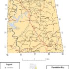
Randolph County Alabama population is located in the east central part of the state and its populations is 22,913. The Alabama Legislature created Randolph County on December 18, 1832, from lands acquired from the Creek Indians in the 1832 Treaty of Cusseta. Its county seat is Wedowee. Its name is in honor of John Randolph, a member of the United States Senate from Virginia.
The first county seat for Randolph County was established in 1833 at Hedgeman Triplett’s Ferry on the west bank of the Big Tallapoosa River, about 10 miles west of Wedowee. In 1835 (2 years later), the county seat was moved by the commissioners to nearby Wedowee. Wedowee lies in the center of Randolph County, on a fork of the Little Tallapoosa River. Wedowee was named after a tribal chief “Wah-wah-nee” (or “Wah-dow-wee”) whose village stood near the present site of the town.
Randolph County is set amidst a landscape of hills and many lakes and river and offers many opportunities for wildlife viewing and outdoor recreation.
Randolph County Alabama History
Source: Northern Alabama – Historical and Biographical by Smith & De Land, Birmingham, Ala 1888
Population: White 13,155; colored 3,420 Area 610 square miles; Woodland all. All metamorphic.
Acres – In cotton (approximately) 23,177; in corn 29,595; in oats 4,850; in wheat 10,156; in tobacco 44; in sweet potatoes 433. Approximate number of bales of cotton, 7,500.
County Seat – Wedowee; population 300. Has fine water power and mineral deposits.
Newspaper published at County Seat – Observer (Republican).
Post offices in the County – Almond, Blake’s Ferry, Christiana, Corn House, Dingier, Gap, Graham, Handley, Haywood, High Shoals, Lamar, Level Road, Louina, Milner, Omaha, Roanoke, Rock Dale, Rock Mills, Sewell, Wedowee, Wehadkee, Wild wood.
The county of Randolph was created in 1832, and named for the famous John Randolph, of Virginia. Its natural advantages are, in a great many respects, superior. Its climate salubrious, lands good, tone of society elevated, and health unsurpassed.
During the census of 1880 the census official rendered in his report at Washington only to have it returned to him for correction, the Washington official declaring the death rate to be too small to be true. But the original report was returned to Washington unchanged, as no error had been committed.
The soils of Randolph are of average fertility, and on account of deep clay subsoil and abundant rainfall, are quite reliable for agricultural purposes. Not more than one-fourth of the magnificent forests of Randolph have been cleared, and the fine pine timber here will one day be a feature in itself. The lands are easily worked and produce remarkably well. All the crops that are congenial to the southern climate grow their best here. Fruit-growing is gradually expanding, and bids fair ere long to rival all other industries. There has been only one failure of the peach crop in thirty-five years, and the apple crop never fails. The farmers produce nearly everything they use at home, and are, as a general tiling, well-to-do.
Like other counties, the absence of railroad transportation has prevented much attention being given to the minerals of Randolph, but this want is now being supplied. The East Alabama Railway has been extended to Roanoke, in the southern portion of the county, and will soon be completed to Anniston, running right through the centre of the county, and will open up some of the finest timber and mineral lands in the State.
In gold, copper, mica, tin, graphite, kaolin and iron, Randolph is doubtless one of the richest counties in the State. All these abound in the northern portion of the county. The kaolin is of superior quality and is inexhaustible. More than one mine is now being worked to advantage.
There is scarcely a square forty acres of land in the county that is not penetrated by a rivulet, creek or river. The Tallapoosa and Little Tallapoosa rivers run through the county, and have some of the finest shoals on them that nature has ever formed. There will be large cotton factories run by them some time in the near future. As for creeks, Randolph has almost a superfluity of them. There are eight flour and grist-mills turned by the waters of Wedowee Creek. Randolph has the purest and coldest freestone water in the world, and that in abundance. This accounts for the wonderful health enjoyed here.
Wedowee, situated as it is, in rich mineral beds of kaolin and mica, will one day be a large and prosperous city. Leaving out the minerals, the large pine forests that extend for miles and miles around it in every direction will one day make it an interesting town. Brockville, in the north-eastern portion of the county, has a fine school, and is building up rapidly.
Rock Mills and Roanoke, in the southern portion, are also points of interest. Rock Mills has a cotton factory, a tannery, pottery and cabinet establishment, and a fine school also. Roanoke has lately arrived at the importance of being the only railroad station in the county, and will doubtless be a flourishing village. There is a flourishing and well-established college there.
Source: Hand-Book of Alabama 1892, by Saffold Berney
Established by act December 18, 1832. Named for John Randolph, the distinguished Virginia statesman. Lies in eastern Alabama, on the Georgia line. Area, 599 square miles; all metamorphic; woodland, all. Surface broken and mountainous, with fertile valleys. Soil varieties, gray and red uplands, with pine, oak and hickory timber, and light, sandy, bottom soils, with white oak, beech and poplar timber. County watered and drained by the Tallapoosa and Little Tallapoosa rivers and a number of large creeks. Water for domestic purposes abundant and of most excellent quality. Wells and springs of best freestone water abound.
Population, white, 13,984; colored, 3.235; total, 17,219.
County seat, Wedowee.
Acres in county, improved, 84,771; unimproved, 286,313; total, 371,084.
Assessed value of property in county in 1891, real, $1,086,616.00; personal, 8408,757.00; total, 81,495. 378.00.
Newspapers, Observer, weekly, Wedowee; Herald, weekly, Roanoke.
Railroads, miles of main track. East Alabama, 3. Telegraph, miles of poles, 3. Chief crops, corn, cotton, oats, wheat, potatoes, etc. All the fruits and vegetables adapted to the latitude come to perfection. County peculiarly adapted to the production of peaches and grapes. Stock raising profitable. Lands easily tilled and, when fertilized, yield well. Gold, copper, mica, tin, graphite and kaolin found in county. Crops in 1889 (census of 1890)—cotton, acres, 28,387; bales, 10,348; value, 8468,958; corn, acres, 27,331; bushels, 331,213; oats, acres, 5,815; bushels, 41,746. Climate salubrious. Health exceptionally good. Churches numerous and good schools throughout the county. At Wedowee, Rock Mills and Roanoke are high schools of merit. Lands, $2.00. to $15.00 an acre. Government land in county, 3,920 acres. County debt, $4,025.00.
Randolph County Alabama Cities:
Roanoke Alabama
Roanoke is located between Birmingham Alabama and Atlanta Georgia, beautiful Lake Wedowee on the Tallapoosa River and West Point Lake on the Chattahoochee River.
City of Roanoke
809 Main street
P.O. box 1270
Roanoke Al, 36274
Phone 334-863-4129
Fax 334-863-2137
Email city@roanokealabama.org
Randolph County Alabama Towns:
Wadley Alabama

Wadley is located in southwest Randolph County in the east-central part of the state on the banks of the Tallapoosa River. Old Wadley Hotel Building Settlers resided in the area that now encompasses Wadley from the 1830s, but the town itself was not founded until 1906.
The Gay Craft House is listed on the Alabama Register of Landmarks and Heritage. The Wadley Railroad Depot, which ceased operations in 1964, is listed on the National Register of Historic Places; it is one of only four Mission-style depots surviving in the state.
Wadley Alabama Police Department
Address
256 Highland Cir
Wadley, Alabama 36276
Phone(256) 395-2261
Wedowee Alabama
Wedowee is a town in Randolph County. At the 2010 census the population was 823, up from 818 in 2000. The small town is the county seat of Randolph County. It was initially incorporated in 1836, but its charter lapsed by the late 19th century. It was reincorporated in 1901. Wedowee, which means “old water” in the Creek language, was named after a Muscogee Creek Indian chief. This area was historically occupied by the Muscogee Creek people.
Since the late 20th century, Lake Wedowee was created by the impoundment of the Tallapoosa River. This has enhanced the tourist drawing power of the town. Also known as the R. L. Harris Reservoir, the lake draws thousands of visitors to Wedowee every year.
Woodland Alabama
Woodland is a town in Randolph County. At the 2010 census the population was 184, down from 192 in 2000. It incorporated in 1967.
Randolph County Alabama Communities:
Almond Alabama
Almond, also known as Flat Rock, is an unincorporated community in Randolph County.
Bacon Level Alabama
Bacon Level is an unincorporated community located 3–4 miles (4.8 to 6.4 km) southeast of Roanoke, in Randolph County.
Corinth Alabama
Corinth is an unincorporated community in Randolph County, located 3.3 miles north of Wadley.
Folsom Alabama
Folsom is an unincorporated community in Randolph County.
Graham Alabama
Graham is a census-designated place and unincorporated community in Randolph County.
Hobson Alabama
Liberty Grove Alabama
Liberty Grove is an unincorporated community in Randolph County.
Louina Alabama
Louina, sometimes Ole Louina, is a ghost town located 14 miles west of Roanoke and about one mile east of Wadley in Randolph County.Ole Louina was a community during early settlement of Randolph County which was settled after the Battle of Horseshoe Bend in 1814 when the Creek Indians were defeated by General Andrew Jackson.
The town was founded in 1834 and lasted until about 1905, and at one time was largest town in Randolph County with two churches, several stores, and a gristmill.
Morrison Crossroads Alabama
Morrison Crossroads (also known as Morrison Crossroad) is a census-designated place and unincorporated community in Randolph County. Its population was 219 as of the 2010 census.
Newell Alabama
Newell is an unincorporated community in Randolph County, located 11.5 miles north-northeast of Wedowee. A post office was established under the name Newell in 1887. The post office was closed on October 5, 2002.
Omaha Alabama
Omaha is an unincorporated community in Randolph County.
Rock Mills Alabama
Rock Mills is a census-designated place (CDP) in Randolph County. At the 2010 census the population was 600, down from 676 in 2000. According to the U.S. Census, from 1890 until the 1920s, Rock Mills was an incorporated community. It was later designated a CDP beginning in 2000.
Randolph County Alabama Historic Destinations
Randolph County Historical Museum – Roanoke Alabama