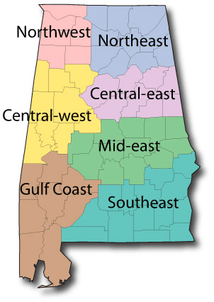
Alabama South-East Region
Alabama South East Region
 Barbour County
Barbour County is located in the southeastern section of the state, bounded on the east by the Chattahoochee River and the State of Georgia. The county encompasses 884 square miles. The county seat was established in Louisville in 1833, and moved to Clayton in 1834. Barbour County was created on 18 Dec. 1832, from former Creek Indian territory and a portion of Pike County. Its boundaries were altered in 1866 and 1868.
Bullock County
Bullock County is in the southeastern section of the state, in the prairie region. It encompasses 625 square miles. Bullock County was created on 1866 Dec. 5, though its boundaries were changed in 1867 Feb. It was named to honor Confederate Col. Edward C. Bullock of Barbour County. Union Springs was chosen as the county seat in 1867.
Butler County
Butler County lies in the south-central part of the state. It encompasses 763 square miles. Butler County was created by the first session of the Alabama legislature on 1819 Dec. 13, from parts of Monroe and Conecuh Counties. It was named for Capt. William Butler, a soldier of the Creek War of 1813-14. The county seat is located at Greenville Alabama, which was originally named Buttsville.
Coffee County
Coffee County is located in the southeastern part of the state and encompasses 680 square miles. It was created by the Alabama legislature on 1841 Dec. 29, from what had been part of Dale County. The first county seat was at Wellborn. The county courthouse is now in the town of Elba, Alabama.
Conecuh County
Conecuh County lies in the southern portion of the state. It was created by the Alabama Territorial legislature on 1818 Feb. 13, from part of Monroe County. It currently comprises 854 square miles.
The county seat is Evergreen, Alabama. The county seat was at Sparta from 1818 until 1868.
Covington County
Crenshaw County
Crenshaw County is located in the south-central section of the state, in the coastal plain area. Crenshaw County encompasses 611 square miles. It was created by an act of the Alabama General Assembly on 1866 Nov. 24. It was formed from parts of Butler, Coffee, Covington, Pike and Lowndes counties.
The county seat is Luverne Alabama. Prior to 1893, the county seat was was in Rutledge.
Dale County
Dale County is located in the southeastern part of the state, wholly within the coastal plain and encompasses 561 square miles.. It was created by the Alabama legislature on 1824 Dec. 22 and was named for General Sam Dale, pioneer and Indian fighter. The county seat is Ozark Alabama.
Escambia County
Escambia County is located in the southern part of the state on the northern boundary of Florida. Escambia County was created by the Alabama legislature on 1868 Dec. 10, from parts of Baldwin and Conecuh counties. It currently encompasses 951 square miles. The county seat is Brewton, Alabama.
Geneva County
Geneva County is located in southeastern Alabama Geneva County was created by the Alabama legislature on 1868 Dec. 26. The county was named for Geneva Alabama, its principal town and county seat.
Henry County
Henry County is located in the southeastern corner of the state, It encompasses 557 square miles. Henry County was created on 1819 Dec. 13. The county was named for Revolutionary War patriot Patrick Henry.
It is identified as part of the coastal plain or Wiregrass region. The county seat is located in Abbeville Alabama.
Houston County
Houston County lies in the extreme southeastern corner of the state, in the Wiregrass region. Houston County was created by the Alabama legislature on 1903 Feb. 9, from parts of Dale, Geneva, and Henry counties. It encompasses 577 square miles. The county seat is Dothan, which was known as Poplar Head, prior to 1871.
Pike County
Pike County is located in the southeastern section of the state, in the coastal plain or “Wiregrass” area. It encompasses 672 square miles. Pike County was created on 1821 Dec. 17. The first county seat was established at Louisville, later moved to Monticello and finally located in Troy in 1839.
Russell County
Russell County is located in the south-central eastern part of the state. It was created by an act of the Alabama General Assembly on 18 Dec. 1832, from former Creek Indian territory. Russell County encompasses 634 square miles.
The county seat is Phenix City, Alabama.